National Register of Historic Places listings in Grant County, New Mexico
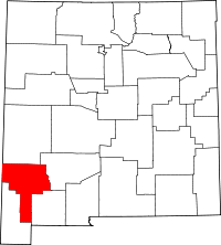
Location of Grant County in New Mexico
This is a list of the National Register of Historic Places listings in Grant County, New Mexico.
This is intended to be a complete list of the properties and districts on the National Register of Historic Places in Grant County, New Mexico, United States. Latitude and longitude coordinates are provided for many National Register properties and districts; these locations may be seen together in a map.[1]
There are 45 properties and districts listed on the National Register in the county, including 1 National Historic Landmark. All of the places within the county on the National Register are also listed on the State Register of Cultural Properties.
- This National Park Service list is complete through NPS recent listings posted October 11, 2018.[2]
| Bernalillo – Catron – Chaves – Cibola – Colfax – Curry – De Baca – Doña Ana – Eddy – Grant – Guadalupe – Harding – Hidalgo – Lea – Lincoln – Los Alamos – Luna – McKinley – Mora – Otero – Quay – Rio Arriba – Roosevelt – San Juan – San Miguel – Sandoval – Santa Fe – Sierra – Socorro – Taos – Torrance – Union – Valencia |
Current listings
| [3] | Name on the Register[4] | Image | Date listed[5] | Location | City or town | Description |
|---|---|---|---|---|---|---|
| 1 | Acklin Store | May 16, 1988 (#88000502) |
State Road 90 32°48′06″N 107°56′24″W / 32.801667°N 107.94°W |
San Lorenzo | ||
| 2 | H. B. Ailman House | 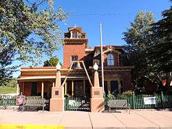 |
May 12, 1975 (#75001163) |
314 W. Broadway 32°46′12″N 108°16′40″W / 32.77°N 108.277778°W |
Silver City | |
| 3 | Trinidad Andazola House | May 16, 1988 (#88000500) |
Southeast of State Road 61 and south of Eby Ranch Rd. 32°37′13″N 107°52′33″W / 32.620278°N 107.875833°W |
Dwyer | ||
| 4 | Bowden Hall | 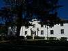 |
September 22, 1988 (#88001552) |
Northeast of Light Hall and southwest of Heating Plant on the Western New Mexico University campus 32°46′32″N 108°16′55″W / 32.775556°N 108.281944°W |
Silver City | Western New Mexico University (WNMU) |
| 5 | Bullard Hotel | 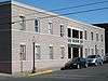 |
July 11, 1988 (#88000435) |
102 S. Bullard St. 32°46′12″N 108°16′33″W / 32.77°N 108.275833°W |
Silver City | |
| 6 | Burro Springs Site |  |
December 31, 1974 (#74001197) |
Address Restricted |
Tyrone | |
| 7 | Chihuahua Hill Historic District | 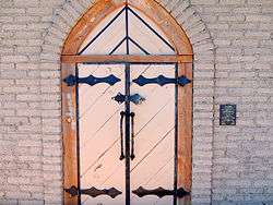 |
January 23, 1984 (#84002943) |
Bounded by Cooper, Spring, Bullard, and Chihuahua Sts. 32°46′01″N 108°16′43″W / 32.766944°N 108.278611°W |
Silver City | |
| 8 | Tom Eby Storage Building | May 16, 1988 (#88000514) |
West of State Road 61 and north of Eby Ranch Rd. 32°37′43″N 107°52′00″W / 32.628611°N 107.866667°W |
Dwyer | ||
| 9 | Fleming Hall | 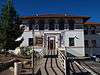 |
September 22, 1988 (#88001553) |
10th St. northeast of Bowden Hall on the Western New Mexico University campus 32°46′36″N 108°16′55″W / 32.776667°N 108.281944°W |
Silver City | WNMU |
| 10 | Fort Bayard Historic District | 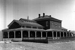 |
July 7, 2002 (#02000726) |
0.5 miles north of the junction of U.S. Route 180 and State Road 152 32°47′47″N 108°08′56″W / 32.796389°N 108.148889°W |
Santa Clara | |
| 11 | Graham Gymnasium | 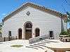 |
September 22, 1988 (#88001554) |
Florida St. on the Western New Mexico University campus 32°46′36″N 108°17′06″W / 32.776667°N 108.285°W |
Silver City | WNMU |
| 12 | Luciana B. Grijalva House | May 16, 1988 (#88000499) |
East of State Road 61 32°49′32″N 107°56′28″W / 32.825556°N 107.941111°W |
San Lorenzo | ||
| 13 | Heating Plant | 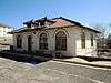 |
September 22, 1988 (#88001555) |
10th St. northeast of Bowden Hall on the Western New Mexico University campus 32°46′32″N 108°16′53″W / 32.775556°N 108.281389°W |
Silver City | WNMU |
| 14 | Hooks-Moore Store | May 16, 1988 (#88000490) |
State Road 61 and Forest Road 73 32°51′19″N 107°59′02″W / 32.855278°N 107.983889°W |
Mimbres | ||
| 15 | Otto Huechling House | May 16, 1988 (#88000496) |
East of State Road 61 32°50′33″N 107°58′03″W / 32.8425°N 107.9675°W |
Mimbres | ||
| 16 | Janss Site | |
July 23, 1980 (#80002550) |
Address Restricted |
San Lorenzo | |
| 17 | L.C. Ranch Headquarters | 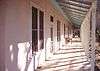 |
December 6, 1978 (#78001816) |
Off U.S. Route 260 32°57′52″N 108°34′50″W / 32.964444°N 108.580556°W |
Gila | |
| 18 | Light Hall | 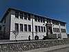 |
September 22, 1988 (#88001556) |
Northern side of College Ave. at B St. on the Western New Mexico University campus 32°46′36″N 108°16′56″W / 32.776667°N 108.282222°W |
Silver City | WNMU |
| 19 | Mattocks Site | December 9, 1980 (#80002548) |
Address Restricted |
Mimbres | ||
| 20 | Menard-Galaz House | May 16, 1988 (#88000503) |
West of State Road 90 32°48′03″N 107°55′01″W / 32.800833°N 107.916944°W |
San Lorenzo | ||
| 21 | Mimbres School | May 16, 1988 (#88000491) |
East of State Road 61 and Forest Road 73 32°51′17″N 107°58′52″W / 32.854722°N 107.981111°W |
Mimbres | ||
| 22 | NAN Ranch | May 16, 1988 (#88000509) |
East of State Road 61 32°37′42″N 107°51′59″W / 32.628333°N 107.866389°W |
Dwyer | ||
| 23 | George O. Perrault House | May 16, 1988 (#88000507) |
East of State Road 61 1.7 miles north of Mimbres Hot Springs Canyon Rd. 32°44′49″N 107°53′15″W / 32.746944°N 107.8875°W |
Sherman | ||
| 24 | Pinos Altos Historic District | 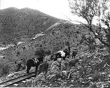 |
May 21, 1984 (#84002945) |
Roughly bounded by Gold Ave. and Cherry, Main, Church, and Silver Sts. 32°51′58″N 108°13′09″W / 32.866111°N 108.219167°W |
Pinos Altos | |
| 25 | Mauricio Portillo House | May 16, 1988 (#88000504) |
East of State Road 61 1 mile south of State Road 90 32°47′08″N 107°55′05″W / 32.785556°N 107.918056°W |
San Lorenzo | ||
| 26 | William Redding House | May 16, 1988 (#88000483) |
Off State Road 61 32°51′16″N 107°58′52″W / 32.854444°N 107.981111°W |
Mimbres | ||
| 27 | Reeds Peak Lookout Tower | January 28, 1988 (#87002472) |
Squeaky Spring in the Gila National Forest 33°08′35″N 107°51′14″W / 33.143056°N 107.853889°W |
Reeds Peak | ||
| 28 | Ritch Hall | 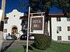 |
September 22, 1988 (#88001557) |
10th St. southeast of Fleming Hall on the Western New Mexico University campus 32°46′35″N 108°16′53″W / 32.776389°N 108.281389°W |
Silver City | WNMU |
| 29 | St. Mary's Academy Historic District | 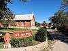 |
September 15, 1983 (#83001621) |
1813 N. Alabama St. 32°47′02″N 108°16′58″W / 32.783889°N 108.282778°W |
Silver City | |
| 30 | San Juan Historic District | May 16, 1988 (#88000481) |
2261-2291 State Road 61 32°45′37″N 107°54′17″W / 32.760278°N 107.904722°W |
San Juan | ||
| 31 | San Juan Teacherage | May 16, 1988 (#88000508) |
West of State Road 61 1.7 miles north of Mimbres Hot Springs Canyon Rd. 32°44′46″N 107°53′18″W / 32.746111°N 107.888333°W |
Sherman | ||
| 32 | San Lorenzo Historic District | 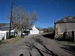 |
May 16, 1988 (#88000480) |
Roughly Galaz St. between C and H Sts. 32°48′38″N 107°55′08″W / 32.810556°N 107.918889°W |
San Lorenzo | |
| 33 | George Sibole Store | May 16, 1988 (#88000482) |
East of State Road 61, north of Forest Road 73 32°51′22″N 107°59′04″W / 32.856111°N 107.984444°W |
Mimbres | ||
| 34 | Silver City Historic District | 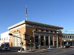 |
May 23, 1978 (#78001817) |
Roughly bounded by Black, College, Hudson, and Spring Sts.; also roughly bounded by College Ave., the "Big Ditch", San Vicente & Black 32°46′19″N 108°16′38″W / 32.771944°N 108.277222°W |
Silver City | Second set of boundaries represents a boundary increase of September 25, 2013 |
| 35 | Silver City North Addition Historic District | 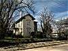 |
February 17, 1983 (#83001620) |
Roughly bounded by the San Vicente Arroyo, College Ave., Chloride and 13th Sts. 32°46′33″N 108°16′44″W / 32.775783°N 108.278795°W |
Silver City | Listed in NRIS as the Silver City Historic District North Addition, though it is not a boundary increase of the Silver City Historic District according to its nomination |
| 36 | Silver City Water Works Building | 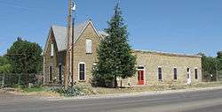 |
January 26, 1984 (#84002950) |
Little Walnut Rd. 32°46′59″N 108°16′42″W / 32.783056°N 108.278333°W |
Silver City | |
| 37 | Silver City Woman's Club | 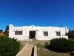 |
September 2, 2003 (#03000886) |
411 Silver Heights Boulevard 32°46′58″N 108°16′18″W / 32.782778°N 108.271667°W |
Silver City | |
| 38 | Soliz-Baca House | June 17, 1988 (#88000518) |
Southeast of State Road 61 and south of Eby Ranch Rd. 32°37′28″N 107°52′14″W / 32.624444°N 107.870556°W |
Dwyer | ||
| 39 | Antonio Torres House | May 16, 1988 (#88000505) |
North of State Road 90 west of the Mimbres River bridge 32°47′28″N 107°55′02″W / 32.791111°N 107.917222°W |
San Lorenzo | ||
| 40 | Maria J. and Juan Trujillo House | May 16, 1988 (#88000516) |
East of State Road 61 and south of Eby Ranch Rd. 32°37′29″N 107°52′11″W / 32.624722°N 107.869722°W |
Dwyer | ||
| 41 | Jesus Valencia House | May 16, 1988 (#88000506) |
East of State Road 61 32°46′39″N 107°54′52″W / 32.7775°N 107.914444°W |
San Juan | ||
| 42 | Ysabel Valencia House | May 16, 1988 (#88000493) |
East of State Road 61 32°50′44″N 107°58′15″W / 32.845556°N 107.970833°W |
Mimbres | ||
| 43 | Wheaton-Smith Site | |
July 23, 1980 (#80002549) |
Address Restricted |
San Juan | |
| 44 | Dr. Granville Wood House | May 16, 1988 (#88000498) |
East of State Road 61 32°50′33″N 107°58′01″W / 32.8425°N 107.966944°W |
Mimbres | ||
| 45 | Woodrow Ruin | |
July 9, 1970 (#70000402) |
Address Restricted |
Cliff |
See also
| Wikimedia Commons has media related to National Register of Historic Places in Grant County, New Mexico. |
References
- ↑ The latitude and longitude information provided in this table was derived originally from the National Register Information System, which has been found to be fairly accurate for about 99% of listings. For about 1% of NRIS original coordinates, experience has shown that one or both coordinates are typos or otherwise extremely far off; some corrections may have been made. A more subtle problem causes many locations to be off by up to 150 yards, depending on location in the country: most NRIS coordinates were derived from tracing out latitude and longitudes from USGS topographical quadrant maps created under the North American Datum of 1927, which differs from the current, highly accurate WGS84 GPS system used by most on-line maps. Chicago is about right, but NRIS longitudes in Washington are higher by about 4.5 seconds, and are lower by about 2.0 seconds in Maine. Latitudes differ by about 1.0 second in Florida. Some locations in this table may have been corrected to current GPS standards.
- ↑ "National Register of Historic Places: Weekly List Actions". National Park Service, United States Department of the Interior. Retrieved on October 11, 2018.
- ↑ Numbers represent an ordering by significant words. Various colorings, defined here, differentiate National Historic Landmarks and historic districts from other NRHP buildings, structures, sites or objects.
- ↑ National Park Service (2010-07-09). "National Register Information System". National Register of Historic Places. National Park Service.
- ↑ The eight-digit number below each date is the number assigned to each location in the National Register Information System database, which can be viewed by clicking the number.
| Topics | |
|---|---|
| Lists by states |
|
| Lists by insular areas | |
| Lists by associated states | |
| Other areas | |
| |
Municipalities and communities of Grant County, New Mexico, United States | ||
|---|---|---|
| City | | |
| Towns | ||
| Village | ||
| CDPs | ||
| Other unincorporated communities | ||
| Ghost towns | ||
This article is issued from
Wikipedia.
The text is licensed under Creative Commons - Attribution - Sharealike.
Additional terms may apply for the media files.