Burpengary, Queensland
| Burpengary Moreton Bay Region, Queensland | |||||||||||||||
|---|---|---|---|---|---|---|---|---|---|---|---|---|---|---|---|
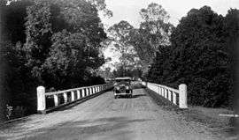 Austin motor vehicle crossing a bridge on the North Coast Road at Burpengary, 1934 | |||||||||||||||
 Burpengary | |||||||||||||||
| Coordinates | 27°09′16″S 152°58′22″E / 27.15444°S 152.97278°ECoordinates: 27°09′16″S 152°58′22″E / 27.15444°S 152.97278°E | ||||||||||||||
| Population | 14,022 (2016 census)[1] | ||||||||||||||
| Postcode(s) | 4505 | ||||||||||||||
| Location | 35 km (22 mi) from Brisbane GPO | ||||||||||||||
| LGA(s) | Moreton Bay Region | ||||||||||||||
| State electorate(s) | |||||||||||||||
| Federal Division(s) | Longman | ||||||||||||||
| |||||||||||||||
Burpengary is a town and suburb in the Moreton Bay Region, Queensland, Australia.[2][3] It is 35 kilometres (22 mi) from the Brisbane CBD.
The name is derived from the Aboriginal word burpengar, meaning the "place of the green wattle".[4]
Burpengary is one of Moreton Bay region's fastest growing residential areas.[5] Major retailers in Burpengary include ALDI, Woolworths Limited, Coles Supermarkets and Kmart Australia.[6]
Burpengary Creek is the suburb's main waterway.
History
The town of Burpengary was initially founded as a large truckstop due to its strategic location on the North Coast Road (now the Bruce Highway) from Brisbane to the North Coast (now the Sunshine Coast). Burpengary is still home to a functional truck weigh-bridge.
Burpengary has been a predominantly blue-collar suburb with a significant proportion of the population directly employed in a labouring or trade-related jobs.
However, with expanding planned communities, easy access to the M1 and council approving plans for mini city initiatives, more and more families are moving to the locality including those in the professions. This is fuelling economic growth with the expansion of the shopping precinct, local services and increasing pressure on the local transport infrastructure since 2005.
The Burpengary Library opened in 1994 and had a major refurbishment in 2016.[7]
Amenities
Burpengary is also home to the Caboolture Regional Aquatic Centre which houses a 50m Olympic pool, a 25m warm up pool, aqua aerobics, tennis, beach volleyball, gymnasium, cafe, barbecues and landscaped settings and enclosed children's play areas. A new centre in the area is the AFL fields, where the Brisbane Lions played three Australian Football League pre-season competition matches.
The Moreton Bay Regional Council operates a public library at 121 Station Road.[8]
Demographics
In the 2016 census, the population of Burpengary was 14,022, with 51% females and 49% males.[1]
The median age of the Burpengary population was 37 years of age, 1 year below the Australian median. Children aged under 15 years made up 20.7% of the population and people aged 65 years and over made up 13.6% of the population.[1]
78.6% of people living in Burpengary were born in Australia. The other top responses for country of birth were England 4.7%, New Zealand 4.2%, South Africa 0.7%, Philippines 0.7%, and Scotland 0.6%.[1]
90.7% of people spoke only English at home; the next most popular languages were Samoan (0.4%), Mandarin (0.3%), Tagalog (0.3%), Dutch (0.3%), and Afrikaans (0.2%).[1]
Education
- Burpengary State School
- St Eugene College
- Burpengary Meadows State School
- Burpengary State Secondary College
Burpengary State School was established in 1876,[9] St Eugene College in 1990,[10] Burpengary Meadows in 2007,[11] and Burpengary State Secondary College in 2015.[12]
The primary schooling in Burpengary includes Burpengary Meadows State School and Burpengary State School, both being state-owned public schools. The secondary schooling in Burpengary includes St Eugene College, which was Burpengary's first high school, and has served the area since 2008. The suburb's second high school, Burpengary state secondary College, began with years 7 and 8 in 2015.[12]
Transport
Burpengary railway station provides access to regular Queensland Rail City network services to Brisbane and Ipswich, as well as Caboolture and the Sunshine Coast. Burpengary is linked regionally by Kangaroo Bus Lines which operate services primarily to Redcliffe and Caboolture.
Notable residents
- Loretta Marron, health advocate and CEO of Friends of Science in Medicine.
References
- 1 2 3 4 5 Australian Bureau of Statistics (27 June 2017). "Burpengary (State Suburb)". 2016 Census QuickStats. Retrieved 2017-07-12.

- ↑ "Burpengary (town) (entry 39163)". Queensland Place Names. Queensland Government. Retrieved 30 May 2014.
- ↑ "Burpengary (locality) (entry 46997)". Queensland Place Names. Queensland Government. Retrieved 30 May 2014.
- ↑ Moreton Bay Regional Council. "Burpengary". Retrieved 8 December 2011.
- ↑ Caboolture township history - Moreton Bay Regional Council
- ↑ LJ Hooker. "Burpengary Plaza". Retrieved 26 March 2018.
- ↑ "Public Libraries Statistical Bulletin 2016–17" (PDF). Public Libraries Connect. State Library of Queensland. November 2017. p. 14. Archived (PDF) from the original on 30 January 2018. Retrieved 30 January 2018.
- ↑ "Burpengary Library". Moreton Bay Regional Council. Retrieved 30 January 2018.
- ↑ "Our school". Burpengary State School. Retrieved 22 October 2017.
- ↑ "ST EUGENE COLLEGE, BURPENGARY QLD". Private Schools Guide. Retrieved 22 October 2017.
- ↑ "Our school". Burpengary Meadows. Retrieved 22 October 2017.
- 1 2 "Principal's welcome". Burpengary State Secondary College. Retrieved 22 October 2017.
Further reading
- Down the track 120 years : a living history of the Burpengary State School, Burpengary State School>, 1996