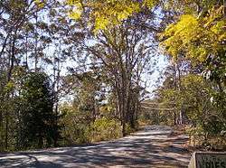
Mount Nebo (Queensland)
| Mount Nebo Queensland | |||||||||||||||
|---|---|---|---|---|---|---|---|---|---|---|---|---|---|---|---|
 Mount Nebo, Queensland | |||||||||||||||
| Population | 433 (2011 census)[1] | ||||||||||||||
| Established | 1919 | ||||||||||||||
| Postcode(s) | 4520 | ||||||||||||||
| LGA(s) | Moreton Bay Region | ||||||||||||||
| State electorate(s) | Pine Rivers | ||||||||||||||
| Federal Division(s) | Dickson | ||||||||||||||
| |||||||||||||||
Coordinates: 27°23′49.7″S 152°47′1.3″E / 27.397139°S 152.783694°E Mount Nebo is a mountain approximately 18 km North West of the Brisbane suburb of The Gap in Queensland, Australia. It is part of the D'Aguilar Range which includes other mountains such as Mount Pleasant, Mount Glorious and Mount Mee. The town of Mount Nebo is named after the mountain on which it is located. The mountain is the source of Enoggera Creek.
History
Settlement began in 1919 with the subdivision of the Highlands Estate into smaller blocks for soldiers returning from World War I.[2] For a number of years the community belonged to the Shire of Esk, but between 1932 and 1936 a redrawing of the boundaries brought Mount Nebo into the Shire of Pine Rivers.[2] The 2008 amalgamation of local councils means it now falls within the Moreton Bay Region.
Mount Nebo opened in 16 February 1931 and the school closed from 31/12/1934-11/04/1939; 30/09/1940-23/10/1940; 18/08/1941-19/08/1946 and 05/11/1948-21/06/1954.[3]
Amenities
The Moreton Bay Regional Council operates a mobile library service which visits the Mount Nebo Rural Fire Shed on Mount Nebo Rd.[4]
Demographics
In the 2011 census, Mount Nebo recorded a population of 433 people, 50.3% female and 49.7% male.[1]
The median age of the Mount Nebo population was 42 years, 5 years above the national median of 37.[1]
76.6% of people living in Mount Nebo were born in Australia. The other top responses for country of birth were England 11.1%, New Zealand 3.5%, France 1.4%, South Africa 1.2%, United States of America 1.2%. 94.2% of people spoke only English at home; the next most common languages were 1.4% French, 1.2% Dhivehi, 0.7% German, 0.7% Hebrew.[1]
The most common religious affiliation was "No Religion" (49.0%); the next most common responses were Catholic 14.3%, Anglican 8.5%, Uniting Church 5.1% and Buddhism 3.5%.[1]
References
- 1 2 3 4 5 Australian Bureau of Statistics (31 October 2012). "Mount Nebo (State Suburb)". 2011 Census QuickStats. Retrieved 17 February 2017.

- 1 2 Horton, Helen (1988). Brisbane's Back Door: The story of the D'Aguilar Range. Bowen Hills, Queensland: Boolarong Publications. pp. 39&mdash, 41. ISBN 0-86439-036-X.
- ↑ "Opening and closing dates of schools in Queensland". Education Queensland. 1 August 2013. Retrieved 3 February 2018.
- ↑ "Mobile Library". Moreton Bay Regional Council. Archived from the original on 30 January 2018. Retrieved 30 January 2018.