Electoral district of Everton
| Everton Queensland—Legislative Assembly | |||||||||||||||
|---|---|---|---|---|---|---|---|---|---|---|---|---|---|---|---|
 Everton electoral district map 2017 | |||||||||||||||
| State | Queensland | ||||||||||||||
| Dates current | 1972–present | ||||||||||||||
| MP | Tim Mander | ||||||||||||||
| Party | Liberal National | ||||||||||||||
| Namesake | Everton Park | ||||||||||||||
| Electors | 36,221 (2017) | ||||||||||||||
| Area | 44 km2 (17.0 sq mi) | ||||||||||||||
| Coordinates | 27°22′S 152°57′E / 27.367°S 152.950°ECoordinates: 27°22′S 152°57′E / 27.367°S 152.950°E | ||||||||||||||
| |||||||||||||||

2008 electoral district map
Everton is an electoral district of the Legislative Assembly in the Australian state of Queensland.
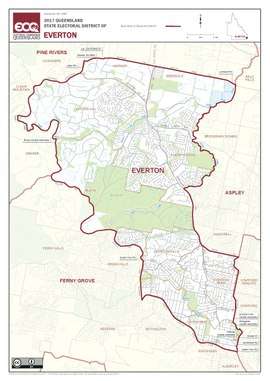
The division encompasses suburbs in Brisbane's north west between Kedron Brook and the South Pine River, including Everton Park, Everton Hills, McDowall and Albany Creek. Parts of Mitchelton are located in the electorate.
Members for Everton
| Member | Party | Term | |
|---|---|---|---|
| Gerry Jones | Labor | 1972–1974 | |
| Brian Lindsay | Liberal | 1974–1977 | |
| Glen Milliner | Labor | 1977–1992 | |
| Rod Welford | Labor | 1992–2009 | |
| Murray Watt | Labor | 2009–2012 | |
| Tim Mander | Liberal National | 2012–present | |
Election results
| Party | Candidate | Votes | % | ± | |
|---|---|---|---|---|---|
| Liberal National | Tim Mander | 16,756 | 51.8 | +2.2 | |
| Labor | David Greene | 11,616 | 35.9 | −4.2 | |
| Greens | Bridget Clinch | 3,997 | 12.3 | +2.4 | |
| Total formal votes | 32,369 | 96.2 | −2.1 | ||
| Informal votes | 1,273 | 3.8 | +2.1 | ||
| Turnout | 33,642 | 91.3 | +0.8 | ||
| Two-party-preferred result | |||||
| Liberal National | Tim Mander | 17,784 | 54.9 | +2.9 | |
| Labor | David Greene | 14,585 | 45.1 | −2.9 | |
| Liberal National hold | Swing | +2.9 | |||
References
External links
- Electorate Profile (Antony Green, ABC)
This article is issued from
Wikipedia.
The text is licensed under Creative Commons - Attribution - Sharealike.
Additional terms may apply for the media files.