Bray Park, Queensland
| Bray Park Moreton Bay, Queensland | |||||||||||||||
|---|---|---|---|---|---|---|---|---|---|---|---|---|---|---|---|
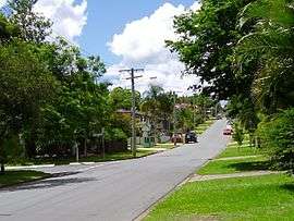 A suburban street in Bray Park | |||||||||||||||
 Bray Park | |||||||||||||||
| Coordinates | 27°17′34″S 152°57′44″E / 27.29278°S 152.96222°ECoordinates: 27°17′34″S 152°57′44″E / 27.29278°S 152.96222°E | ||||||||||||||
| Population | 10,246 (2016 census)[1] | ||||||||||||||
| • Density | 2,282.0/km2 (5,910/sq mi) | ||||||||||||||
| Postcode(s) | 4500 | ||||||||||||||
| Area | 4.49 km2 (1.7 sq mi) | ||||||||||||||
| Location | 23 km (14 mi) from Brisbane GPO | ||||||||||||||
| LGA(s) | Moreton Bay Region | ||||||||||||||
| State electorate(s) | |||||||||||||||
| Federal Division(s) | Dickson | ||||||||||||||
| |||||||||||||||
Bray Park is a suburb of Moreton Bay Region, Queensland, Australia.[2] It is a part of Brisbane metropolitan area. It is named after John Bray, a former Shire councillor.[3] Bray Park is bounded by Four Mile Creek in the south, the Caboolture railway line in the east, Francis Road in the north, and Old North Road in the west.
Bray Park is on the Caboolture line of the Queensland Rail City network; see Bray Park railway station. The main state schools are Bray Park State School, opened on 31 January 1973, and Bray Park High School which was opened on 27 January 1987.[4]
Demographics
In the 2011 census, Bray Park recorded a population of 10,002 people, 51.2% female and 48.8% male.
The median age of the Bray Park population was 33 years, 4 years below the national median of 37.
78.4% of people living in Bray Park were born in Australia. The other top responses for country of birth were New Zealand 5.7%, England 3.4%, Philippines 0.9%, South Africa 0.8%, and Fiji 0.6%.
90% of people spoke only English at home; the next most common languages were 0.7% Hindi, 0.7% Samoan, 0.4% Tagalog, 0.4% Cantonese, and 0.3% Afrikaans.
Amenities
The Moreton Bay Regional Council operates a mobile library service which visits Kensington Village on Sovereign Way.[5]
Education
Bray Park State High School opened on 27 January 1987.[6] It is a coeducational school, catering to year 7 through 12. At 2016, enrollment was 753.[7]
References
- ↑ Australian Bureau of Statistics (27 June 2017). "Bray Park (Qld) (State Suburb)". 2016 Census QuickStats. Retrieved 19 April 2018.

- ↑ "Bray Park (entry 45367)". Queensland Place Names. Queensland Government. Retrieved 30 May 2014.
- ↑ Page Title Archived August 22, 2006, at the Wayback Machine.
- ↑ "Opening and closing dates of Queensland schools (B)". education.qld.gov.au. Retrieved 2018-01-23.
- ↑ "Mobile Library". Moreton Bay Regional Council. Archived from the original on 30 January 2018. Retrieved 30 January 2018.
- ↑ "Opening and closing dates of Queensland schools (B)". Education Queensland. 16 August 2013. Retrieved 2 February 2018.
- ↑ "Bray Park State School Annual Report 2016" (PDF). Education Queensland. 2016. Retrieved 2 February 2018.
External links