Monnières, Jura
| Monnières | ||
|---|---|---|
| Commune | ||
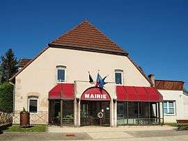 Town hall | ||
| ||
 Monnières Location within Bourgogne-Franche-Comté region  Monnières | ||
| Coordinates: 47°06′46″N 5°27′46″E / 47.1128°N 5.4628°ECoordinates: 47°06′46″N 5°27′46″E / 47.1128°N 5.4628°E | ||
| Country | France | |
| Region | Bourgogne-Franche-Comté | |
| Department | Jura | |
| Arrondissement | Dole | |
| Canton | Dole-1 | |
| Government | ||
| • Mayor (2014–2020) | Patrick Sautrey | |
| Area1 | 2.06 km2 (0.80 sq mi) | |
| Population (2006)2 | 471 | |
| • Density | 230/km2 (590/sq mi) | |
| Time zone | UTC+1 (CET) | |
| • Summer (DST) | UTC+2 (CEST) | |
| INSEE/Postal code | 39345 /39100 | |
| Elevation | 220–341 m (722–1,119 ft) | |
|
1 French Land Register data, which excludes lakes, ponds, glaciers > 1 km2 (0.386 sq mi or 247 acres) and river estuaries. 2 Population without double counting: residents of multiple communes (e.g., students and military personnel) only counted once. | ||
.svg.png)
Monnières is a commune in the Jura department in Franche-Comté in eastern France.
See also
References
| Wikimedia Commons has media related to Monnières (Jura). |
This article is issued from
Wikipedia.
The text is licensed under Creative Commons - Attribution - Sharealike.
Additional terms may apply for the media files.