Mutigney
| Mutigney | |
|---|---|
| Commune | |
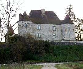 Chateau | |
 Mutigney Location within Bourgogne-Franche-Comté region  Mutigney | |
| Coordinates: 47°16′44″N 5°32′40″E / 47.2789°N 5.5444°ECoordinates: 47°16′44″N 5°32′40″E / 47.2789°N 5.5444°E | |
| Country | France |
| Region | Bourgogne-Franche-Comté |
| Department | Jura |
| Arrondissement | Dole |
| Canton | Authume |
| Government | |
| • Mayor (2014–2020) | Christine Lecomte |
| Area1 | 8.00 km2 (3.09 sq mi) |
| Population (2012)2 | 166 |
| • Density | 21/km2 (54/sq mi) |
| Time zone | UTC+1 (CET) |
| • Summer (DST) | UTC+2 (CEST) |
| INSEE/Postal code | 39377 /39290 |
| Elevation | 188–233 m (617–764 ft) |
|
1 French Land Register data, which excludes lakes, ponds, glaciers > 1 km2 (0.386 sq mi or 247 acres) and river estuaries. 2 Population without double counting: residents of multiple communes (e.g., students and military personnel) only counted once. | |
Mutigney is a commune in the Jura department in Franche-Comté in eastern France.
Population
| Historical population | ||
|---|---|---|
| Year | Pop. | ±% |
| 1793 | 278 | — |
| 1806 | 365 | +31.3% |
| 1821 | 316 | −13.4% |
| 1831 | 481 | +52.2% |
| 1841 | 478 | −0.6% |
| 1851 | 514 | +7.5% |
| 1861 | 448 | −12.8% |
| 1872 | 468 | +4.5% |
| 1881 | 394 | −15.8% |
| 1891 | 364 | −7.6% |
| 1901 | 346 | −4.9% |
| 1911 | 319 | −7.8% |
| 1921 | 278 | −12.9% |
| 1931 | 270 | −2.9% |
| 1946 | 225 | −16.7% |
| 1954 | 195 | −13.3% |
| 1962 | 200 | +2.6% |
| 1968 | 191 | −4.5% |
| 1975 | 175 | −8.4% |
| 1982 | 169 | −3.4% |
| 1990 | 161 | −4.7% |
| 1999 | 143 | −11.2% |
| 2006 | 147 | +2.8% |
| 2012 | 166 | +12.9% |
See also
References
| Wikimedia Commons has media related to Mutigney. |
This article is issued from
Wikipedia.
The text is licensed under Creative Commons - Attribution - Sharealike.
Additional terms may apply for the media files.