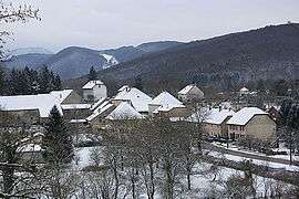
La Chapelle-sur-Furieuse
| La Chapelle-sur-Furieuse | ||
|---|---|---|
| Commune | ||
 | ||
| ||
 La Chapelle-sur-Furieuse Location within Bourgogne-Franche-Comté region  La Chapelle-sur-Furieuse | ||
| Coordinates: 46°59′55″N 5°51′29″E / 46.9986°N 5.8581°ECoordinates: 46°59′55″N 5°51′29″E / 46.9986°N 5.8581°E | ||
| Country | France | |
| Region | Bourgogne-Franche-Comté | |
| Department | Jura | |
| Arrondissement | Dole | |
| Canton | Arbois | |
| Government | ||
| • Mayor (2014–2020) | Bernard Brunel | |
| Area1 | 9.03 km2 (3.49 sq mi) | |
| Population (2012)2 | 328 | |
| • Density | 36/km2 (94/sq mi) | |
| Time zone | UTC+1 (CET) | |
| • Summer (DST) | UTC+2 (CEST) | |
| INSEE/Postal code | 39103 /39110 | |
| Elevation | 250–550 m (820–1,800 ft) | |
|
1 French Land Register data, which excludes lakes, ponds, glaciers > 1 km2 (0.386 sq mi or 247 acres) and river estuaries. 2 Population without double counting: residents of multiple communes (e.g., students and military personnel) only counted once. | ||

La Chapelle-sur-Furieuse is a commune in the Jura department in Franche-Comté in eastern France.
Population
| Historical population | ||
|---|---|---|
| Year | Pop. | ±% |
| 1793 | 419 | — |
| 1806 | 397 | −5.3% |
| 1821 | 455 | +14.6% |
| 1831 | 674 | +48.1% |
| 1841 | 642 | −4.7% |
| 1851 | 678 | +5.6% |
| 1861 | 564 | −16.8% |
| 1872 | 480 | −14.9% |
| 1881 | 448 | −6.7% |
| 1891 | 440 | −1.8% |
| 1901 | 360 | −18.2% |
| 1911 | 352 | −2.2% |
| 1921 | 337 | −4.3% |
| 1931 | 304 | −9.8% |
| 1946 | 265 | −12.8% |
| 1954 | 292 | +10.2% |
| 1962 | 241 | −17.5% |
| 1968 | 222 | −7.9% |
| 1975 | 200 | −9.9% |
| 1982 | 224 | +12.0% |
| 1990 | 254 | +13.4% |
| 1999 | 286 | +12.6% |
| 2006 | 312 | +9.1% |
| 2012 | 328 | +5.1% |
See also
References
| Wikimedia Commons has media related to La Chapelle-sur-Furieuse. |
This article is issued from
Wikipedia.
The text is licensed under Creative Commons - Attribution - Sharealike.
Additional terms may apply for the media files.