Abergement-la-Ronce
| Abergement-la-Ronce | |
|---|---|
| Commune | |
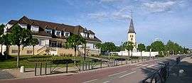 Town hall | |
 Abergement-la-Ronce Location within Bourgogne-Franche-Comté region  Abergement-la-Ronce | |
| Coordinates: 47°04′15″N 5°22′11″E / 47.0708°N 5.3697°ECoordinates: 47°04′15″N 5°22′11″E / 47.0708°N 5.3697°E | |
| Country | France |
| Region | Bourgogne-Franche-Comté |
| Department | Jura |
| Arrondissement | Dole |
| Canton | Tavaux |
| Intercommunality | Grand Dole |
| Government | |
| • Mayor (2014-2020) | Jean-Louis Bouchard |
| Area1 | 7.12 km2 (2.75 sq mi) |
| Population (2014)2 | 809 |
| • Density | 110/km2 (290/sq mi) |
| Time zone | UTC+1 (CET) |
| • Summer (DST) | UTC+2 (CEST) |
| INSEE/Postal code | 39001 /39500 |
| Elevation | 186–195 m (610–640 ft) |
|
1 French Land Register data, which excludes lakes, ponds, glaciers > 1 km2 (0.386 sq mi or 247 acres) and river estuaries. 2 Population without double counting: residents of multiple communes (e.g., students and military personnel) only counted once. | |
Abergement-la-Ronce is a commune in the Jura department in the region of Bourgogne-Franche-Comté in eastern France.
Population
| Historical population | ||
|---|---|---|
| Year | Pop. | ±% |
| 1793 | 254 | — |
| 1800 | 218 | −14.2% |
| 1806 | 291 | +33.5% |
| 1821 | 283 | −2.7% |
| 1831 | 365 | +29.0% |
| 1836 | 331 | −9.3% |
| 1841 | 335 | +1.2% |
| 1846 | 316 | −5.7% |
| 1851 | 303 | −4.1% |
| 1856 | 324 | +6.9% |
| 1861 | 326 | +0.6% |
| 1866 | 333 | +2.1% |
| 1872 | 326 | −2.1% |
| 1876 | 383 | +17.5% |
| 1881 | 397 | +3.7% |
| 1886 | 375 | −5.5% |
| 1891 | 391 | +4.3% |
| 1896 | 370 | −5.4% |
| 1901 | 346 | −6.5% |
| 1906 | 334 | −3.5% |
| 1911 | 332 | −0.6% |
| 1921 | 295 | −11.1% |
| 1926 | 277 | −6.1% |
| 1931 | 358 | +29.2% |
| 1936 | 297 | −17.0% |
| 1946 | 322 | +8.4% |
| 1954 | 351 | +9.0% |
| 1962 | 417 | +18.8% |
| 1968 | 454 | +8.9% |
| 1975 | 610 | +34.4% |
| 1982 | 677 | +11.0% |
| 1990 | 667 | −1.5% |
| 1999 | 735 | +10.2% |
| 2008 | 744 | +1.2% |
| 2014 | 809 | +8.7% |
See also
References
| Wikimedia Commons has media related to Abergement-la-Ronce. |
This article is issued from
Wikipedia.
The text is licensed under Creative Commons - Attribution - Sharealike.
Additional terms may apply for the media files.