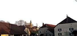
Lemuy
| Lemuy | |
|---|---|
| Commune | |
 | |
 Lemuy Location within Bourgogne-Franche-Comté region  Lemuy | |
| Coordinates: 46°53′54″N 5°58′09″E / 46.8983°N 5.9692°ECoordinates: 46°53′54″N 5°58′09″E / 46.8983°N 5.9692°E | |
| Country | France |
| Region | Bourgogne-Franche-Comté |
| Department | Jura |
| Arrondissement | Dole |
| Canton | Arbois |
| Government | |
| • Mayor (2014–2020) | Jean-Luc Brocard |
| Area1 | 21.33 km2 (8.24 sq mi) |
| Population (2012)2 | 232 |
| • Density | 11/km2 (28/sq mi) |
| Time zone | UTC+1 (CET) |
| • Summer (DST) | UTC+2 (CEST) |
| INSEE/Postal code | 39291 /39110 |
| Elevation | 608–884 m (1,995–2,900 ft) |
|
1 French Land Register data, which excludes lakes, ponds, glaciers > 1 km2 (0.386 sq mi or 247 acres) and river estuaries. 2 Population without double counting: residents of multiple communes (e.g., students and military personnel) only counted once. | |
Lemuy is a commune in the Jura department in Franche-Comté in eastern France.
Population
| Historical population | ||
|---|---|---|
| Year | Pop. | ±% |
| 1793 | 501 | — |
| 1806 | 574 | +14.6% |
| 1821 | 598 | +4.2% |
| 1831 | 574 | −4.0% |
| 1841 | 619 | +7.8% |
| 1851 | 605 | −2.3% |
| 1861 | 485 | −19.8% |
| 1872 | 436 | −10.1% |
| 1881 | 437 | +0.2% |
| 1891 | 412 | −5.7% |
| 1901 | 405 | −1.7% |
| 1911 | 361 | −10.9% |
| 1921 | 323 | −10.5% |
| 1931 | 351 | +8.7% |
| 1946 | 309 | −12.0% |
| 1954 | 313 | +1.3% |
| 1962 | 288 | −8.0% |
| 1968 | 273 | −5.2% |
| 1975 | 294 | +7.7% |
| 1982 | 306 | +4.1% |
| 1990 | 291 | −4.9% |
| 1999 | 264 | −9.3% |
| 2006 | 248 | −6.1% |
| 2012 | 232 | −6.5% |
See also
References
| Wikimedia Commons has media related to Lemuy. |
This article is issued from
Wikipedia.
The text is licensed under Creative Commons - Attribution - Sharealike.
Additional terms may apply for the media files.