Lect, Jura
| Lect | |
|---|---|
| Commune | |
 | |
 Lect Location within Bourgogne-Franche-Comté region  Lect | |
| Coordinates: 46°23′24″N 5°40′36″E / 46.39°N 5.6767°ECoordinates: 46°23′24″N 5°40′36″E / 46.39°N 5.6767°E | |
| Country | France |
| Region | Bourgogne-Franche-Comté |
| Department | Jura |
| Arrondissement | Saint-Claude |
| Canton | Moirans-en-Montagne |
| Government | |
| • Mayor (2014–2020) | Guy Morel |
| Area1 | 11.94 km2 (4.61 sq mi) |
| Population (2014)2 | 350 |
| • Density | 29/km2 (76/sq mi) |
| Time zone | UTC+1 (CET) |
| • Summer (DST) | UTC+2 (CEST) |
| INSEE/Postal code | 39289 /39260 |
| Elevation | 306–743 m (1,004–2,438 ft) |
|
1 French Land Register data, which excludes lakes, ponds, glaciers > 1 km2 (0.386 sq mi or 247 acres) and river estuaries. 2 Population without double counting: residents of multiple communes (e.g., students and military personnel) only counted once. | |
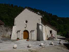
Lect is a commune in the Jura department in Franche-Comté in eastern France. The hamlet of Vouglans has been attached to Lect since 1822.
Population
The demographic increase after 1820 is due to the attachment of Vouglans to Lect in 1822. The large increase after 1960 can be explained by the construction of the dam, the reservoir of the hydro-electric power station of the Lac de Vouglans, which required a workforce of more than 500 for five years.
| Historical population | ||
|---|---|---|
| Year | Pop. | ±% |
| 1793 | 362 | — |
| 1806 | 400 | +10.5% |
| 1821 | 386 | −3.5% |
| 1831 | 642 | +66.3% |
| 1841 | 566 | −11.8% |
| 1851 | 613 | +8.3% |
| 1861 | 562 | −8.3% |
| 1872 | 550 | −2.1% |
| 1881 | 488 | −11.3% |
| 1891 | 450 | −7.8% |
| 1901 | 439 | −2.4% |
| 1911 | 409 | −6.8% |
| 1921 | 394 | −3.7% |
| 1931 | 346 | −12.2% |
| 1946 | 334 | −3.5% |
| 1954 | 284 | −15.0% |
| 1962 | 257 | −9.5% |
| 1968 | 841 | +227.2% |
| 1975 | 273 | −67.5% |
| 1982 | 280 | +2.6% |
| 1990 | 266 | −5.0% |
| 1999 | 352 | +32.3% |
| 2006 | 377 | +7.1% |
| 2012 | 365 | −3.2% |
| 2014 | 350 | −4.1% |
See also
References
| Wikimedia Commons has media related to Lect. |
| Wikimedia Commons has media related to Vouglans. |
This article is issued from
Wikipedia.
The text is licensed under Creative Commons - Attribution - Sharealike.
Additional terms may apply for the media files.