Plaisia
| Plaisia | |
|---|---|
| Commune | |
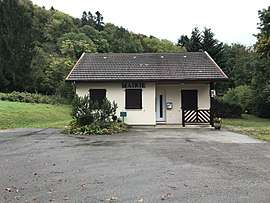 Town hall of Plaisia. | |
 Plaisia Location within Bourgogne-Franche-Comté region  Plaisia | |
| Coordinates: 46°32′00″N 5°38′03″E / 46.5333°N 5.6342°ECoordinates: 46°32′00″N 5°38′03″E / 46.5333°N 5.6342°E | |
| Country | France |
| Region | Bourgogne-Franche-Comté |
| Department | Jura |
| Arrondissement | Lons-le-Saunier |
| Canton | Moirans-en-Montagne |
| Government | |
| • Mayor (2014–2020) | Jean-Marc Boilletot |
| Area1 | 5.31 km2 (2.05 sq mi) |
| Population (2014)2 | 120 |
| • Density | 23/km2 (59/sq mi) |
| Time zone | UTC+1 (CET) |
| • Summer (DST) | UTC+2 (CEST) |
| INSEE/Postal code | 39423 /39270 |
| Elevation | 420–690 m (1,380–2,260 ft) |
|
1 French Land Register data, which excludes lakes, ponds, glaciers > 1 km2 (0.386 sq mi or 247 acres) and river estuaries. 2 Population without double counting: residents of multiple communes (e.g., students and military personnel) only counted once. | |
Plaisia is a commune in the Jura department in Franche-Comté in eastern France.
Population
| Historical population | ||
|---|---|---|
| Year | Pop. | ±% |
| 1793 | 138 | — |
| 1806 | 291 | +110.9% |
| 1821 | 289 | −0.7% |
| 1831 | 443 | +53.3% |
| 1841 | 268 | −39.5% |
| 1851 | 235 | −12.3% |
| 1861 | 228 | −3.0% |
| 1872 | 180 | −21.1% |
| 1881 | 158 | −12.2% |
| 1891 | 188 | +19.0% |
| 1901 | 166 | −11.7% |
| 1911 | 118 | −28.9% |
| 1921 | 89 | −24.6% |
| 1931 | 107 | +20.2% |
| 1946 | 105 | −1.9% |
| 1954 | 107 | +1.9% |
| 1962 | 95 | −11.2% |
| 1968 | 94 | −1.1% |
| 1975 | 90 | −4.3% |
| 1982 | 100 | +11.1% |
| 1990 | 97 | −3.0% |
| 1999 | 115 | +18.6% |
| 2006 | 112 | −2.6% |
| 2012 | 119 | +6.2% |
See also
References
| Wikimedia Commons has media related to Plaisia. |
This article is issued from
Wikipedia.
The text is licensed under Creative Commons - Attribution - Sharealike.
Additional terms may apply for the media files.