Aromas, Jura
| Aromas | |
|---|---|
| Commune | |
 | |
 Aromas Location within Bourgogne-Franche-Comté region  Aromas | |
| Coordinates: 46°17′36″N 5°28′53″E / 46.2933°N 5.4814°ECoordinates: 46°17′36″N 5°28′53″E / 46.2933°N 5.4814°E | |
| Country | France |
| Region | Bourgogne-Franche-Comté |
| Department | Jura |
| Arrondissement | Lons-le-Saunier |
| Canton |
Moirans-en-Montagne Saint-Amour |
| Government | |
| • Mayor (2014-2020) | Jean-Louis Delorme |
| Area1 | 25.80 km2 (9.96 sq mi) |
| Population (2015)2 | 643 |
| • Density | 25/km2 (65/sq mi) |
| Time zone | UTC+1 (CET) |
| • Summer (DST) | UTC+2 (CEST) |
| INSEE/Postal code | 39018 /39240 |
| Elevation | 390–660 m (1,280–2,170 ft) |
|
1 French Land Register data, which excludes lakes, ponds, glaciers > 1 km2 (0.386 sq mi or 247 acres) and river estuaries. 2 Population without double counting: residents of multiple communes (e.g., students and military personnel) only counted once. | |
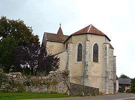
Aromas is a commune in the Jura department in the region of Bourgogne-Franche-Comté in eastern France. On 1 January 2017, the former commune of Villeneuve-lès-Charnod was merged into Aromas.[1]
Population
| Historical population | ||
|---|---|---|
| Year | Pop. | ±% |
| 1793 | 240 | — |
| 1800 | 238 | −0.8% |
| 1806 | 252 | +5.9% |
| 1821 | 244 | −3.2% |
| 1831 | 790 | +223.8% |
| 1836 | 704 | −10.9% |
| 1841 | 744 | +5.7% |
| 1846 | 806 | +8.3% |
| 1851 | 755 | −6.3% |
| 1856 | 732 | −3.0% |
| 1861 | 710 | −3.0% |
| 1866 | 780 | +9.9% |
| 1872 | 756 | −3.1% |
| 1876 | 785 | +3.8% |
| 1881 | 772 | −1.7% |
| 1886 | 795 | +3.0% |
| 1891 | 739 | −7.0% |
| 1896 | 907 | +22.7% |
| 1901 | 788 | −13.1% |
| 1906 | 712 | −9.6% |
| 1911 | 677 | −4.9% |
| 1921 | 535 | −21.0% |
| 1926 | 523 | −2.2% |
| 1931 | 413 | −21.0% |
| 1936 | 462 | +11.9% |
| 1946 | 447 | −3.2% |
| 1954 | 410 | −8.3% |
| 1962 | 418 | +2.0% |
| 1968 | 388 | −7.2% |
| 1975 | 387 | −0.3% |
| 1982 | 353 | −8.8% |
| 1990 | 344 | −2.5% |
| 1999 | 495 | +43.9% |
| 2008 | 521 | +5.3% |
| 2015 | 643 | +23.4% |
See also
References
- ↑ Arrêté préfectoral 15 December 2016 (in French)
| Wikimedia Commons has media related to Aromas. |
This article is issued from
Wikipedia.
The text is licensed under Creative Commons - Attribution - Sharealike.
Additional terms may apply for the media files.