Orgelet
| Orgelet | ||
|---|---|---|
| Commune | ||
 | ||
| ||
 Orgelet Location within Bourgogne-Franche-Comté region  Orgelet | ||
| Coordinates: 46°31′23″N 5°36′40″E / 46.5231°N 5.6111°ECoordinates: 46°31′23″N 5°36′40″E / 46.5231°N 5.6111°E | ||
| Country | France | |
| Region | Bourgogne-Franche-Comté | |
| Department | Jura | |
| Arrondissement | Lons-le-Saunier | |
| Canton | Moirans-en-Montagne | |
| Government | ||
| • Mayor (2014–2020) | Jean-Luc Allemand | |
| Area1 | 23.11 km2 (8.92 sq mi) | |
| Population (2012)2 | 1,593 | |
| • Density | 69/km2 (180/sq mi) | |
| Time zone | UTC+1 (CET) | |
| • Summer (DST) | UTC+2 (CEST) | |
| INSEE/Postal code | 39397 /39270 | |
| Elevation | 374–653 m (1,227–2,142 ft) | |
|
1 French Land Register data, which excludes lakes, ponds, glaciers > 1 km2 (0.386 sq mi or 247 acres) and river estuaries. 2 Population without double counting: residents of multiple communes (e.g., students and military personnel) only counted once. | ||
.svg.png)
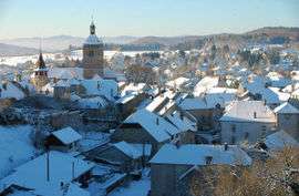
Orgelet is a commune in the Jura department in Franche-Comté in eastern France.
Surrounding communes
Some adjacent communes of Orgelet are:
Population
| Historical population | ||
|---|---|---|
| Year | Pop. | ±% |
| 1793 | 2,758 | — |
| 1806 | 2,231 | −19.1% |
| 1821 | 2,291 | +2.7% |
| 1831 | 2,367 | +3.3% |
| 1841 | 2,017 | −14.8% |
| 1851 | 2,123 | +5.3% |
| 1861 | 1,912 | −9.9% |
| 1872 | 1,706 | −10.8% |
| 1881 | 1,720 | +0.8% |
| 1891 | 1,591 | −7.5% |
| 1901 | 1,502 | −5.6% |
| 1911 | 1,455 | −3.1% |
| 1921 | 1,278 | −12.2% |
| 1931 | 1,232 | −3.6% |
| 1946 | 1,223 | −0.7% |
| 1954 | 1,259 | +2.9% |
| 1962 | 1,413 | +12.2% |
| 1968 | 1,662 | +17.6% |
| 1975 | 1,711 | +2.9% |
| 1982 | 1,622 | −5.2% |
| 1990 | 1,700 | +4.8% |
| 1999 | 1,686 | −0.8% |
| 2006 | 1,733 | +2.8% |
| 2012 | 1,593 | −8.1% |
See also
References
| Wikimedia Commons has media related to Orgelet. |
| Authority control |
|---|
This article is issued from
Wikipedia.
The text is licensed under Creative Commons - Attribution - Sharealike.
Additional terms may apply for the media files.