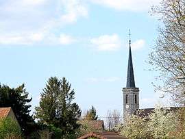
Petit-Noir
| Petit-Noir | |
|---|---|
| Commune | |
 | |
 Petit-Noir Location within Bourgogne-Franche-Comté region  Petit-Noir | |
| Coordinates: 46°56′17″N 5°20′34″E / 46.9381°N 5.3428°ECoordinates: 46°56′17″N 5°20′34″E / 46.9381°N 5.3428°E | |
| Country | France |
| Region | Bourgogne-Franche-Comté |
| Department | Jura |
| Arrondissement | Dole |
| Canton | Tavaux |
| Government | |
| • Mayor (2014–2020) | Étienne Cordier |
| Area1 | 20.52 km2 (7.92 sq mi) |
| Population (2012)2 | 1,140 |
| • Density | 56/km2 (140/sq mi) |
| Time zone | UTC+1 (CET) |
| • Summer (DST) | UTC+2 (CEST) |
| INSEE/Postal code | 39415 /39120 |
| Elevation | 177–215 m (581–705 ft) |
|
1 French Land Register data, which excludes lakes, ponds, glaciers > 1 km2 (0.386 sq mi or 247 acres) and river estuaries. 2 Population without double counting: residents of multiple communes (e.g., students and military personnel) only counted once. | |
Petit-Noir is a commune in the Jura department in Franche-Comté in eastern France.
Population
| Historical population | ||
|---|---|---|
| Year | Pop. | ±% |
| 1793 | 910 | — |
| 1806 | 1,051 | +15.5% |
| 1821 | 1,104 | +5.0% |
| 1831 | 1,134 | +2.7% |
| 1841 | 1,291 | +13.8% |
| 1851 | 1,298 | +0.5% |
| 1861 | 1,240 | −4.5% |
| 1872 | 1,202 | −3.1% |
| 1881 | 1,144 | −4.8% |
| 1891 | 1,045 | −8.7% |
| 1901 | 962 | −7.9% |
| 1911 | 988 | +2.7% |
| 1921 | 885 | −10.4% |
| 1931 | 798 | −9.8% |
| 1946 | 722 | −9.5% |
| 1954 | 691 | −4.3% |
| 1962 | 730 | +5.6% |
| 1968 | 717 | −1.8% |
| 1975 | 804 | +12.1% |
| 1982 | 929 | +15.5% |
| 1990 | 938 | +1.0% |
| 1999 | 974 | +3.8% |
| 2006 | 1,139 | +16.9% |
| 2012 | 1,140 | +0.1% |
See also
References
| Wikimedia Commons has media related to Petit-Noir. |
This article is issued from
Wikipedia.
The text is licensed under Creative Commons - Attribution - Sharealike.
Additional terms may apply for the media files.