Souvans
| Souvans | |
|---|---|
| Commune | |
 | |
 Souvans Location within Bourgogne-Franche-Comté region  Souvans | |
| Coordinates: 46°59′42″N 5°32′58″E / 46.995°N 5.5494°ECoordinates: 46°59′42″N 5°32′58″E / 46.995°N 5.5494°E | |
| Country | France |
| Region | Bourgogne-Franche-Comté |
| Department | Jura |
| Arrondissement | Dole |
| Canton | Mont-sous-Vaudrey |
| Government | |
| • Mayor (2014–2020) | Jean-Charles Koehren |
| Area1 | 19.66 km2 (7.59 sq mi) |
| Population (2013)2 | 511 |
| • Density | 26/km2 (67/sq mi) |
| Time zone | UTC+1 (CET) |
| • Summer (DST) | UTC+2 (CEST) |
| INSEE/Postal code | 39520 /39380 |
| Elevation | 202–246 m (663–807 ft) |
|
1 French Land Register data, which excludes lakes, ponds, glaciers > 1 km2 (0.386 sq mi or 247 acres) and river estuaries. 2 Population without double counting: residents of multiple communes (e.g., students and military personnel) only counted once. | |
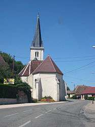
Souvans is a commune in the Jura department in the Bourgogne-Franche-Comté region in eastern France.
Population
| Historical population | ||
|---|---|---|
| Year | Pop. | ±% |
| 1793 | 568 | — |
| 1806 | 601 | +5.8% |
| 1821 | 691 | +15.0% |
| 1831 | 813 | +17.7% |
| 1841 | 791 | −2.7% |
| 1851 | 738 | −6.7% |
| 1861 | 654 | −11.4% |
| 1872 | 600 | −8.3% |
| 1881 | 586 | −2.3% |
| 1891 | 555 | −5.3% |
| 1901 | 508 | −8.5% |
| 1911 | 464 | −8.7% |
| 1921 | 398 | −14.2% |
| 1931 | 392 | −1.5% |
| 1946 | 383 | −2.3% |
| 1954 | 384 | +0.3% |
| 1962 | 369 | −3.9% |
| 1968 | 375 | +1.6% |
| 1975 | 401 | +6.9% |
| 1982 | 358 | −10.7% |
| 1990 | 405 | +13.1% |
| 1999 | 451 | +11.4% |
| 2006 | 480 | +6.4% |
| 2013 | 511 | +6.5% |
See also
References
| Wikimedia Commons has media related to Souvans. |
This article is issued from
Wikipedia.
The text is licensed under Creative Commons - Attribution - Sharealike.
Additional terms may apply for the media files.