Arrondissement of Dole
| Dole | |
|---|---|
| Arrondissement | |
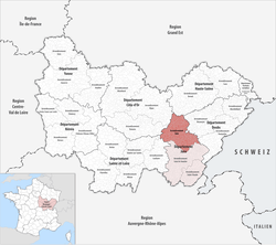 Map of the arrondissement of Dole within Bourgogne-Franche-Comté | |
| Country | France |
| Region | Bourgogne-Franche-Comté |
| Department | Jura |
| Communes | 191 |
| Subprefecture | Dole |
| Population (2013) | |
| • Total | 83,474 |
| ¹ French Land Register data, which exclude lakes, ponds, and glaciers larger than 1 km² as well as the estuaries of rivers. | |
The arrondissement of Dole is an arrondissement of France in the Jura department in the Bourgogne-Franche-Comté region. Since the January 2017 reorganization of the arrondissements of Jura, it has 191 communes.[1]
Composition
Cantons
The cantons of the arrondissement of Dole are:
- Arbois
- Authume
- Bletterans (partly)
- Dole-1
- Dole-2
- Mont-sous-Vaudrey
- Poligny (partly)
- Tavaux
Communes
The communes of the arrondissement of Dole are:[2]
- Abergement-la-Ronce
- Abergement-le-Grand
- Abergement-le-Petit
- Abergement-lès-Thésy
- Aiglepierre
- Amange
- Annoire
- Arbois
- Archelange
- Aresches
- Les Arsures
- Asnans-Beauvoisin
- Audelange
- Augerans
- Aumont
- Aumur
- Authume
- Auxange
- Balaiseaux
- Bans
- La Barre
- Barretaine
- Baverans
- Belmont
- Bersaillin
- Besain
- Biarne
- Biefmorin
- Bracon
- Brainans
- Brans
- La Bretenière
- Bretenières
- Brevans
- Buvilly
- Cernans
- Chaînée-des-Coupis
- Chamblay
- Chamole
- Champagne-sur-Loue
- Champagney
- Champdivers
- Champvans
- La Chapelle-sur-Furieuse
- La Châtelaine
- Chatelay
- Le Chateley
- Châtenois
- Chaussenans
- Chaussin
- Chaux-Champagny
- Chemin
- Chêne-Bernard
- Chevigny
- Chilly-sur-Salins
- Chissey-sur-Loue
- Choisey
- Clucy
- Colonne
- Courtefontaine
- Cramans
- Crissey
- Dammartin-Marpain
- Damparis
- Dampierre
- Darbonnay
- Le Deschaux
- Dole
- Dournon
- Éclans-Nenon
- Écleux
- Les Essards-Taignevaux
- Étrepigney
- Évans
- Falletans
- Fay-en-Montagne
- La Ferté
- Le Fied
- Foucherans
- Fraisans
- Frasne-les-Meulières
- Gatey
- Gendrey
- Geraise
- Germigney
- Gevry
- Grange-de-Vaivre
- Gredisans
- Grozon
- Les Hays
- Ivory
- Ivrey
- Jouhe
- Lavangeot
- Lavans-lès-Dole
- Lemuy
- Longwy-sur-le-Doubs
- Louvatange
- La Loye
- Malange
- Marnoz
- Mathenay
- Menotey
- Mesnay
- Miéry
- Moissey
- Molain
- Molamboz
- Molay
- Monay
- Monnières
- Montbarrey
- Monteplain
- Montholier
- Montigny-lès-Arsures
- Montmarlon
- Montmirey-la-Ville
- Montmirey-le-Château
- Mont-sous-Vaudrey
- Mouchard
- Mutigney
- Neublans-Abergement
- Neuvilley
- Nevy-lès-Dole
- Offlanges
- Orchamps
- Ougney
- Ounans
- Our
- Oussières
- Pagney
- Pagnoz
- Parcey
- Peintre
- Peseux
- Le Petit-Mercey
- Petit-Noir
- Picarreau
- Les Planches-près-Arbois
- Plasne
- Pleure
- Plumont
- Pointre
- Poligny
- Pont-d'Héry
- Port-Lesney
- Pretin
- Pupillin
- Rahon
- Rainans
- Ranchot
- Rans
- Rochefort-sur-Nenon
- Romain
- Romange
- Rouffange
- Saint-Aubin
- Saint-Baraing
- Saint-Cyr-Montmalin
- Saint-Lothain
- Saint-Loup
- Saint-Thiébaud
- Saizenay
- Salans
- Saligney
- Salins-les-Bains
- Sampans
- Santans
- Séligney
- Sermange
- Serre-les-Moulières
- Souvans
- Tassenières
- Tavaux
- Taxenne
- Thervay
- Thésy
- Tourmont
- Vadans
- Vaudrey
- Vaux-sur-Poligny
- La Vieille-Loye
- Villeneuve-d'Aval
- Villerserine
- Villers-Farlay
- Villers-les-Bois
- Villers-Robert
- Villette-lès-Arbois
- Villette-lès-Dole
- Vitreux
- Vriange
References
- ↑ "Arrêté préfectoral, 27 December 2016, p 10" (PDF). Retrieved 2017-07-31.
- ↑ INSEE Communes de l'arrondissement de Dole
External links
This article is issued from
Wikipedia.
The text is licensed under Creative Commons - Attribution - Sharealike.
Additional terms may apply for the media files.