Vaux-lès-Saint-Claude
| Vaux-lès-Saint-Claude | |
|---|---|
| Commune | |
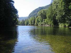 The Bienne River | |
 Vaux-lès-Saint-Claude Location within Bourgogne-Franche-Comté region  Vaux-lès-Saint-Claude | |
| Coordinates: 46°21′31″N 5°44′16″E / 46.3586°N 5.7378°ECoordinates: 46°21′31″N 5°44′16″E / 46.3586°N 5.7378°E | |
| Country | France |
| Region | Bourgogne-Franche-Comté |
| Department | Jura |
| Arrondissement | Saint-Claude |
| Canton | Saint-Lupicin |
| Government | |
| • Mayor (2014–2020) | Alain Rigaud |
| Area1 | 9.36 km2 (3.61 sq mi) |
| Population (2013)2 | 707 |
| • Density | 76/km2 (200/sq mi) |
| Time zone | UTC+1 (CET) |
| • Summer (DST) | UTC+2 (CEST) |
| INSEE/Postal code | 39547 /39360 |
| Elevation | 324–950 m (1,063–3,117 ft) |
|
1 French Land Register data, which excludes lakes, ponds, glaciers > 1 km2 (0.386 sq mi or 247 acres) and river estuaries. 2 Population without double counting: residents of multiple communes (e.g., students and military personnel) only counted once. | |
Vaux-lès-Saint-Claude is a commune in the Jura department in the Bourgogne-Franche-Comté region in eastern France.
Population
| Historical population | ||
|---|---|---|
| Year | Pop. | ±% |
| 1793 | 240 | — |
| 1806 | 258 | +7.5% |
| 1821 | 261 | +1.2% |
| 1831 | 505 | +93.5% |
| 1841 | 444 | −12.1% |
| 1851 | 410 | −7.7% |
| 1861 | 389 | −5.1% |
| 1872 | 412 | +5.9% |
| 1881 | 418 | +1.5% |
| 1891 | 363 | −13.2% |
| 1901 | 427 | +17.6% |
| 1911 | 438 | +2.6% |
| 1921 | 429 | −2.1% |
| 1931 | 455 | +6.1% |
| 1946 | 446 | −2.0% |
| 1954 | 472 | +5.8% |
| 1962 | 435 | −7.8% |
| 1968 | 487 | +12.0% |
| 1975 | 505 | +3.7% |
| 1982 | 572 | +13.3% |
| 1990 | 629 | +10.0% |
| 1999 | 684 | +8.7% |
| 2008 | 708 | +3.5% |
| 2013 | 707 | −0.1% |
See also
References
| Wikimedia Commons has media related to Vaux-lès-Saint-Claude. |
This article is issued from
Wikipedia.
The text is licensed under Creative Commons - Attribution - Sharealike.
Additional terms may apply for the media files.