List of towns in Alberta
A town is an urban municipality status type used in the Canadian province of Alberta. Alberta towns are created when communities with populations of at least 1,000 people, where a majority of their buildings are on parcels of land smaller than 1,850 m², apply to Alberta Municipal Affairs for town status under the authority of the Municipal Government Act.[1] Applications for town status are approved via orders in council made by the Lieutenant Governor in Council under recommendation from the Minister of Municipal Affairs.[1]
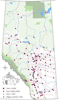
Alberta has 108 towns that had a cumulative population of 437,957 and an average population of 4,055 in the 2011 Census.[2] The number of towns increased to 108 on January 1, 2017 when Thorsby changed from village status to town status.[3] Alberta's largest and smallest towns are Okotoks and Granum with populations of 28,881 and 447 respectively.[2]
When a town's population exceeds 10,000 people, the council may request a change to city status, but the change in incorporated status is not mandatory.[4] Towns with populations less than 1,000, whether their populations have declined below 1,000 or they were incorporated as towns prior to the minimum 1,000 population requirement, are permitted to retain town status.
714 elected town officials (108 mayors and 606 councillors) provide town governance throughout the province.[5]
The highest frequency of towns in Alberta is found in the Queen Elizabeth II Highway/Highway 2A corridor between Calgary and Edmonton corridor including, from south to north, Crossfield, Carstairs, Didsbury, Olds, Bowden, Innisfail, Penhold, Blackfalds, Ponoka and Millet.
Administration
Pursuant to Part 5, Division 1 of the Municipal Government Act (MGA), each municipality created under the authority of the MGA is governed by a council. As a requirement of the MGA, a town council consists of an odd number of councillors, one of which is the town's chief elected official (CEO) or mayor. A town council consists of seven councillors by default, but it can consist of a higher or lower odd number if council passes a bylaw altering its size (so long as it does not consist of fewer than three councillors).[1] For the 2013-2017 term, 87 towns have a council of seven, and 21 have a council of five.[6]
Town councils are governed by a mayor and an even number of councillors that are elected by popular vote, resulting in a total odd number of members to avoid tie votes on council matters.[1] All council members are elected under the provisions of the Local Authorities Election Act (LAEA).[7] Mayoral or councillor candidates are required to be residents of their municipality for a minimum of six consecutive months prior to nomination day. The last municipal election was October 21, 2013.
Alberta Municipal Affairs, a ministry of the Cabinet of Alberta, is charged with coordination of all levels of local government.
Administrative duties of towns include public safety, local transit, roads, water service, drainage and waste collection, as well as coordination of infrastructure with provincial and regional authorities (including road construction, education, and health).
List
The below table is a list of only those urban municipalities in Alberta that are incorporated as towns.
The municipalities of Crowsnest Pass and Jasper are not listed because they are incorporated as specialized municipalities, not towns. For more information on specialized municipalities, see Specialized municipalities of Alberta.
| Municipal census population (year)[8] | Population (2011)[9] | Population (2006)[9] | Change (%)[9] | Land area (km²)[9] | Population density (per km²)[9] | |||
|---|---|---|---|---|---|---|---|---|
| Athabasca[N 1] | Athabasca County | September 19, 1911 | align=center| 2,990 | 2,580 | 15.9 | 17.48 | 171.1 | |
| Banff | Improvement District No. 9 (Banff) | January 1, 1990 | 8,421[N 2] (2014) | align=center| 7,584 | 6,700 | 13.2 | 4.88 | 1,555.0 |
| Barrhead | Barrhead No. 11, County of | November 26, 1946 | align=center| 4,432 | 4,209 | 5.3 | 8.10 | 547.2 | |
| Bashaw | Camrose County | May 1, 1964 | align=center| 873 | 796 | 9.7 | 2.84 | 306.9 | |
| Bassano | Newell, County of | January 16, 1911 | align=center| 1,282 | 1,345 | −4.7 | 5.16 | 248.6 | |
| Beaumont | Leduc County | January 1, 1980 | 17,720 (2016) | align=center| 13,284 | 8,961 | 48.2 | 10.50 | 1,264.8 |
| Beaverlodge | Grande Prairie No. 1, County of | January 24, 1956 | align=center| 2,365 | 2,264 | 4.5 | 5.58 | 424.0 | |
| Bentley | Lacombe County | January 1, 2001 | 1,122 (2014) | align=center| 1,073 | 1,083 | −0.9 | 2.30 | 466.3 |
| Black Diamond | Foothills No. 31, M.D. of | January 1, 1956 | align=center| 2,373 | 1,900 | 24.9 | 3.21 | 740.3 | |
| Blackfalds | Lacombe County | April 1, 1980 | 9,510 (2016) | align=center| 6,300 | 4,618 | 36.4 | 16.36 | 385.0 |
| Bon Accord | Sturgeon County | November 20, 1979 | align=center| 1,488 | 1,534 | −3.0 | 2.11 | 706.2 | |
| Bonnyville | Bonnyville No. 87, M.D. of | February 3, 1948 | 6,921 (2014) | align=center| 6,216 | 5,832 | 6.6 | 14.10 | 440.7 |
| Bow Island | Forty Mile No. 8, County of | February 1, 1912 | align=center| 2,025 | 1,790 | 13.1 | 5.92 | 342.1 | |
| Bowden | Red Deer County | September 1, 1981 | align=center| 1,241 | 1,210 | 2.6 | 2.73 | 454.7 | |
| Bruderheim | Lamont County | September 17, 1980 | 1,348 (2014) | align=center| 1,155 | 1,215 | −4.9 | 4.23 | 273.2 |
| Calmar | Leduc County | January 19, 1954 | 2,101 (2014) | align=center| 1,970 | 1,959 | 0.6 | 4.65 | 423.7 |
| Canmore | Bighorn No. 8, M.D. of Kananaskis Improvement District[11] | June 1, 1966 | 13,077 (2014) | align=center| 12,288 | 12,039 | 2.1 | 68.90 | 178.4 |
| Cardston | Cardston County | July 2, 1901 | align=center| 3,580 | 3,452 | 3.7 | 8.64 | 414.1 | |
| Carstairs | Mountain View County | September 1, 1966 | align=center| 3,442 | 2,699 | 27.5 | 11.53 | 298.4 | |
| Castor | Paintearth No. 18, County of | June 27, 1910 | align=center| 932 | 931 | 0.1 | 2.72 | 343.1 | |
| Claresholm | Willow Creek No. 26, M.D. of | August 31, 1905 | align=center| 3,758 | 3,700 | 1.6 | 9.08 | 414.0 | |
| Coaldale | Lethbridge County | January 7, 1952 | 7,526 (2013) | align=center| 7,493 | 6,177 | 21.3 | 7.95 | 942.8 |
| Coalhurst | Lethbridge County | June 1, 1995 | 2,522 (2015) | align=center| 1,963 | 1,523 | 28.9 | 2.39 | 820.3 |
| Cochrane | Rocky View County | February 15, 1971 | 25,122 (2016) | align=center| 17,580 | 13,760 | 27.8 | 30.03 | 585.5 |
| Coronation | Paintearth No. 18, County of | April 29, 1912 | align=center| 947 | 1,015 | −6.7 | 3.73 | 253.6 | |
| Crossfield | Rocky View County | August 1, 1980 | 2,918 (2014) | align=center| 2,853 | 2,668 | 6.9 | 11.87 | 240.3 |
| Daysland | Flagstaff County | April 2, 1907 | align=center| 807 | 818 | −1.3 | 1.75 | 461.2 | |
| Devon | Leduc County | February 24, 1950 | 6,650 (2014) | align=center| 6,510 | 6,261 | 4.0 | 11.72 | 555.6 |
| Didsbury | Mountain View County | September 27, 1906 | align=center| 4,957 | 4,305 | 15.1 | 16.08 | 308.2 | |
| Drayton Valley | Brazeau County | February 1, 1957 | align=center| 7,049 | 6,893 | 2.3 | 12.27 | 574.3 | |
| Drumheller[N 3] | Kneehill County Special Area No. 2 Starland County Wheatland County[12] | March 2, 1916 January 1, 1998 | align=center| 8,029 | 7,932 | 1.2 | 107.93 | 74.4 | |
| Eckville | Lacombe County | July 1, 1966 | align=center| 1,125 | 951 | 18.3 | 1.58 | 710.8 | |
| Edson | Yellowhead County | September 21, 1911 | 8,646 (2012) | align=center| 8,475 | 8,098 | 4.7 | 29.58 | 286.5 |
| Elk Point | St. Paul No. 19, County of | January 1, 1962 | 1,646 (2015) | align=center| 1,412 | 1,487 | −5.0 | 4.88 | 289.1 |
| Fairview | Fairview No. 136, M.D. of | April 25, 1949 | align=center| 3,162 | 3,297 | −4.1 | 11.30 | 279.8 | |
| Falher | Smoky River No. 130, M.D. of | January 1, 1955 | align=center| 1,075 | 941 | 14.2 | 2.87 | 374.7 | |
| Fort Macleod[N 4] | Willow Creek No. 26, M.D. of | March 29, 1912 | align=center| 3,117 | 3,072 | 1.5 | 23.34 | 133.5 | |
| Fox Creek | Greenview No. 16, M.D. of | September 1, 1983 | 2,112 (2013) | align=center| 1,969 | 2,278 | −13.6 | 11.54 | 170.6 |
| Gibbons | Sturgeon County | April 1, 1977 | align=center| 3,030 | 2,642 | 14.7 | 7.39 | 409.9 | |
| Grande Cache | Greenview No. 16, M.D. of | September 1, 1983 | align=center| 4,319 | 3,783 | 14.2 | 35.48 | 121.7 | |
| Granum[N 5] | Willow Creek No. 26, M.D. of | November 7, 1910 | align=center| 447 | 415 | 7.7 | 1.87 | 239.6 | |
| Grimshaw | Peace No. 135, M.D. of | February 2, 1953 | align=center| 2,515 | 2,537 | −0.9 | 7.21 | 349.0 | |
| Hanna | Special Area No. 2 | April 14, 1914 | align=center| 2,673 | 2,847 | −6.1 | 8.56 | 312.4 | |
| Hardisty | Flagstaff County | November 9, 1910 | align=center| 639 | 760 | −15.9 | 5.48 | 116.6 | |
| High Level | Mackenzie County | September 1, 1983 | 3,823 (2015) | align=center| 3,641 | 3,887 | −6.3 | 31.99 | 113.8 |
| High Prairie | Big Lakes County | January 10, 1950 | align=center| 2,600 | 2,785 | −6.6 | 7.92 | 328.2 | |
| High River | Foothills No. 31, M.D. of | February 12, 1906 | align=center| 12,920 | 10,716 | 20.6 | 14.27 | 905.5 | |
| Hinton | Yellowhead County | December 29, 1958 | align=center| 9,640 | 9,738 | −1.0 | 33.77 | 285.4 | |
| Innisfail | Red Deer County | November 20, 1903 | 7,953 (2015) | align=center| 7,876 | 7,331 | 7.4 | 19.53 | 403.2 |
| Irricana | Rocky View County | June 9, 2005 | align=center| 1,162 | 1,243 | −6.5 | 3.18 | 364.9 | |
| Killam | Flagstaff County | May 1, 1965 | align=center| 981 | 1,019 | −3.7 | 4.53 | 216.3 | |
| Lamont | Lamont County | May 31, 1968 | align=center| 1,753 | 1,669 | 5.0 | 9.27 | 189.2 | |
| Legal | Sturgeon County | January 1, 1998 | align=center| 1,225 | 1,192 | 2.8 | 3.22 | 381.0 | |
| Magrath | Cardston County | July 24, 1907 | 2,398 (2015) | align=center| 2,217 | 2,081 | 6.5 | 4.97 | 446.2 |
| Manning | Northern Lights, County of | January 1, 1957 | align=center| 1,164 | 1,493 | −22.0 | 3.42 | 340.0 | |
| Mayerthorpe | Lac Ste. Anne County | March 20, 1961 | align=center| 1,398 | 1,474 | −5.2 | 4.78 | 292.7 | |
| McLennan | Smoky River No. 130, M.D. of | February 11, 1948 | align=center| 809 | 824 | −1.8 | 3.58 | 226.2 | |
| Milk River | Warner No. 5, County of | February 7, 1956 | 892 (2015) | align=center| 811 | 816 | −0.6 | 2.39 | 339.6 |
| Millet | Wetaskiwin No. 10, County of | September 1, 1983 | align=center| 2,092 | 2,068 | 1.2 | 3.74 | 558.7 | |
| Morinville | Sturgeon County | April 21, 1911 | 9,893 (2016) | align=center| 8,569 | 6,775 | 26.5 | 11.34 | 755.6 |
| Mundare | Lamont County | January 4, 1951 | align=center| 855 | 712 | 20.1 | 4.20 | 203.6 | |
| Nanton | Willow Creek No. 26, M.D. of | August 9, 1907 | align=center| 2,132 | 2,055 | 3.7 | 4.80 | 443.9 | |
| Nobleford | Lethbridge County | February 28, 2018 | align=center| 1,000 | 689 | 45.1 | 1.54 | 647.8 | |
| Okotoks | Foothills No. 31, M.D. of | June 1, 1904 | 28,016 (2015) | align=center| 24,511 | 17,150 | 42.9 | 19.24 | 1,273.8 |
| Olds | Mountain View County | July 1, 1905 | 8,617 (2014) | align=center| 8,235 | 7,253 | 13.5 | 14.87 | 553.8 |
| Onoway | Lac Ste. Anne County | September 1, 2005 | align=center| 1,039 | 875 | 18.7 | 3.34 | 311.5 | |
| Oyen | Special Area No. 3 | September 1, 1965 | 1,006 (2015) | align=center| 973 | 1,015 | −4.1 | 4.93 | 197.4 |
| Peace River[N 6] | Northern Lights, County of Northern Sunrise County Peace No. 135, M.D. of[13] | December 1, 1919 | align=center| 6,729[14] | 6,315 | 6.6 | 25.92 | 259.6 | |
| Penhold | Red Deer County | September 1, 1980 | 2,842 (2014) | align=center| 2,375 | 1,971 | 20.5 | 5.33 | 445.3 |
| Picture Butte | Lethbridge County | January 1, 1960 | align=center| 1,650 | 1,592 | 3.6 | 2.90 | 569.5 | |
| Pincher Creek | Pincher Creek No. 9, M.D. of | May 12, 1906 | 3,619 (2013) | align=center| 3,685 | 3,625 | 1.7 | 10.19 | 361.6 |
| Ponoka | Ponoka County | October 15, 1904 | align=center| 6,773 | 6,576 | 3.0 | 13.05 | 519.2 | |
| Provost | Provost No. 52, M.D. of | December 29, 1952 | align=center| 2,041 | 2,072 | −1.5 | 4.93 | 413.8 | |
| Rainbow Lake | Mackenzie County | September 1, 1995 | 938 (2015) | align=center| 870 | 965 | −9.8 | 11.04 | 78.8 |
| Raymond | Warner No. 5, County of | July 1, 1903 | 4,202 (2016) | align=center| 3,743 | 3,225 | 16.1 | 6.85 | 546.1 |
| Redcliff | Cypress County | August 5, 1912 | align=center| 5,588 | 5,116 | 9.2 | 16.20 | 344.9 | |
| Redwater | Sturgeon County | December 31, 1950 | 2,116 (2012) | align=center| 1,915 | 2,202 | −13.0 | 20.12 | 95.2 |
| Rimbey | Ponoka County | December 13, 1948 | align=center| 2,378 | 2,252 | 5.6 | 11.34 | 209.7 | |
| Rocky Mountain House | Clearwater County | August 31, 1939 | 7,220 (2015) | align=center| 6,933 | 6,874 | 0.9 | 12.99 | 533.6 |
| Sedgewick | Flagstaff County | May 1, 1966 | align=center| 857 | 891 | −3.8 | 2.60 | 329.1 | |
| Sexsmith | Grande Prairie No. 1, County of | October 15, 1979 | align=center| 2,418 | 1,969 | 22.8 | 13.43 | 180.1 | |
| Slave Lake | Lesser Slave River No. 124, M.D. of | August 2, 1965 | align=center| 6,782 | 6,703 | 1.2 | 14.18 | 478.4 | |
| Smoky Lake | Smoky Lake County | February 1, 1962 | align=center| 1,022 | 1,010 | 1.2 | 4.20 | 243.5 | |
| Spirit River | Spirit River No. 133, M.D. of | September 18, 1951 | align=center| 1,025 | 1,148 | −10.7 | 2.81 | 365.4 | |
| St. Paul[N 7] | St. Paul No. 19, County of | December 15, 1936 | 6,004 (2014) | align=center| 5,400 | 5,106 | 5.8 | 7.89 | 684.7 |
| Stavely | Willow Creek No. 26, M.D. of | May 25, 1912 | align=center| 505 | 435 | 16.1 | 1.62 | 311.3 | |
| Stettler | Stettler No. 6, County of | November 23, 1906 | align=center| 5,748 | 5,445 | 5.6 | 13.12 | 438.2 | |
| Stony Plain | Parkland County | December 10, 1908 | 16,127 (2015) | align=center| 15,051 | 12,363 | 21.7 | 35.61 | 422.7 |
| Strathmore | Wheatland County | July 6, 1911 | 13,327 (2015) | align=center| 12,305 | 10,280 | 19.7 | 27.28 | 451.0 |
| Sundre | Mountain View County | January 1, 1956 | 2,695 (2012) | align=center| 2,610 | 2,523 | 3.4 | 11.16 | 233.9 |
| Swan Hills | Big Lakes County | January 1, 1967 | align=center| 1,465 | 1,645 | −10.9 | 25.44 | 57.6 | |
| Sylvan Lake | Red Deer County | May 20, 1946 | 14,310 (2015) | align=center| 12,327 | 10,250 | 20.3 | 15.62 | 789.4 |
| Taber | Taber, M.D. of | July 1, 1907 | 8,380 (2015) | align=center| 8,104 | 7,591 | 6.8 | 15.09 | 537.2 |
| Thorsby | Leduc County | January 1, 2017[3] | 1,025 (2015) | align=center| 951[14] | 945 | 0.6 | 3.87 | 245.7 |
| Three Hills | Kneehill County | January 1, 1929 | 3,230 (2012) | align=center| 3,198 | 3,089 | 3.5 | 5.63 | 567.8 |
| Tofield | Beaver County | September 10, 1909 | align=center| 2,182 | 1,876 | 16.3 | 8.17 | 267.1 | |
| Trochu | Kneehill County | August 1, 1962 | align=center| 1,072 | 1,005 | 6.7 | 2.82 | 380.1 | |
| Turner Valley | Foothills No. 31, M.D. of | September 1, 1977 | 2,511 (2015) | align=center| 2,167 | 1,908 | 13.6 | 5.45 | 397.6 |
| Two Hills | Two Hills No. 21, County of | January 1, 1955 | 1,431 (2012) | align=center| 1,379 | 1,047 | 31.7 | 3.31 | 416.3 |
| Valleyview | Greenview No. 16, M.D. of | February 5, 1957 | 1,972 (2013) | align=center| 1,761 | 1,725 | 2.1 | 9.66 | 182.2 |
| Vauxhall | Taber, M.D. of | January 1, 1961 | align=center| 1,288 | 1,069 | 20.5 | 2.88 | 447.6 | |
| Vegreville | Minburn No. 27, County of | August 15, 1906 | 5,758 (2012) | align=center| 5,717 | 5,519 | 3.6 | 13.92 | 410.6 |
| Vermilion | Vermilion River, County of | August 27, 1906 | 4,545 (2012) | align=center| 3,930 | 4,036 | −2.6 | 13.69 | 287.0 |
| Viking | Beaver County | November 10, 1952 | align=center| 1,041 | 1,085 | −4.1 | 3.76 | 277.1 | |
| Vulcan | Vulcan County | June 15, 1921 | align=center| 1,836 | 1,940 | −5.4 | 6.58 | 279.0 | |
| Wainwright | Wainwright No. 61, M.D. of | July 14, 1910 | 6,289 (2013) | align=center| 5,925 | 5,426 | 9.2 | 8.91 | 665.4 |
| Wembley | Grande Prairie No. 1, County of | August 1, 1980 | 1,410 (2012) | align=center| 1,383 | 1,443 | −4.2 | 4.54 | 304.8 |
| Westlock | Westlock County | January 7, 1947 | 5,147 (2015) | align=center| 4,823 | 5,008 | −3.7 | 13.57 | 355.3 |
| Whitecourt | Woodlands County | December 20, 1971 | 10,574 (2013) | align=center| 9,605 | 8,971 | 7.1 | 26.14 | 367.4 |
| Total towns | – | – | – | 437,957 | 395,684 | 10.7 | 1,244.91 | 351.8 |
New towns
New town is a former urban municipal status in Alberta that is no longer in use. The authority to incorporate a community as a new town came from The New Towns Act, which was chapter 39 of the Statutes of Alberta, 1956.
At least 12 communities incorporated as a new town between 1956 and 1967. Cynthia and Drayton Valley were the first communities in Alberta to incorporate as new towns on June 1, 1956.[15][16] Drayton Valley did so after only six months of incorporation as a village,[16] and was also the community that operated under new town status for the shortest period – eight months from June 1, 1956 to February 1, 1957.[17]
The last community to incorporate as a new town was Fox Creek on July 19, 1967.[18] Fox Creek was previously unincorporated prior to this date. It remained a new town for just over sixteen years until September 1, 1983 when it changed to town status.[19]
Rainbow Lake was the last community to be recognized as a new town. Its status was changed to that of a town in 1994 when numerous former acts under the authority of Alberta Municipal Affairs were transitioned into the current Municipal Government Act.[20] Rainbow Lake was also the community that operated under new town status for the longest period – nearly 28 years from September 1, 1966 to May 2, 1994.
Other communities that applied for new town status included Slave Lake and Smith. Slave Lake applied, despite already being incorporated, to access additional provincial funding but the application was denied by the provincial cabinet. In the case of Smith, after applying in 1968, its application was denied after the province's feasibility study for the community determined Smith was unlikely to attract further economic development.[21]
Below is a list of the 12 communities that were once incorporated as a new town. All but one of them are resource communities in northern or west–central Alberta and were recently founded communities at their dates of incorporation as new towns. St. Albert was the only community that was not in northern or west–central Alberta and had been incorporated as its own municipality since December 7, 1899.[22]
| Former new town | Incorporation date (new town) |
Previous status |
Subsequent status change date |
Subsequent status |
|---|---|---|---|---|
| Cynthia | June 1, 1956[15] | Unincorporated | May 1, 1959[23] | Hamlet[N 8] |
| Drayton Valley | June 1, 1956[16] | Village | February 1, 1957[17] | Town |
| Fort McMurray | June 30, 1964[24] | Town | September 1, 1980[24] | City[N 9] |
| Fox Creek | July 19, 1967[18] | Unincorporated | September 1, 1983[19] | Town |
| Grande Cache | September 1, 1966[26] | Unincorporated | September 1, 1983[27] | Town |
| High Level | June 1, 1965[28] | Hamlet | September 1, 1983[29] | Town |
| Hinton | November 1, 1956[30] | Hamlet | December 29, 1958[31] | Town |
| Lodgepole | July 1, 1956[32] | Unincorporated | March 1, 1970[33] | Hamlet[N 10] |
| Rainbow Lake | September 1, 1966[34] | Unincorporated | May 2, 1994[20] | Town |
| St. Albert | January 1, 1957[22] | Town | July 3, 1962[22] | Town[N 11] |
| Swan Hills | September 1, 1959[36] | Unincorporated | January 1, 1967[37] | Town |
| Whitecourt | August 15, 1961[38] | Village | December 20, 1971[39] | Town |
Former towns
All cities in Alberta[40] and the former cities of Fort McMurray[41] and Strathcona[42] previously held town status in their histories. Other communities that previously held town status include Beverly, Big Valley, Blairmore, Bowness, Carmangay, Coleman, Cynthia, Diamond City, Forest Lawn, Gleichen, Grand Centre, Grouard, Irvine, Jasper Place, Lac La Biche, Lodgepole, Montgomery and Youngstown.[41][43] Of these, the villages of Big Valley, Carmangay and Youngstown are the only communities that remain incorporated municipalities.[44] The others either amalgamated to form other municipalities (Blairmore, Coleman, Grand Centre and Lac La Biche),[45][46][47] were absorbed through annexation by Calgary (Bowness, Forest Lawn and Montgomery)[48] or Edmonton (Beverly and Jasper Place)[49] or dissolved to become hamlets under the jurisdiction of municipal districts (Cynthia, Diamond City, Gleichen, Grouard, Irvine and Lodgepole).[50]
Town status eligibility
The village of Stirling, with a population of 1,090 respectively,[2][51] meets the legislated population requirements for town status. There are also at least nine hamlets – Cardiff, Clairmont, Dunmore, Fort Chipewyan, La Crete, Lac La Biche, Langdon, Springbrook, and Wabasca – that meet the population requirements for town status.
City status eligibility
There are currently nine towns – Beaumont, Canmore, Cochrane, High River, Okotoks, Stony Plain, Strathmore, Sylvan Lake and Whitecourt – that are eligible for city status having populations in excess of 10,000.[8] Of these, Okotoks is undertaking a community visioning exercise in which city status is expected to be addressed,[52] while Beaumont is currently investigating city status with community engagement in 2016.[53] In 2009, the Town of Hinton expressed interest in incorporating as a city once it surpasses 10,000 people.[54] Its population in 2011 was 9,640.[2] In 2016, the Town of Morinville is conducting a municipal census in which it is anticipated the town will surpass 10,000; thus the town is investigating city status as well as a specialized municipality model with Sturgeon County.[53]
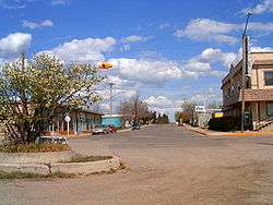
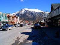
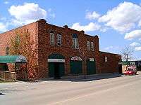
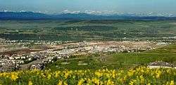
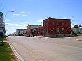
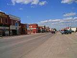
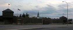
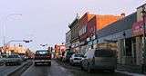
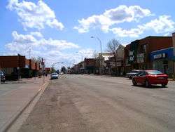
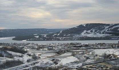
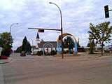
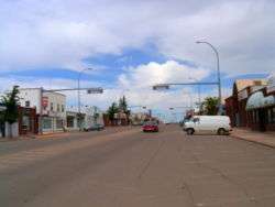
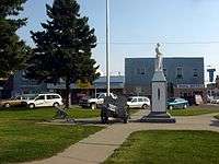
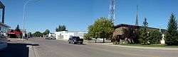
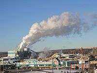
Gallery


Notes
- ↑ Athabasca was formerly known as Athabasca Landing prior to August 4, 1913.[10]
- ↑ Banff's latest municipal census population of 8,421 does not include a shadow (non-permanent) population of 965 for a total combined population of 9,386.[8]
- ↑ Drumheller originally incorporated as a city on April 3, 1930 but reverted from city status as a result of its amalgamation with the M.D. of Badlands No. 7 in 1998.[10]
- ↑ Fort Macleod was formerly known as Macleod prior to April 1, 1952.[10]
- ↑ Granum was formerly known as Leavings prior to March 31, 1908.[10]
- ↑ Peace River was formerly known as Peace River Crossing prior to May 22, 1916.[10]
- ↑ St. Paul was formerly known as St. Paul de Métis prior to December 15, 1932.
- ↑ Cynthia dissolved as development in Cynthia "did not materialize sufficiently to warrant the attention of a Board of Administrators as appointed under the New Towns Act", and did not have "sufficient population or occupied dwellings ... to allow for its establishment into a town or a village under the provisions of The Towns and Villages Act."[23]
- ↑ Fort McMurray later dissolved from city status on April 1, 1995 and is now designated as an urban service area.[25]
- ↑ Lodgepole dissolved as development in Lodgepole "did not materialize sufficiently to qualify under the provisions of the Municipal Government Act for the formation of a town or village."[33]
- ↑ St. Albert later incorporated as a city on January 1, 1977.[35]
See also
| Wikimedia Commons has media related to Main streets in Alberta. |
- List of census divisions of Alberta
- List of cities in Alberta
- List of communities in Alberta
- List of hamlets in Alberta
- List of mayors in Alberta
- List of municipal districts in Alberta
- List of municipalities in Alberta
- List of population centres in Alberta
- List of summer villages in Alberta
- List of villages in Alberta
References
- 1 2 3 4 "Municipal Government Act". Alberta Queen's Printer. Retrieved March 21, 2010.
- 1 2 3 4 "Population and dwelling counts, for Canada, provinces and territories, and census subdivisions (municipalities), 2011 and 2006 censuses (Alberta)". Statistics Canada. August 9, 2016. Retrieved November 5, 2016.
- 1 2 "Order in Council (O.C.) 344/2016" (PDF). Province of Alberta. December 13, 2016. Retrieved December 15, 2016.
- ↑ "Types of Municipalities in Alberta". Alberta Municipal Affairs. Retrieved March 21, 2010.
- ↑ "Municipal Profiles (Towns)" (PDF). Alberta Municipal Affairs. Retrieved March 21, 2010.
- ↑ "Municipal Officials Search". Alberta Municipal Affairs. Retrieved December 24, 2013.
- ↑ "Local Authorities Election Act". Alberta Queen's Printer. Retrieved March 21, 2010.
- 1 2 3 "2016 Municipal Affairs Population List" (PDF). Alberta Municipal Affairs. ISBN 978-1-4601-3127-5. Retrieved February 7, 2017.
- 1 2 3 4 5 "Population and dwelling counts, for Canada, provinces and territories, and census subdivisions (municipalities), 2011 and 2006 censuses (Alberta)". Statistics Canada. August 9, 2016. Retrieved November 5, 2016.
- 1 2 3 4 5
- ↑ "Census Profile - Map : Canmore, Town (Census Subdivision), Alberta". Statistics Canada. March 22, 2013. Retrieved May 21, 2013.
- ↑ "Census Profile - Map : Drumheller, Town (Census Subdivision), Alberta". Statistics Canada. March 22, 2013. Retrieved May 21, 2013.
- ↑ "Census Profile - Map : Peace River, Town (Census Subdivision), Alberta". Statistics Canada. March 22, 2013. Retrieved May 21, 2013.
- 1 2 "Corrections and updates". Statistics Canada. December 30, 2015. Retrieved November 5, 2016.
- 1 2 "The Alberta Gazette, 1956 (Volume 52) – Order in Council 783–56: New Town of Cynthia Established". Government of Alberta. June 11, 1956. pp. 1122&ndash, 1123. Retrieved October 11, 2015.
- 1 2 3 "Order in Council (O.C.) 601/56" (PDF). Province of Alberta. May 9, 1956. Retrieved March 13, 2010.
- 1 2 "Order in Council (O.C.) 403/57" (PDF). Province of Alberta. March 11, 1957. Retrieved March 13, 2010.
- 1 2 "Order in Council (O.C.) 1405/67" (PDF). Province of Alberta. July 19, 1967. Retrieved March 13, 2010.
- 1 2 "Order in Council (O.C.) 40/83" (PDF). Province of Alberta. January 12, 1983. Retrieved March 13, 2010.
- 1 2 "Transitional Provisions, Consequental Amendments, Repeal and Commencement, Transition from Former Acts to this Act" (PDF). Province of Alberta. May 2, 1994. Retrieved March 13, 2010.
- ↑ Jack Masson with Edward C. LeSage Jr. (1994). Alberta's Local Governments: Politics and Democracy. The University of Alberta Press. pp. 91–92. ISBN 0-88864-251-2.
- 1 2 3 Arlene Borgstede (1985). "The Black Robe's Vision : A History of St. Albert & District (Volume 2)". St. Albert Historical Society. p. 681. Retrieved March 13, 2010.
- 1 2 "The Alberta Gazette, 1959 (Volume 55) – Order in Council 760/59: Dissolution of the Town of Cynthia". Government of Alberta. May 19, 1959. p. 911. Retrieved October 11, 2015.
- 1 2 Order in Council (O.C.) 930/64, Province of Alberta, June 30, 1964
- ↑ "Order in Council (O.C.) 817/94" (PDF). Province of Alberta. December 21, 1994. Retrieved March 13, 2010.
- ↑ "Order in Council (O.C.) 1605/66" (PDF). Province of Alberta. August 30, 1966. Retrieved March 13, 2010.
- ↑ "Order in Council (O.C.) 749/83" (PDF). Province of Alberta. August 31, 1983. Retrieved March 13, 2010.
- ↑ "Order in Council (O.C.) 967/65" (PDF). Province of Alberta. June 1, 1965. Retrieved March 13, 2010.
- ↑ "Order in Council (O.C.) 750/83" (PDF). Province of Alberta. August 31, 1983. Retrieved March 13, 2010.
- ↑ "Order in Council (O.C.) 1547/56" (PDF). Province of Alberta. November 6, 1956. Retrieved March 13, 2010.
- ↑ "Order in Council (O.C.) 1661/58" (PDF). Province of Alberta. November 14, 1958. Retrieved March 13, 2010.
- ↑ "Order in Council (O.C.) 1034/56" (PDF). Province of Alberta. July 31, 1956. Retrieved March 13, 2010.
- 1 2 "Order in Council (O.C.) 325/70" (PDF). Province of Alberta. July 31, 1956. Retrieved March 13, 2010.
- ↑ "Order in Council (O.C.) 1606/66" (PDF). Province of Alberta. August 30, 1966. Retrieved March 13, 2010.
- ↑ "Order in Council (O.C.) 1284/76" (PDF). Province of Alberta. December 1, 1976. Retrieved March 13, 2010.
- ↑ "Order in Council (O.C.) 1242/59" (PDF). Province of Alberta. August 18, 1959. Retrieved March 13, 2010.
- ↑ "Order in Council (O.C.) 2145/66" (PDF). Province of Alberta. November 15, 1966. Retrieved March 13, 2010.
- ↑ "Order in Council (O.C.) 1253/61" (PDF). Province of Alberta. August 15, 1961. Retrieved March 13, 2010.
- ↑ "Order in Council (O.C.) 1917/71" (PDF). Province of Alberta. November 10, 1971. Retrieved March 13, 2010.
- ↑ "Municipal Profiles: Summary Reports (Cities)" (PDF). Alberta Municipal Affairs. January 25, 2013. Retrieved February 1, 2013.
- 1 2 "Population Data – 1958" (PDF). Alberta Municipal Affairs. 1958. Retrieved January 31, 2013.
- ↑ History of Annexations (Map). City of Edmonton, Planning and Development Department.
|access-date=requires|url=(help) - ↑ "Population Data 1935" (PDF). Alberta Municipal Affairs. 1935. Retrieved January 31, 2013.
- ↑ "2013 Municipal Codes" (PDF). Alberta Municipal Affairs. April 9, 2013. Retrieved May 21, 2013.
- ↑ "Municipality of Crowsnest Pass - Location and History Profile". Alberta Municipal Affairs. January 25, 2013. Retrieved February 1, 2013.
- ↑ "City of Cold Lake - Location and History Profile". Alberta Municipal Affairs. January 25, 2013. Retrieved February 1, 2013.
- ↑ "Lac La Biche County - Location and History Profile". Alberta Municipal Affairs. January 25, 2013. Retrieved February 1, 2013.
- ↑ "Chapter 3: Establishing the Pattern, 1955–1962" (PDF). Retrieved February 1, 2013.
- ↑ "Population History". City of Edmonton. Retrieved February 1, 2013.
- ↑
- ↑ Mark Wierzbicki (May 21, 2015). "Thorsby council briefs". Leduc Representative. Canoe Sun Media. Retrieved May 23, 2015.
- ↑ Roxanne Blackwell (July 23, 2014). "City status up to residents". Okotoks Western Wheel. Great West Newspapers LP. Retrieved August 22, 2014.
- 1 2 Tristan Turner (February 12, 2016). "Morinville Council Briefs". Morinville News. Pawn Marketing & Publishing Inc. Retrieved February 19, 2016.
- ↑ "Town of Hinton Regular Meeting of Council Agenda (see page 113 of 157)". Town of Hinton. April 21, 2009. Retrieved December 9, 2009.
External links
| Provinces | |
|---|---|
| Territories |
|
| |
| History | ||
|---|---|---|
| Politics | ||
| Geography | ||
| Communities | ||
| Economy |
| |
| Culture | ||
| ||