Municipal District of Pincher Creek No. 9
| Municipal District of Pincher Creek No. 9 | |
|---|---|
| Municipal district | |
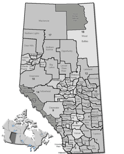 Location of Pincher Creek No. 9 in Alberta | |
| Coordinates: 49°29′8″N 113°56′54″W / 49.48556°N 113.94833°WCoordinates: 49°29′8″N 113°56′54″W / 49.48556°N 113.94833°W | |
| Country |
|
| Province |
|
| Region | Southern Alberta |
| Census division | No. 3 |
| Established | 1944 |
| Incorporated | 1945 |
| Government[1] | |
| • Reeve | Brian Hammond |
| • Governing body | M.D. Pincher Creek Council |
| • Office location | Pincher Creek |
| Area (2016)[2] | |
| • Land | 3,482.05 km2 (1,344.43 sq mi) |
| Population (2016)[2] | |
| • Total | 2,965 |
| • Density | 0.9/km2 (2/sq mi) |
| Time zone | UTC-7 (MST) |
| Website | mdpinchercreek.ab.ca |
The Municipal District of Pincher Creek No. 9 is a municipal district in south western Alberta, Canada. Located in Census Division No. 3, its municipal office is located in the Town of Pincher Creek.
History
The Municipal District of Pincher Creek No. 9 was originally renamed from the Municipal District of Crowsnest No. 39 to the Municipal District of Pincher Creek No. 39 in 1944. It was renumbered a year later in 1945.
Demographics
In the 2016 Census of Population conducted by Statistics Canada, the Municipal District of Pincher Creek No. 9 recorded a population of 2,965 living in 1,119 of its 1,640 total private dwellings, a −6.1% change from its 2011 population of 3,158. With a land area of 3,482.05 km2 (1,344.43 sq mi), it had a population density of 0.9/km2 (2.2/sq mi) in 2016.[2]
In the 2011 Census, the Municipal District of Pincher Creek No. 9 had a population of 3,158 living in 1,151 of its 1,550 total dwellings, a -4.6% change from its 2006 population of 3,309. With a land area of 3,480.91 km2 (1,343.99 sq mi), it had a population density of 0.9/km2 (2.3/sq mi) in 2011.[3]
Communities and localities
|
The following urban municipalities are surrounded by the Municipal District of Pincher Creek No. 9:[4]
The following hamlets are located within the Municipal District of Pincher Creek No. 9:[4]
|
The following localities are located within the Municipal District of Pincher Creek No. 9:[5]
|
See also
References
- ↑ "Municipal Officials Search". Alberta Municipal Affairs. September 22, 2017. Retrieved September 25, 2017.
- 1 2 3 "Population and dwelling counts, for Canada, provinces and territories, and census subdivisions (municipalities), 2016 and 2011 censuses – 100% data (Alberta)". Statistics Canada. February 8, 2017. Retrieved February 8, 2017.
- ↑ "Population and dwelling counts, for Canada, provinces and territories, and census subdivisions (municipalities), 2011 and 2006 censuses (Alberta)". Statistics Canada. February 8, 2012. Retrieved February 8, 2012.
- 1 2 "Specialized and Rural Municipalities and Their Communities" (PDF). Alberta Municipal Affairs. 2012-03-01. Retrieved 2012-08-12.
- ↑ "Standard Geographical Classification (SGC) 2006, Economic Regions: 4803011 - Pincher Creek No. 9, geographical codes and localities, 2006". Statistics Canada. 2010-03-05. Retrieved 2012-08-12.
External links
Places adjacent to Municipal District of Pincher Creek No. 9 | ||||||||||
|---|---|---|---|---|---|---|---|---|---|---|
| ||||||||||