Langdon, Alberta
| Langdon | |
|---|---|
| Hamlet | |
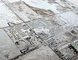 Aerial view of Langdon in winter | |
 Location of Langdon in Alberta | |
| Coordinates: 50°58′21″N 113°40′36″W / 50.97250°N 113.67667°WCoordinates: 50°58′21″N 113°40′36″W / 50.97250°N 113.67667°W | |
| Country |
|
| Province |
|
| Census division | No. 6 |
| Municipal district | Rocky View County |
| Incorporated (village) | August 31, 1907[1] |
| Dissolved | January 1, 1946[2] |
| Government | |
| • Type | Unincorporated |
| • Reeve | Greg Boehlke |
| • Governing body |
Rocky View County Council
|
| Area[3][4] | |
| • Total | 3.44 km2 (1.33 sq mi) |
| Elevation | 1,005 m (3,297 ft) |
| Population (2016)[3][4] | |
| • Total | 5,060 |
| • Density | 1,500/km2 (3,800/sq mi) |
| • Dwellings | 1,586 |
| Time zone | UTC-7 (MST) |
Langdon is a hamlet in southern Alberta, Canada under the jurisdiction of Rocky View County.[5] It previously held village status between August 31, 1907 and January 1, 1946.
Langdon is located 12 km (7.5 mi) east of the City of Calgary at the intersection of Highway 560 (Glenmore Trail) and Highway 797, approximately 6 km (3.7 mi) south of the Trans Canada Highway and 7 km (4.3 mi) north of Highway 22X. It has an elevation of 1,005 m (3,297 ft).
The hamlet is located in Census Division No. 6 and in the federal riding of Bow River. The hamlet is represented in federal government by Member of Parliament Martin Shields and in municipal government by Councillor Rolly Ashdown.
History
Langdon was named for R.B. Langdon of Langdon & Shepard, a Canadian Pacific Railway subcontracting firm who built a section of the line just east of Calgary.[6] He was born in Vermont in 1826 and worked on the railroad lines within at least ten US states, notably the St. Paul & Pacific Railroad in 1858. Langdon served as a state senator in Minnesota from 1873 to 1881.[7] The nearby Shepard station was named for his partner. Langdon was one of two people to turn the first sod in the settlement in 1882. A year later, a railway station was set up in a boxcar and named after him.[8]
A post office was established on January 1, 1890 and a telegraph office in 1899.[9] Langdon incorporated as a village on August 31, 1907.[1] It subsequently dissolved on January 1, 1946 to become part of the Municipal District of Conrich No. 44.[2]
Demographics
Rocky View County's 2013 municipal census counted a population of 4,897 in Langdon, an 87.1% change from its 2006 municipal census population of 2,617.[10] Its population in 2000 was 1,658.[11]
In the 2011 Census, by combining its adjacent population centre and designated place geographies, Langdon had a population of 3,653 living in 1,125 of its 1,157 total dwellings, a 40.8% change from its 2006 population of 2,595. With a land area of 3.44 km2 (1.33 sq mi), it had a population density of 1,061.9/km2 (2,750/sq mi) in 2011.[3][4]
As of 2006, Langdon had a total population of 2,595 living in 811 dwellings. With a land area of 3.33 km2 (1.29 sq mi), it has a population density of 779.3/km2 (2,018/sq mi).[12][13]
These figures were derived from summing Langdon's urban area Statistics Canada data with its designated place Statistics Canada data. More specifically:
- the Langdon urban area had a total population of 2,380 living in 739 dwellings within a land area of 1.80 km2 (0.69 sq mi), resulting in a population density of 1,322.2/km2 (3,424/sq mi);[12] and
- the Langdon designated place had a total population of 215 living in 72 dwellings within a land area of 1.53 km2 (0.59 sq mi), resulting in a population density of 140.1/km2 (363/sq mi).[13]
Langdon's 2006 urban area and designated place boundaries are contiguous with no overlaps.[14]
Attractions
Langdon is home to the Boulder Creek Golf Course.[15]
Education
Langdon School provides education to students in kindergarten through grade 9.[16] Sarah Thompson School provides education to students from K-5.[17]
See also
References
- 1 2 "The Alberta Gazette, 1907: Establishment of Villages". Government of Alberta. September 30, 1907. p. 8. Retrieved September 27, 2015.
- 1 2 "The Alberta Gazette, 1946: Dissolution of the Village of Langdon and the Lands Added to the Municipal District of Conrich No. 44". Government of Alberta. January 15, 1946. p. 44. Retrieved September 27, 2015.
- 1 2 3 "Population and dwelling counts, for Canada, provinces and territories, and population centres, 2011 and 2006 censuses (Alberta)". Statistics Canada. 2012-02-08. Retrieved 2012-04-08.
- 1 2 3 "Population and dwelling counts, for Canada, provinces and territories, and designated places, 2011 and 2006 censuses (Alberta)". Statistics Canada. 2012-02-08. Retrieved 2012-04-08.
- ↑ "Specialized and Rural Municipalities and Their Communities" (PDF). Alberta Municipal Affairs. April 1, 2010. Archived from the original (PDF) on February 29, 2012. Retrieved June 6, 2010.
- ↑ Langdon Crossings Archived 2006-03-08 at the Wayback Machine.
- ↑ Folsom, William Henry Carman (January 1888). Fifty Years In The Northwest: With An Introduction And Appendix Containing Reminiscences, Incidents, And Notes. Pioneer Press Co. Retrieved February 25, 2012.
- ↑ Read, Tracey (1983). Acres and Empires – A History of the Municipal District of Rocky View, Calgary, Alberta.
- ↑ Read, Tracy (1983). Acres and Empires : A History of the Municipal District of Rocky View No. 44. p. 83.
- ↑ "County Census Identifies Divisional Population Changes". Rocky View County. September 23, 2013. Retrieved September 23, 2013.
- ↑ "Municipal District of Rocky View, Alberta, Canada: Community Profile" (PDF). Municipal District of Rocky View No. 44. April 2004. p. 11. Retrieved September 27, 2015.
- 1 2 Statistics Canada (2007). "Population and dwelling counts, for Canada, provinces and territories, and urban areas, 2006 and 2001 censuses". Retrieved 2010-02-07.
- 1 2 Statistics Canada (2007). "Population and dwelling counts, for Canada, provinces and territories, and designated places, 2006 and 2001 censuses". Retrieved 2010-02-07.
- ↑ Statistics Canada. "GeoSearch2006 (2006 Census)". Retrieved 2010-02-07.
- ↑ "Calgary Golf – Boulder Creek Golf Course". Boulder Creek Golf Course. Retrieved 2012-02-24.
- ↑ "Langdon School". Rocky View Schools. Retrieved 2012-02-24.
- ↑ "Sarah Thompson School (K-5) — Rocky View Schools". www.rockyview.ab.ca. Retrieved 11 April 2018.
- Karamitsanis, Aphrodite (1992). Place Names of Alberta – Volume II, Southern Alberta, University of Calgary Press, Calgary, Alberta.
External links
Places adjacent to Langdon, Alberta | |
|---|---|