Slave Lake
| Slave Lake | |
|---|---|
| Town | |
| Town of Slave Lake | |
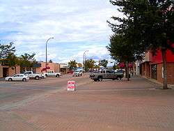 Main street in August 2006 | |
 Slave Lake Location of Slave Lake in Alberta | |
| Coordinates: 55°17′07″N 114°46′14″W / 55.28528°N 114.77056°WCoordinates: 55°17′07″N 114°46′14″W / 55.28528°N 114.77056°W | |
| Country | Canada |
| Province | Alberta |
| Region | Northern Alberta |
| Census division | 17 |
| Municipal district | M.D. of Lesser Slave River No. 124 |
| Incorporated[1] | |
| • Village | January 1, 1961 |
| • Town | August 2, 1965 |
| Government[2] | |
| • Mayor | Tyler Warman |
| • Governing body |
Slave Lake Town Council
|
| • CAO | Brian Vance |
| • MP | Arnold Viersen (Peace River-Westlock-Cons) |
| • MLA | Danielle Larivee (Lesser Slave Lake-NDP) |
| Area (2016)[3] | |
| • Land | 14.44 km2 (5.58 sq mi) |
| Elevation[4] | 590 m (1,940 ft) |
| Population (2016)[3] | |
| • Total | 6,651 |
| • Density | 460.5/km2 (1,193/sq mi) |
| Time zone | UTC−7 (MST) |
| • Summer (DST) | UTC−6 (MDT) |
| Postal code span | T0G |
| Area code(s) | 780, 587, 825 |
| Highways |
Highway 2 Bicentennial Highway |
| Waterways |
Lesser Slave Lake Lesser Slave River |
| Website | Official website |
Slave Lake is a small town in northern Alberta, Canada about 200 km northwest of Edmonton and a similar distance southwest of Fort McMurray. It is located on the southeast shore of Lesser Slave Lake, at the junction of Highway 2 and Highway 88, in the Municipal District of Lesser Slave River No. 124.
Slave Lake serves as a local centre for the area. The administrative office for the Sawridge First Nation reserve is also located in the town.
History
The area of the present-day Town of Slave Lake was discovered by Europeans when David Thompson visited the area in 1799. Following his brief visit, several fur trading posts were established around Slave Lake, with a Hudson's Bay Company post established at the mouth of the lake. The first community, called Sawridge, was renamed Slave Lake in 1923. It was wiped out by a flood in the 1930s, and was subsequently moved to its current location. It was incorporated as a town in 1965.[5]
The Town of Slave Lake was inundated by a flood of Sawridge Creek in July 1988.[6]
2011 wildfire
On May 15, 2011, large parts of the town were affected by wildfires in the area. Winds pushed the flames into the town and destroyed many houses and businesses. Mandatory evacuation orders were issued, but with highways being closed, residents were urged to make their way to beaches, large parking lots, and open spaces.[7][8] Highway 2 had been closed at the outset of the fire, but eventually re-opened for evacuation,[9] with full evacuation ordered for Slave Lake.[10]
On May 16, 2011, provincial officials said that 40% of the town had been destroyed or damaged, including the town hall, the library, a radio station, a mall and a significant number of homes and other buildings; no injuries or deaths were reported.[11][12][13][14] On May 17, 2011, Mayor Karina Pillay-Kinnee indicated one-third of the town had been destroyed by the wildfire.[15] On May 20, 2011, a firefighting helicopter crashed into the Lesser Slave Lake near Canyon Creek where its pilot died at the scene. It crashed about 30 m (98 ft) off shore into water that was 1.5 m (4.9 ft) deep.[16] On July 6, Prince William and Catherine, the Duke and Duchess of Cambridge, visited the town to offer encouragement to residents and support for rebuilding efforts.[17]
Geography
Climate
Slave Lake experiences a subarctic climate (Köppen climate classification Dfc) that borders on a humid continental climate (Köppen Dfb).
| Climate data for Slave Lake Airport | |||||||||||||
|---|---|---|---|---|---|---|---|---|---|---|---|---|---|
| Month | Jan | Feb | Mar | Apr | May | Jun | Jul | Aug | Sep | Oct | Nov | Dec | Year |
| Record high °C (°F) | 13.6 (56.5) |
14.8 (58.6) |
17 (63) |
28.6 (83.5) |
32.5 (90.5) |
33.3 (91.9) |
32.2 (90) |
32.3 (90.1) |
29.6 (85.3) |
28.1 (82.6) |
19.1 (66.4) |
12.4 (54.3) |
33.3 (91.9) |
| Average high °C (°F) | −9.4 (15.1) |
−5.9 (21.4) |
1.2 (34.2) |
9.4 (48.9) |
16.1 (61) |
19.3 (66.7) |
21.2 (70.2) |
20.3 (68.5) |
14.6 (58.3) |
9.1 (48.4) |
−1.6 (29.1) |
−8.2 (17.2) |
7.2 (45) |
| Daily mean °C (°F) | −14.5 (5.9) |
−11.7 (10.9) |
−4.7 (23.5) |
3.3 (37.9) |
9.7 (49.5) |
13.6 (56.5) |
15.6 (60.1) |
14.6 (58.3) |
9.2 (48.6) |
3.8 (38.8) |
−6.1 (21) |
−12.9 (8.8) |
1.7 (35.1) |
| Average low °C (°F) | −19.6 (−3.3) |
−17.4 (0.7) |
−10.6 (12.9) |
−2.9 (26.8) |
3.3 (37.9) |
7.9 (46.2) |
10.0 (50) |
8.8 (47.8) |
3.7 (38.7) |
−1.5 (29.3) |
−10.5 (13.1) |
−17.7 (0.1) |
−3.9 (25) |
| Record low °C (°F) | −42.8 (−45) |
−42.5 (−44.5) |
−38.3 (−36.9) |
−26.1 (−15) |
−7.2 (19) |
−2.7 (27.1) |
2.9 (37.2) |
−2.2 (28) |
−7.8 (18) |
−21.8 (−7.2) |
−36.1 (−33) |
−42.5 (−44.5) |
−42.8 (−45) |
| Average precipitation mm (inches) | 24.3 (0.957) |
17.3 (0.681) |
17.7 (0.697) |
21.4 (0.843) |
43.5 (1.713) |
88.2 (3.472) |
95.6 (3.764) |
72.5 (2.854) |
50.8 (2) |
27.2 (1.071) |
18.9 (0.744) |
25.2 (0.992) |
502.7 (19.791) |
| Average rainfall mm (inches) | 0.6 (0.024) |
1.0 (0.039) |
1.7 (0.067) |
12.1 (0.476) |
40.9 (1.61) |
88.2 (3.472) |
95.6 (3.764) |
72.4 (2.85) |
48.8 (1.921) |
18.0 (0.709) |
3.1 (0.122) |
2.0 (0.079) |
384.5 (15.138) |
| Average snowfall cm (inches) | 29.9 (11.77) |
21.2 (8.35) |
20.8 (8.19) |
10.4 (4.09) |
2.7 (1.06) |
0.0 (0) |
0.0 (0) |
0.0 (0) |
2.2 (0.87) |
9.7 (3.82) |
19.7 (7.76) |
29.8 (11.73) |
146.5 (57.68) |
| Average precipitation days (≥ 0.2 mm) | 12.0 | 10.0 | 9.2 | 7.1 | 10.5 | 14.1 | 15.0 | 12.6 | 12.6 | 10.0 | 11.3 | 12.9 | 137.3 |
| Average rainy days (≥ 0.2 mm) | 0.9 | 0.9 | 1.6 | 4.3 | 10.1 | 14.1 | 15.0 | 12.6 | 11.9 | 7.3 | 2.6 | 1.2 | 82.5 |
| Average snowy days (≥ 0.2 cm) | 12.5 | 10.2 | 8.6 | 3.6 | 1.0 | 0.0 | 0.0 | 0.0 | 1.0 | 4.5 | 10.1 | 13.0 | 64.5 |
| Average relative humidity (%) (at 3pm) | 76.2 | 71.3 | 64.1 | 51.0 | 47.5 | 55.6 | 59.0 | 59.9 | 60.5 | 59.8 | 73.7 | 77.5 | 63.0 |
| Mean monthly sunshine hours | 80.4 | 112.2 | 173.3 | 234.8 | 281.1 | 277.7 | 294.6 | 260.4 | 167.9 | 141.7 | 84.6 | 63.1 | 2,171.8 |
| Percent possible sunshine | 33.3 | 41.3 | 47.3 | 55.4 | 56.1 | 53.4 | 56.5 | 56.0 | 43.8 | 43.5 | 33.5 | 28.2 | 45.7 |
| Source: Environment Canada[18] | |||||||||||||
Demographics
| Population history | ||
|---|---|---|
| Year | Pop. | ±% |
| 1996 | 6,553 | — |
| 2001 | 6,600 | +0.7% |
| 2006 | 6,703 | +1.6% |
| 2011 | 6,782 | +1.2% |
| 2016 | 6,651 | −1.9% |
| Source: Statistics Canada [19][20] | ||
In the 2016 Census of Population conducted by Statistics Canada, the Town of Slave Lake recorded a population of 6,651 living in 2,329 of its 2,762 total private dwellings, a −1.9% change from its 2011 population of 6,782. With a land area of 14.44 km2 (5.58 sq mi), it had a population density of 460.6/km2 (1,192.9/sq mi) in 2016.[3]
In the 2011 Census, the Town of Slave Lake had a population of 6,782 living in 2,294 of its 2,554 total dwellings, a 1.2% change from its 2006 population of 6,703. With a land area of 14.18 km2 (5.47 sq mi), it had a population density of 478.3/km2 (1,238.7/sq mi) in 2011.[21]
The population of the Town of Slave Lake according to its 2007 municipal census was 7,031.[22]
Sports
In 1994, the town hosted the Arctic Winter Games, which is a celebration of circumpolar sports and culture.
| Club | League | Sport | Venue | Established | Championships |
|---|---|---|---|---|---|
| Slave Lake Wolves | Ice Hockey | Arctic Ice Centre |
Government
Residents of Slave Lake are in the electoral district of Peace River—Westlock for elections to the House of Commons of Canada, and Lesser Slave Lake for elections to the Legislative Assembly of Alberta.[23][24]
Media
Media outlets serving Slave Lake and surrounding area include BOOM (FM) and the Lakeside Leader, a local community newspaper.
Notable people
- Lane Caffaro, professional ice hockey player
- Gordon Kruppke, former professional ice hockey player
- Omar Mouallem, also known as A.O.K., rapper and journalist
- Walter Patrick Twinn, former Canadian senator and chief of the Sawridge First Nation
Gallery
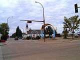 Main Street in 2006
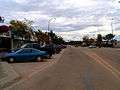 Main Street in 2006
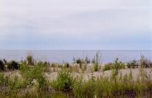 Slave Lake, Slave Lake, shoreline
See also
References
- ↑ "Location and History Profile: Town of Slave Lake" (PDF). Alberta Municipal Affairs. October 7, 2016. p. 562. Retrieved October 11, 2016.
- ↑ "Municipal Officials Search". Alberta Municipal Affairs. 2017-09-22. Retrieved 2017-09-25.
- 1 2 3 "Population and dwelling counts, for Canada, provinces and territories, and census subdivisions (municipalities), 2016 and 2011 censuses – 100% data (Alberta)". Statistics Canada. February 8, 2017. Retrieved February 8, 2017.
- ↑ "Alberta Private Sewage Systems 2009 Standard of Practice Handbook: Appendix A.3 Alberta Design Data (A.3.A. Alberta Climate Design Data by Town)" (PDF) (PDF). Safety Codes Council. January 2012. pp. 212–215 (PDF pages 226–229). Retrieved October 9, 2013.
- ↑ "Town History". Town of Slave Lake. Archived from the original on March 24, 2012. Retrieved 2011-05-16.
- ↑ "1988 Flood Archive". Dartmouth Flood Observatory. July 2003. Retrieved 2011-05-16.
- ↑ Wingrove, Josh (May 15, 2011). "Change in winds caused chaos for fire-devastated Slave Lake, Alta". The Globe and Mail. The Globe and Mail Inc. Retrieved 2011-05-16.
- ↑ Ibrahim, Mariam; Jesse Snyder; Julianna Cummins (May 16, 2011). "Slave Lake burns as thousands evacuated". Edmonton Journal. Postmedia Network. Retrieved 2011-05-16.
- ↑ "Wildfire Update: HWY 2 Re-Opened". 93.5 Prairie FM. Newcap Radio. May 15, 2011. Retrieved 2011-05-17.
- ↑ "Wildfire Update: Slave Lake". 93.5 Prairie FM. Newcap Radio. May 15, 2011. Retrieved 2011-05-17.
- ↑ "Slave Lake firefighters struggle to save town". CBC News. May 16, 2011. Retrieved 2011-05-16.
- ↑ "Aerial view of fire damage in Slave Lake". CTV Edmonton. Retrieved 2011-05-17.
- ↑ Ibrahim, Mariam; Ryan Cormier (May 16, 2011). "A third of town reduced to ashes: Slave Lake mayor". National Post. Postmedia Network. Retrieved 2011-05-17.
- ↑ "Destroyed Slave Lake radio station turns to internet". CBC News. 2011-05-17. Retrieved 2011-05-17.
- ↑ Ibrahim, Mariam; Ryan Cormier (2011-05-17). "One-third of Slave Lake destroyed in massive wildfire, mayor says". Edmonton Journal. Postmedia Network. Retrieved 2011-05-17.
- ↑ "Pilot dies in helicopter crash near Slave Lake". CBC News. 2011-05-20. Retrieved 2011-05-22.
- ↑ "Prince William and Kate arrive... at town devastated by wildfire". The Daily Mail. 2011-07-06.
- ↑ Environment Canada—Canadian Climate Normals 1971–2000. Retrieved 6 July 2011.
- ↑ "Population and Dwelling Counts, for Canada, Provinces and Territories, and Census Divisions, 2001 and 1996 Censuses – 100% Data (Alberta)". Statistics Canada. Retrieved April 16, 2014.
- ↑ "Population and dwelling counts, for Canada, provinces and territories, and census subdivisions (municipalities), 2011 and 2006 censuses". Statistics Canada. Retrieved April 16, 2014.
- ↑ "Population and dwelling counts, for Canada, provinces and territories, and census subdivisions (municipalities), 2011 and 2006 censuses (Alberta)". Statistics Canada. 2012-02-08. Retrieved 2012-02-08.
- ↑ Alberta Municipal Affairs (2009-09-15). "Alberta 2009 Official Population List" (PDF). Retrieved 2010-09-14.
- ↑ "Peace River–Westlock | Maps Corner | Elections Canada Online". elections.ca. Retrieved 2017-09-22.
- ↑ "Provincial Electoral Divisions of Alberta as Defined by the Electoral Divisions Act, 2010" (PDF).
External links
| Wikimedia Commons has media related to Slave Lake, Alberta. |
| Wikivoyage has a travel guide for Slave Lake. |
Places adjacent to Slave Lake | |
|---|---|