Laillé
| Laillé Lalieg | ||
|---|---|---|
| Commune | ||
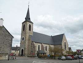 The church of Saint-Pierre, in Laillé | ||
| ||
 Laillé Location within Brittany region  Laillé | ||
| Coordinates: 47°58′43″N 1°43′02″W / 47.9786°N 1.7172°WCoordinates: 47°58′43″N 1°43′02″W / 47.9786°N 1.7172°W | ||
| Country | France | |
| Region | Brittany | |
| Department | Ille-et-Vilaine | |
| Arrondissement | Rennes | |
| Canton | Bruz | |
| Intercommunality | Rennes Métropole | |
| Government | ||
| • Mayor (2014–2020) | Pascal Hervé | |
| Area1 | 32.04 km2 (12.37 sq mi) | |
| Population (2008)2 | 4,364 | |
| • Density | 140/km2 (350/sq mi) | |
| Time zone | UTC+1 (CET) | |
| • Summer (DST) | UTC+2 (CEST) | |
| INSEE/Postal code | 35139 /35890 | |
| Elevation | 5–110 m (16–361 ft) | |
|
1 French Land Register data, which excludes lakes, ponds, glaciers > 1 km2 (0.386 sq mi or 247 acres) and river estuaries. 2 Population without double counting: residents of multiple communes (e.g., students and military personnel) only counted once. | ||
.svg.png)
Laillé (Breton: Lalieg) is a commune in the Ille-et-Vilaine department in Brittany in northwestern France.
The 1 July 2012, Laillé quit the Canton of Guichen intercommunality for Rennes Métropole.
Population
Inhabitants of Laillé are called Lailléens in French.
| Historical population | ||
|---|---|---|
| Year | Pop. | ±% |
| 1962 | 1,267 | — |
| 1968 | 1,336 | +5.4% |
| 1975 | 1,497 | +12.1% |
| 1982 | 2,411 | +61.1% |
| 1990 | 2,973 | +23.3% |
| 1999 | 3,558 | +19.7% |
| 2008 | 4,364 | +22.7% |
See also
References
- Mayors of Ille-et-Vilaine Association (in French)
External links
| Wikimedia Commons has media related to Laillé. |
- French Ministry of Culture list for Laillé (in French)
| Authority control |
|---|
This article is issued from
Wikipedia.
The text is licensed under Creative Commons - Attribution - Sharealike.
Additional terms may apply for the media files.