Chantepie
| Chantepie Kantpig | |
|---|---|
| Commune | |
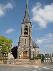 Saint Martin church | |
 Chantepie Location within Brittany region  Chantepie | |
| Coordinates: 48°05′21″N 1°36′55″W / 48.0892°N 1.6153°WCoordinates: 48°05′21″N 1°36′55″W / 48.0892°N 1.6153°W | |
| Country | France |
| Region | Brittany |
| Department | Ille-et-Vilaine |
| Arrondissement | Rennes |
| Canton | Rennes-3 |
| Intercommunality | Rennes Métropole |
| Government | |
| • Mayor (2014–2020) | Grégoire Le Blond (MoDem) |
| Area1 | 11.98 km2 (4.63 sq mi) |
| Population (2008)2 | 8,154 |
| • Density | 680/km2 (1,800/sq mi) |
| Time zone | UTC+1 (CET) |
| • Summer (DST) | UTC+2 (CEST) |
| INSEE/Postal code | 35055 /35135 |
| Elevation | 32–77 m (105–253 ft) |
|
1 French Land Register data, which excludes lakes, ponds, glaciers > 1 km2 (0.386 sq mi or 247 acres) and river estuaries. 2 Population without double counting: residents of multiple communes (e.g., students and military personnel) only counted once. | |
Chantepie (Breton: Kantpig, Gallo: Chauntepiy) is a commune in the Ille-et-Vilaine department in Brittany in northwestern France.
Population
Inhabitants of Chantepie are called Cantepiens in French.
| Historical population | ||
|---|---|---|
| Year | Pop. | ±% |
| 1962 | 1,310 | — |
| 1968 | 1,594 | +21.7% |
| 1975 | 2,651 | +66.3% |
| 1982 | 3,677 | +38.7% |
| 1990 | 5,898 | +60.4% |
| 1999 | 6,793 | +15.2% |
| 2008 | 8,154 | +20.0% |
See also
References
- Mayors of Ille-et-Vilaine Association (in French)
External links
| Wikimedia Commons has media related to Chantepie. |
- Official website (in French)
- French Ministry of Culture list for Chantepie (in French)
| Authority control |
|---|
This article is issued from
Wikipedia.
The text is licensed under Creative Commons - Attribution - Sharealike.
Additional terms may apply for the media files.