Fleurigné
| Fleurigné Flurinieg | |
|---|---|
| Commune | |
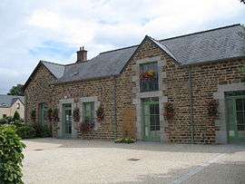 Town hall | |
 Fleurigné Location within Brittany region  Fleurigné | |
| Coordinates: 48°20′10″N 1°07′11″W / 48.3361°N 1.1197°WCoordinates: 48°20′10″N 1°07′11″W / 48.3361°N 1.1197°W | |
| Country | France |
| Region | Brittany |
| Department | Ille-et-Vilaine |
| Arrondissement | Fougères-Vitré |
| Canton | Fougères-2 |
| Intercommunality | Fougères |
| Government | |
| • Mayor (2014–2020) | Monique Pommereul |
| Area1 | 18.17 km2 (7.02 sq mi) |
| Population (2008)2 | 1,032 |
| • Density | 57/km2 (150/sq mi) |
| Time zone | UTC+1 (CET) |
| • Summer (DST) | UTC+2 (CEST) |
| INSEE/Postal code | 35112 /35133 |
| Elevation | 79–233 m (259–764 ft) |
|
1 French Land Register data, which excludes lakes, ponds, glaciers > 1 km2 (0.386 sq mi or 247 acres) and river estuaries. 2 Population without double counting: residents of multiple communes (e.g., students and military personnel) only counted once. | |
Fleurigné (Breton: Flurinieg, Gallo: Floereinyaè) is a commune in the Ille-et-Vilaine department in Brittany in northwestern France.
Population
Inhabitants of Fleurigné are called Fleurignéens in French.
| Historical population | ||
|---|---|---|
| Year | Pop. | ±% |
| 1962 | 646 | — |
| 1968 | 674 | +4.3% |
| 1975 | 676 | +0.3% |
| 1982 | 812 | +20.1% |
| 1990 | 841 | +3.6% |
| 1999 | 896 | +6.5% |
| 2008 | 1,032 | +15.2% |
See also
References
- Mayors of Ille-et-Vilaine Association (in French)
External links
| Wikimedia Commons has media related to Fleurigné. |
- French Ministry of Culture list for Fleurigné (in French)
This article is issued from
Wikipedia.
The text is licensed under Creative Commons - Attribution - Sharealike.
Additional terms may apply for the media files.