La Bosse-de-Bretagne
| La Bosse-de-Bretagne Bosenn | |
|---|---|
| Commune | |
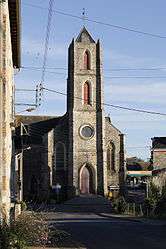 The church of La Bosse-de-Bretagne | |
 La Bosse-de-Bretagne Location within Brittany region  La Bosse-de-Bretagne | |
| Coordinates: 47°52′12″N 1°35′51″W / 47.8700°N 1.5975°WCoordinates: 47°52′12″N 1°35′51″W / 47.8700°N 1.5975°W | |
| Country | France |
| Region | Brittany |
| Department | Ille-et-Vilaine |
| Arrondissement | Redon |
| Canton | Bain-de-Bretagne |
| Intercommunality | Moyenne Vilaine et du Semnon |
| Government | |
| • Mayor (2014–2020) | Nathalie Gestin |
| Area1 | 10.21 km2 (3.94 sq mi) |
| Population (2008)2 | 572 |
| • Density | 56/km2 (150/sq mi) |
| Time zone | UTC+1 (CET) |
| • Summer (DST) | UTC+2 (CEST) |
| INSEE/Postal code | 35030 /35320 |
| Elevation | 22–106 m (72–348 ft) |
|
1 French Land Register data, which excludes lakes, ponds, glaciers > 1 km2 (0.386 sq mi or 247 acres) and river estuaries. 2 Population without double counting: residents of multiple communes (e.g., students and military personnel) only counted once. | |
La Bosse-de-Bretagne (Breton: Bosenn, Gallo: La Bocz) is a commune in the Ille-et-Vilaine department in Brittany in northwestern France.
Geography
The river Semnon forms most of the commune's southern border.
Population
| Historical population | ||
|---|---|---|
| Year | Pop. | ±% |
| 1962 | 483 | — |
| 1968 | 495 | +2.5% |
| 1975 | 437 | −11.7% |
| 1982 | 390 | −10.8% |
| 1990 | 388 | −0.5% |
| 1999 | 386 | −0.5% |
| 2008 | 572 | +48.2% |
Inhabitants of La Bosse-de-Bretagne are called Bosséens in French.
See also
References
- Mayors of Ille-et-Vilaine Association (in French)
External links
| Wikimedia Commons has media related to La Bosse-de-Bretagne. |
This article is issued from
Wikipedia.
The text is licensed under Creative Commons - Attribution - Sharealike.
Additional terms may apply for the media files.