Villamée
| Villamée Gwilavez | ||
|---|---|---|
| Commune | ||
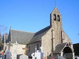 The church in Villamée | ||
| ||
 Villamée Location within Brittany region  Villamée | ||
| Coordinates: 48°27′42″N 1°13′14″W / 48.4617°N 1.2206°WCoordinates: 48°27′42″N 1°13′14″W / 48.4617°N 1.2206°W | ||
| Country | France | |
| Region | Brittany | |
| Department | Ille-et-Vilaine | |
| Arrondissement | Fougères-Vitré | |
| Canton | Fougères-2 | |
| Intercommunality | Louvigné | |
| Government | ||
| • Mayor (2014–2020) | Daniel Courtois | |
| Area1 | 10.66 km2 (4.12 sq mi) | |
| Population (2009)2 | 326 | |
| • Density | 31/km2 (79/sq mi) | |
| Time zone | UTC+1 (CET) | |
| • Summer (DST) | UTC+2 (CEST) | |
| INSEE/Postal code | 35357 /35420 | |
| Elevation | 134–171 m (440–561 ft) | |
|
1 French Land Register data, which excludes lakes, ponds, glaciers > 1 km2 (0.386 sq mi or 247 acres) and river estuaries. 2 Population without double counting: residents of multiple communes (e.g., students and military personnel) only counted once. | ||

Villamée (Breton: Gwilavez, Gallo: Vilaemaé) is a commune in the Ille-et-Vilaine department of Brittany in northwestern France.
Population
Inhabitants of Villamée are called Villaméens in French.
| Historical population | ||
|---|---|---|
| Year | Pop. | ±% |
| 1962 | 450 | — |
| 1968 | 470 | +4.4% |
| 1975 | 417 | −11.3% |
| 1982 | 377 | −9.6% |
| 1990 | 334 | −11.4% |
| 1999 | 314 | −6.0% |
| 2004 | 322 | +2.5% |
| 2006 | 317 | −1.6% |
| 2009 | 326 | +2.8% |
| 2011 | 335 | +2.8% |
See also
References
- Mayors of Ille-et-Vilaine Association (in French)
External links
| Wikimedia Commons has media related to Villamée. |
- French Ministry of Culture list for Villamée (in French)
This article is issued from
Wikipedia.
The text is licensed under Creative Commons - Attribution - Sharealike.
Additional terms may apply for the media files.