Boistrudan
| Boistrudan | |
|---|---|
| Commune | |
 The town hall of Boistrudan | |
 Boistrudan Location within Brittany region  Boistrudan | |
| Coordinates: 47°58′13″N 1°23′59″W / 47.9703°N 1.3997°WCoordinates: 47°58′13″N 1°23′59″W / 47.9703°N 1.3997°W | |
| Country | France |
| Region | Brittany |
| Department | Ille-et-Vilaine |
| Arrondissement | Fougères-Vitré |
| Canton | Châteaugiron |
| Intercommunality | Pays de la Roche-aux-Fées |
| Government | |
| • Mayor (2014–2020) | Anne Renault |
| Area1 | 12.80 km2 (4.94 sq mi) |
| Population (2009)2 | 673 |
| • Density | 53/km2 (140/sq mi) |
| Time zone | UTC+1 (CET) |
| • Summer (DST) | UTC+2 (CEST) |
| INSEE/Postal code | 35028 /35150 |
| Elevation | 32–85 m (105–279 ft) |
|
1 French Land Register data, which excludes lakes, ponds, glaciers > 1 km2 (0.386 sq mi or 247 acres) and river estuaries. 2 Population without double counting: residents of multiple communes (e.g., students and military personnel) only counted once. | |
Boistrudan (Gallo: Boéz-Trudan) is a commune in the Ille-et-Vilaine department in Brittany in northwestern France.
Population
| Historical population | ||
|---|---|---|
| Year | Pop. | ±% |
| 1962 | 546 | — |
| 1968 | 576 | +5.5% |
| 1975 | 505 | −12.3% |
| 1982 | 475 | −5.9% |
| 1990 | 501 | +5.5% |
| 1999 | 494 | −1.4% |
| 2009 | 673 | +36.2% |
Inhabitants of Boistrudan are called Boistrudanais in French.
Toponymy
Bosco Truant in 1197,[1] Boays-Trudant in the 16th century, then Bois-Trudain in 1685, Bois-trudaine around 1780.
Meaning : Truant's wood, Truant can be a surname or the common word for "beggar, tramp" in Old French.
See also
References
External links
| Wikimedia Commons has media related to Boistrudan. |
- Official website (in French)
- French Ministry of Culture list for Boistrudan (in French)
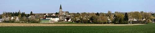
Panorama of the commune
This article is issued from
Wikipedia.
The text is licensed under Creative Commons - Attribution - Sharealike.
Additional terms may apply for the media files.