La Bouëxière
| La Bouëxière Beuzid-ar-C'hoadoù | ||
|---|---|---|
| Commune | ||
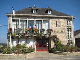 The town hall of La Bouëxière | ||
| ||
 La Bouëxière Location within Brittany region  La Bouëxière | ||
| Coordinates: 48°11′05″N 1°26′12″W / 48.1847°N 1.4367°WCoordinates: 48°11′05″N 1°26′12″W / 48.1847°N 1.4367°W | ||
| Country | France | |
| Region | Brittany | |
| Department | Ille-et-Vilaine | |
| Arrondissement | Rennes | |
| Canton | Liffré | |
| Government | ||
| • Mayor (2014–2020) | Stéphane Piquet | |
| Area1 | 49.68 km2 (19.18 sq mi) | |
| Population (2008)2 | 3,845 | |
| • Density | 77/km2 (200/sq mi) | |
| Time zone | UTC+1 (CET) | |
| • Summer (DST) | UTC+2 (CEST) | |
| INSEE/Postal code | 35031 /35340 | |
| Elevation | 42–125 m (138–410 ft) | |
|
1 French Land Register data, which excludes lakes, ponds, glaciers > 1 km2 (0.386 sq mi or 247 acres) and river estuaries. 2 Population without double counting: residents of multiple communes (e.g., students and military personnel) only counted once. | ||
.svg.png)
La Bouëxière (Breton: Beuzid-ar-C'hoadoù) is a commune in the Ille-et-Vilaine department in Brittany in northwestern France.
It is situated 19 km (12 mi) from Rennes in the forest of Rennes.
Population
| Historical population | ||
|---|---|---|
| Year | Pop. | ±% |
| 1962 | 1,870 | — |
| 1968 | 1,965 | +5.1% |
| 1975 | 2,142 | +9.0% |
| 1982 | 2,667 | +24.5% |
| 1990 | 3,027 | +13.5% |
| 1999 | 3,503 | +15.7% |
| 2008 | 3,845 | +9.8% |
Inhabitants of La Bouëxière are called Bouexièrais in French.
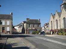
The main road
International relations
La Bouëxière is twinned with Wingrave in England and Hambrücken in Germany.
See also
References
External links
| Wikimedia Commons has media related to La Bouëxière. |
- Cultural Heritage (in French)
- La Bouëxière website(in French)
- English translation of La Bouëxière website
- Hambrücken website
This article is issued from
Wikipedia.
The text is licensed under Creative Commons - Attribution - Sharealike.
Additional terms may apply for the media files.