Guichen
| Guichen Gwizien | ||
|---|---|---|
| Commune | ||
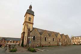 Church of Guichen | ||
| ||
 Guichen Location within Brittany region  Guichen | ||
| Coordinates: 47°58′05″N 1°47′38″W / 47.9681°N 1.7939°WCoordinates: 47°58′05″N 1°47′38″W / 47.9681°N 1.7939°W | ||
| Country | France | |
| Region | Brittany | |
| Department | Ille-et-Vilaine | |
| Arrondissement | Redon | |
| Canton | Guichen | |
| Intercommunality | Canton of Guichen | |
| Government | ||
| • Mayor (2014–2020) | Joël Sieller | |
| Area1 | 42.99 km2 (16.60 sq mi) | |
| Population (2008)2 | 7,316 | |
| • Density | 170/km2 (440/sq mi) | |
| Time zone | UTC+1 (CET) | |
| • Summer (DST) | UTC+2 (CEST) | |
| INSEE/Postal code | 35126 /35580 | |
| Elevation | 7–107 m (23–351 ft) | |
|
1 French Land Register data, which excludes lakes, ponds, glaciers > 1 km2 (0.386 sq mi or 247 acres) and river estuaries. 2 Population without double counting: residents of multiple communes (e.g., students and military personnel) only counted once. | ||
.svg.png)
Guichen (Breton: Gwizien, Gallo: Gischen) is a commune in the Ille-et-Vilaine department in Brittany in northwestern France.
Population
Inhabitants of Guichen are called Guichenais in French.
| Historical population | ||
|---|---|---|
| Year | Pop. | ±% |
| 1962 | 2,868 | — |
| 1968 | 3,311 | +15.4% |
| 1975 | 4,431 | +33.8% |
| 1982 | 5,311 | +19.9% |
| 1990 | 5,891 | +10.9% |
| 1999 | 6,526 | +10.8% |
| 2008 | 7,316 | +12.1% |
| 2014 | 8,109 | +10.8% |
Image gallery
 The Halles of Guichen.
 Church of Pont-Réan.
 The bridge of Pont-Réan.
 The lock and mill of Boel.
See also
References
External links
| Wikimedia Commons has media related to Guichen. |
- INSEE
- Mayors of Ille-et-Vilaine Association (in French)
- Official website (in French)
- French Ministry of Culture list for Guichen (in French)
This article is issued from
Wikipedia.
The text is licensed under Creative Commons - Attribution - Sharealike.
Additional terms may apply for the media files.