Saint-Séglin
| Saint-Séglin Sant-Sewenn | |
|---|---|
| Commune | |
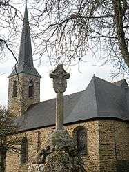 Church and calvary of Saint-Séglin | |
 Saint-Séglin Location within Brittany region  Saint-Séglin | |
| Coordinates: 47°51′15″N 2°00′12″W / 47.8542°N 2.0033°WCoordinates: 47°51′15″N 2°00′12″W / 47.8542°N 2.0033°W | |
| Country | France |
| Region | Brittany |
| Department | Ille-et-Vilaine |
| Arrondissement | Redon |
| Canton | Guichen |
| Intercommunality | Pays de Maure-de-Bretagne |
| Government | |
| • Mayor (2014–2020) | Marie-Thérèse Monvoisin |
| Area1 | 9.40 km2 (3.63 sq mi) |
| Population (2009)2 | 468 |
| • Density | 50/km2 (130/sq mi) |
| Time zone | UTC+1 (CET) |
| • Summer (DST) | UTC+2 (CEST) |
| INSEE/Postal code | 35311 /35330 |
| Elevation | 12–74 m (39–243 ft) |
|
1 French Land Register data, which excludes lakes, ponds, glaciers > 1 km2 (0.386 sq mi or 247 acres) and river estuaries. 2 Population without double counting: residents of multiple communes (e.g., students and military personnel) only counted once. | |
Saint-Séglin (Breton: Sant-Sewenn, Gallo: Saent-Segelein) is a commune in the Ille-et-Vilaine department in Brittany in northwestern France.
Population
Inhabitants of Saint-Séglin are called Séglinois in French.
| Historical population | ||
|---|---|---|
| Year | Pop. | ±% |
| 1962 | 465 | — |
| 1968 | 512 | +10.1% |
| 1975 | 495 | −3.3% |
| 1982 | 411 | −17.0% |
| 1990 | 409 | −0.5% |
| 1999 | 433 | +5.9% |
| 2009 | 468 | +8.1% |
See also
References
- Mayors of Ille-et-Vilaine Association (in French)
External links
| Wikimedia Commons has media related to Saint-Séglin. |
- French Ministry of Culture list for Saint-Séglin (in French)
This article is issued from
Wikipedia.
The text is licensed under Creative Commons - Attribution - Sharealike.
Additional terms may apply for the media files.