L'Île-Perrot, Quebec
- This page is about the municipality, for the island see Île Perrot
| L'Île-Perrot | ||
|---|---|---|
| City | ||
 | ||
| ||
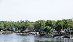
 Location within Vaudreuil-Soulanges RCM. | ||
 L'Île-Perrot Location in southern Quebec. | ||
| Coordinates: 45°23′N 73°57′W / 45.383°N 73.950°WCoordinates: 45°23′N 73°57′W / 45.383°N 73.950°W[1] | ||
| Country |
| |
| Province |
| |
| Region | Montérégie | |
| RCM | Vaudreuil-Soulanges | |
| Constituted | July 1, 1855 | |
| Government[2][3] | ||
| • Mayor | Pierre Séguin | |
| • Federal riding | Vaudreuil-Soulanges | |
| • Prov. riding | Vaudreuil | |
| Area[2][4] | ||
| • Total | 5.50 km2 (2.12 sq mi) | |
| • Land | 5.56 km2 (2.15 sq mi) | |
|
There is an apparent contradiction between two authoritative sources | ||
| Population (2016)[5] | ||
| • Total | 10,756 | |
| • Density | 1,955.6/km2 (5,065/sq mi) | |
| • Pop 2011-2016 |
| |
| • Dwellings | 4,701 | |
| Time zone | UTC−5 (EST) | |
| • Summer (DST) | UTC−4 (EDT) | |
| Postal code(s) | J7V | |
| Area code(s) | 514 and 438 | |
| Highways |
| |
| Website |
www | |

Town of Île-Perrot (French/Official Name: Ville de l'Île-Perrot) is a town and municipality on Île Perrot in southwestern Quebec, Canada. The population as of the Canada 2011 Census was 10,503. The town is at the western end of Lake Saint-Louis, and borders the local island communities of Terrasse-Vaudreuil, Pincourt and Notre-Dame-de-l'Île-Perrot. It also includes Dowker Island and the small Claude and Bellevue Islands (Île Claude and Île Bellevue).
Demographics
Population
| Canada census – L'Île-Perrot, Quebec community profile | |||
|---|---|---|---|
| 2011 | 2006 | ||
| Population: | 10,503 (+5.8% from 2006) | 9,927 (+5.9% from 2001) | |
| Land area: | 5.56 km2 (2.15 sq mi) | 5.56 km2 (2.15 sq mi) | |
| Population density: | 1,889.8/km2 (4,895/sq mi) | 1,786.0/km2 (4,626/sq mi) | |
| Median age: | 40.6 (M: 39.5, F: 41.7) | 38.6 (M: 38.2, F: 39.0) | |
| Total private dwellings: | 4,701 | 4,371 | |
| Median household income: | $55,233 | $66,035 | |
| References: 2011[4] 2006[6] earlier[7] | |||
| Historical Census Data - L'Île-Perrot, Quebec[8] | |||||||||||||||||||||||||||||
|---|---|---|---|---|---|---|---|---|---|---|---|---|---|---|---|---|---|---|---|---|---|---|---|---|---|---|---|---|---|
|
|
| |||||||||||||||||||||||||||
Language
| Canada Census Mother Tongue - L'Île-Perrot, Quebec[8] | |||||||||||||||||||
|---|---|---|---|---|---|---|---|---|---|---|---|---|---|---|---|---|---|---|---|
| Census | Total | French |
English |
French & English |
Other | ||||||||||||||
| Year | Responses | Count | Trend | Pop % | Count | Trend | Pop % | Count | Trend | Pop % | Count | Trend | Pop % | ||||||
2016 |
10,665 |
6,420 | 60.19% | 2,380 | 22.32% | 215 | 2.01% | 1,475 | 13.83% | ||||||||||
2011 |
10,315 |
6,840 | 66.31% | 2,140 | 20.75% | 185 | 1.79% | 1,150 | 11.15% | ||||||||||
2006 |
9,825 |
7,365 | 74.96% | 1,630 | 16.59% | 100 | 1.02% | 730 | 7.43% | ||||||||||
2001 |
9,265 |
7,305 | 78.85% | 1,430 | 15.43% | 110 | 1.19% | 420 | 4.53% | ||||||||||
1996 |
9,025 |
7,295 | n/a | 80.83% | 1,320 | n/a | 14.63% | 95 | n/a | 1.05% | 315 | n/a | 3.49% | ||||||
Infrastructure
Transportation
Autoroute 20 runs through the town, with three at-grade intersections serving as exits. The east side of L'Île-Perrot is bordered by a branch of the Ottawa River with a crossing via Autoroute 20 over the Galipeault Bridge (Pont Galipeault) to Sainte-Anne-de-Bellevue on Montreal Island.
There is a shuttle bus service operated by CIT La Presqu'Île connecting to the Île-Perrot station on the Vaudreuil-Hudson commuter rail line.
Schools
There are 3 francophone elementary schools (Virginie Roy, François-Perrot and La Perdriolle) and an adult education center in L'Île-Perrot, all run by the Commission Scolaire des Trois-Lacs.[9]
Lester B. Pearson School Board operates Anglophone schools. The community is zoned to Dorset Elementary School in Baie-d'Urfé.[10]
See also
References
- ↑ Reference number 177380 of the Commission de toponymie du Québec (in French)
- 1 2 Ministère des Affaires municipales, des Régions et de l'Occupation du territoire: L'Île-Perrot
- ↑ Parliament of Canada Federal Riding History: VAUDREUIL-SOULANGES (Quebec)
- 1 2 "2011 Community Profiles". Canada 2011 Census. Statistics Canada. July 5, 2013. Retrieved 2014-02-01.
- ↑
- ↑ "2006 Community Profiles". Canada 2006 Census. Statistics Canada. March 30, 2011. Retrieved 2014-02-01.
- ↑ "2001 Community Profiles". Canada 2001 Census. Statistics Canada. February 17, 2012.
- 1 2 Statistics Canada: 1996, 2001, 2006, 2011, 2016 census
- ↑ "Les écoles et les centres". Commission Scolaire des Trois-Lacs. Retrieved 18 January 2013.
- ↑ "School Board Map." Lester B. Pearson School Board. Retrieved on September 28, 2017.
External links
Adjacent Municipal Subdivisions | |
|---|---|
| Cities & towns | |
|---|---|
| Municipalities | |
| Villages | |
| |