Mahanpur
| Mahanpur | |
|---|---|
| Town | |
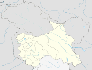
 Mahanpur Location in Jammu and Kashmir, India  Mahanpur Mahanpur (India) | |
| Coordinates: 32°32′N 75°38′E / 32.54°N 75.64°ECoordinates: 32°32′N 75°38′E / 32.54°N 75.64°E | |
| Country |
|
| State | Jammu and Kashmir |
| District | Kathua |
| Elevation | 919 m (3,015 ft) |
| Population (2011) | |
| • Total | 1,554[1] (Town) |
| Languages | |
| • Official | Dogri urdu |
| Time zone | UTC+5:30 (IST) |
| Vehicle registration | JK-08 |
Mahanpur is a newly created tehsil in Kathua district in the state of Jammu and Kashmir, India. Earlier, Mahanpur was a town in Basohli Tehsil. It is located about 33 KM North towards from District head quarters Kathua and 119 KM from State capital Jammu (winter) and 299 from Srinagar (summer).
Geography
Mahanpur is located at 32°32′N 75°38′E / 32.54°N 75.64°E,[2] It has an average elevation of 396 metres in the lower Sivalik Hills range of Himalaya. Mahanpur (Town) 919 has an area of 363 square kilometers[3]. Mahanpur borders Bani and Duggan Tehsil to the north, Billawar to the west and Dharkalan to the south.
Places to visit
- Ranjit Sagar Dam also called "Thein Dam"
- Sukrala Mata Temple
- Bala Sundri Mata Temple
- Dhole -joode Mata
Nearby places
See also
References
This article is issued from
Wikipedia.
The text is licensed under Creative Commons - Attribution - Sharealike.
Additional terms may apply for the media files.