Kōriyama
| Kōriyama 郡山市 | |||
|---|---|---|---|
| Core city | |||
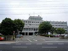
 View of central Koriyama | |||
| |||
|
Location of Kōriyama in Fukushima Prefecture | |||
 Kōriyama | |||
| Coordinates: 37°24′1.6″N 140°21′35″E / 37.400444°N 140.35972°ECoordinates: 37°24′1.6″N 140°21′35″E / 37.400444°N 140.35972°E | |||
| Country | Japan | ||
| Region | Tōhoku | ||
| Prefecture | Fukushima | ||
| Government | |||
| • Mayor | Masato Shinagawa | ||
| Area | |||
| • Total | 757.20 km2 (292.36 sq mi) | ||
| Population (April 2018) | |||
| • Total | 333,108 | ||
| • Density | 440/km2 (1,100/sq mi) | ||
| Time zone | UTC+9 (Japan Standard Time) | ||
| - Tree | Prunus serrulata (Japanese hill cherry) | ||
| - Flower | Japanese iris | ||
| - Bird | Common cuckoo | ||
| Phone number | 024-924-2491 | ||
| Address | 1-23-7 Asahi, Koriyama, Fukushima 963-8024[1] | ||
| Website | Official website | ||
Kōriyama (郡山市 Kōriyama-shi) is a city in Fukushima Prefecture, Japan. As of 1 April 2018, the city has an estimated population of 333,108 people in 140,913 households,[2] and a population density of 435 persons per km². The total area of the city was 757.20 square kilometres (292.36 sq mi).. Kōriyama is designated as a core city and functions as a commercial center for Fukushima Prefecture. Kōriyama is the second largest conurbation in the Tōhoku region.
Geography and climate
Kōriyama is located in the center of the Nakadōri region of Fukushima Prefecture in the Tōhoku region of Japan. The Adatara Mountains are to the north, Lake Inawashiro is to the west, and the Abukuma highlands are to the east. The Abukuma River flows through downtown Kōriyama. The downtown area extends to the west of Kōriyama Station.
Neighboring municipalities
Demographics
Per Japanese census data,[3] the population of Kōriyama has increased over the past 40 years.
| Census Year | Population |
|---|---|
| 1970 | 241,726 |
| 1980 | 286,451 |
| 1990 | 314,642 |
| 2000 | 334,824 |
| 2010 | 338,712 |
Climate
Kōriyama has a humid continental climate (Köppen Cfa) characterized by mild summers and cold winters with heavy snowfall. The average annual temperature in Kōriyama is 11.9 °C. The average annual rainfall is 1216 mm with September as the wettest month.The temperatures are highest on average in August, at around 25.0 °C, and lowest in January, at around 0.1 °C.[4]
| Climate data for Koriyama (1981 - 2010) | |||||||||||||
|---|---|---|---|---|---|---|---|---|---|---|---|---|---|
| Month | Jan | Feb | Mar | Apr | May | Jun | Jul | Aug | Sep | Oct | Nov | Dec | Year |
| Average high °C (°F) | 4.4 (39.9) |
5.1 (41.2) |
8.8 (47.8) |
16.0 (60.8) |
21.1 (70) |
24.3 (75.7) |
27.5 (81.5) |
29.4 (84.9) |
24.7 (76.5) |
19.0 (66.2) |
13.1 (55.6) |
7.6 (45.7) |
16.8 (62.2) |
| Average low °C (°F) | −2.7 (27.1) |
−2.4 (27.7) |
−0.1 (31.8) |
4.9 (40.8) |
10.5 (50.9) |
15.3 (59.5) |
19.3 (66.7) |
20.6 (69.1) |
16.3 (61.3) |
9.7 (49.5) |
3.7 (38.7) |
−0.4 (31.3) |
7.9 (46.2) |
| Average precipitation mm (inches) | 37.4 (1.472) |
37.5 (1.476) |
70.3 (2.768) |
82.8 (3.26) |
99.8 (3.929) |
127.2 (5.008) |
185.0 (7.283) |
152.1 (5.988) |
165.1 (6.5) |
111.1 (4.374) |
62.5 (2.461) |
32.6 (1.283) |
1,163.2 (45.795) |
| Source: Japan Meteorological Agency[5] | |||||||||||||
History
Kōriyama originated as a regional governmental center in the Nara period, when the area was on the frontier of Yamato settlement of the Tōhoku region. The surrounding area developed into shōen controlled by various samurai clans in the Heian and Kamakura periods. Nearby centers, such as Nihonmatsu developed into castle towns, Kōriyama remained as a commercial center and thrived as a post town because of its importance as a traffic focal point into the Edo period and was part of the territory of Nihonmatsu Domain.
With the establishment of the modern municipalities system on April 1, 1889, the town of Kōriyama was established within Asaka District. In the early Meiji period, many dispossessed samurai were assigned undeveloped lands in the area to reclaim and as a result, the population grew and region developed into an agricultural center. The relative abundance of hydroelectric power also helped with the development of local industry.
Kōriyama was raised from town to city status on September 1, 1924 with the annexation of neighboring Odawara Village. Kuwano Village was likewise annexed on June 1, 1925. During the 1930s, Kōriyama was noted a center for military equipment production. It was thus a target for American bombers during World War II, and the city was subject to three large-scale air raids during the war.
From 1954-1955, Kōriyama expanded by annexing the town of Otsuki and portions of the villages of Tomita and Iwae, and in 1965 annexed the villages of Nishida and Nakata. In 1997, the city received core city designation, giving it increased autonomy from national and prefectural governments.
On March 11, 2011, the Great East Japan Earthquake caused damage, but Kōriyama is located outside of the mandatory evacuation zone set by the Japanese government after the Fukushima Daiichi nuclear disaster. Many people from the evacuation zone relocated to Kōriyama.
Government
Kōriyama has a mayor-council form of government with a directly elected mayor and a unicameral city legislature of 38 members. The city contributes nine members to the Fukushima Prefectural Assembly. In terms of national politics, Kōriyama is part of the Fukushima 2nd Electoral District, which includes neighbouring Nihonmatsu, Motomiya and Adachi District.
Mayors
|
|
Sources:[6]
Economy
Kōriyama city is called the "commercial capital in Fukushima" and the economic bloc is the biggest in Fukushima Prefecture. There are many department stores and shops in the area around Kōriyama Station.
- Principal companies headquartered in Koriyama
- XEBIO; sporting goods
- Kourakuen; ramen noodle shop chain
- York Benimaru; large supermarket retailer with networks in south Tōhoku, Nigata, and North Kanto
- Banks headquartered in Koriyama
- Daito Bank
- Toho Bank
Transportation
Kōriyama is an important transportation hub, as it is located in the center of Fukushima Prefecture and is the nexus of several railway lines and expressways. Kōriyama Station is the central station for the city. However, Kōriyama does not have an airport.
Railway
.jpg)
.svg.png)
- Asaka-Nagamori - Kōriyama - Hiwada
- Kōriyama - Mōgi
- Kōriyama - Kōriyamatomita - Kikuta - Akogashima] - Bandai-Atami - Nakayamajuku
- Kōriyama - Asaka-Nagamori - Yatagawa - Iwaki-Moriyama
Highway
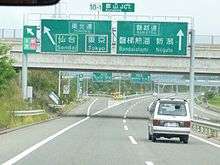
.jpg)
- Ban-etsu Expressway - Kōriyama-higashi IC - Kōriyama JCT - Gohyakugawa PA - Bandai-Atami IC


Media
Television
- Fukushima Central Television (Nippon Television chain)
- Fukushima Broadcasting (TV Asahi chain)
CATY
- Information Network Kōriyama
Radio
- FM Fukushima (JFN)
Newspaper
- Fukushima Mimpō (Fukushima, Mainichi chain)
- Fukushima Minyū (Fukushima, Yomiuri chain)
- Kahoku Shinpō (Sendai)
Education
Universities and colleges
- Nihon University, Faculty of Engineering
- Ohu University
- Kōriyama Women's University & Colleges
- Kōriyama Women's University Junior College
- Open University of Japan, Fukushima Learning Center
Senior high schools
Kōriyama has ten public high schools operated by the Fukushima Prefectural Board of Education and six private high schools
- Public (prefectural)
- Asaka High School
- Asaka Mitate Branch High School
- Asaka Reimei High School
- Kōriyama High School
- Kōriyama Higashi High School
- Kōriyama Shōgyō High School
- Kōriyama Kita Kōgyō High School
- Asaka Kaisei High School
- Konan High School
- Kōriyama Hōsei High School
- Private
- Tohoku High School of Nihon University
- Shōshi Gakuen Shōshi High School
- Teikyō Asaka High School
- High School affiliated with Kōriyama Women's Colleges
Junior high schools
|
|
Multi-level schools
- Fukushima Korean School (JA/KO) - North Korean international school[7]
Noted people from Koriyama
- Takeshi Honda - Figure skater
- Toru Iwaya - Mezzotint engraver, painter
- Miki Nagasawa - voice actress
- Toshiyuki Nishida - actor
- Saga(Alice Nine) - musician
- Masashi Ohuchi - Olympic weightlifter[8]
- Satoru Saito - Actor
- Toshio Tamogami - chief of staff of Japan Air Self-Defense Force
- Joji Yuasa - composer
- Hidekaz Himaruya - Creator Hetalia
Twinnings
Japanese sister cities
- Nara, Nara (since 5 August 1971)
- Kurume, Fukuoka (since 3 August 1975)
- Tottori, Tottori (since 25 November 2005)
International relations

Local attractions
Festivals
- Kōriyama Uneme Festival
- Koriyama Summer Festival - an Oktoberfest-style festival.
- Koriyama Autumn Festival - includes children's activities, taiko and mikoshi parades.
References
- ↑ "A page for Koriyama city foreigners [City Hall & Branch Offices]". Koriyama City. Retrieved 2014-02-03.
- ↑ "Estimated population April 1, 2018" (in Japanese). Official Koriyama city website. Retrieved 20 April 2018.
- ↑ Kōriyama population statistics
- ↑ Kōriyama climate data
- ↑ "Koriyama 19801-2010". Japan Meteorological Agency. Retrieved 2011-10-18.
- ↑ 歴代の郡山市長の一覧 [List of previous mayors of Kōriyama] (in Japanese). Retrieved 28 November 2009.
- ↑ Home. Fukushima Korean School. August 5, 2002. Retrieved on October 13, 2015.
- ↑ "Masashi Ohuchi Passes On". International Weightlifting Federation. 2011-06-07. Retrieved 2011-06-19.
External links
| Wikimedia Commons has media related to Kōriyama, Fukushima. |
- Official website (in Japanese)
- Koriyama City Guide 2017 (Japanese/English)