Sōka
| Sōka 草加市 | |||
|---|---|---|---|
| Special city | |||
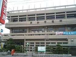 Sōka City office | |||
| |||
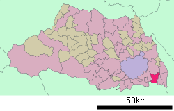 Location of Sōka in Saitama Prefecture | |||
 Sōka Location of Sōka in Japan | |||
| Coordinates: 35°49′31.4″N 139°48′19.2″E / 35.825389°N 139.805333°ECoordinates: 35°49′31.4″N 139°48′19.2″E / 35.825389°N 139.805333°E | |||
| Country | Japan | ||
| Region | Kantō | ||
| Prefecture | Saitama Prefecture | ||
| Area | |||
| • Total | 27.46 km2 (10.60 sq mi) | ||
| Population (February 2016) | |||
| • Total | 247,165 | ||
| • Density | 9,000/km2 (20,000/sq mi) | ||
| Time zone | UTC+9 (Japan Standard Time) | ||
| - Tree | Pinus | ||
| - Flower | Chrysanthemum | ||
| Phone number | 048-922-0151 | ||
| Address | 1-1-1 Takasago, Soka-shi, Saitama-ken 840-8550 | ||
| Website | www.city.soka.saitama.jp | ||


Sōka (草加市 Sōka-shi) is a city in Saitama Prefecture, Japan. As of 1 February 2016, the city had an estimated population of 247,165, and a population density of 9,000 persons per km². Its total area is 27.46 square kilometres (10.60 sq mi).
Geography
Situated in the southeast corner of Saitama Prefecture approximately 30 kilometers away from Tokyo. Sōka is surrounded to the east by the cities of Yashio, Misato and Yoshikawa, and to the west by Kawaguchi. To the north is Koshigaya and to the south Adachi Ward of Metropolitan Tokyo.
Sōka, once a peaceful agricultural area surrounded by water and greenery, lies in the Nakagawa-ayase basin, an area referred to as the Nakagawa-teichi district. This alluvial plain spreads over the central part of the Kanto Plain. As a result of urbanization, the once abundant greenery and clean water was adversely affected. Now, Sōka is promoting a "town of greenery and water based on history and the natural features of the area". Creation of areas of greenery reflecting the changes of the four seasons, and the restoration of waterways and environs is being advanced.
Surrounding municipalities
History
During the Edo period, Sōka-shuku developed as a post station on the Nikkō Kaidō highway. The town of was Sōka created within Kitaadachi District, Saitama with the establishment of the municipalities system on April 1, 1889. It annexed the neighboring villages of Yatsuka and Shinden on January 1, 1955, followed by the village of Kawayanagi on August 1, 1955. On November 1, 1955, Sōka was elevated to city status. Following this, rapid population expansion and urbanization took hold due to strong economic growth which was fueled by its proximity to Tokyo. The city was proclaimed a tokureishi on April 1, 2004 with increased local autonomy.
Economy
Sōka traditionally is known for its rice cracker, the Sōka senbei. However, agriculture and food processing form a minor portion of the local economy, which is heavily industrialized.
Education
- Dokkyo University
- Sōka has 21 elementary schools, 11 junior high schools, four high school, and one special education school.
Transportation
Railway
Highway
Twin towns and sister cities
Sōka is twinned with:


Local attractions
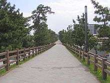
- Sōka Matsubara
Notable people from Sōka
- Hiroshi Imai, politician
- Yōko Honna, voice actress
- Yumi Kawai, actress
- Kenta Kobayashi, wrestler
- Tatsuya Yamaguchi, musician
References
- ↑ "US-Japan Sister Cities by State". Asia Matters for America. Honolulu, HI: East-West Center. Retrieved 20 November 2015.
- ↑ "International Exchange". List of Affiliation Partners within Prefectures. Council of Local Authorities for International Relations (CLAIR). Archived from the original on 4 January 2016. Retrieved 21 November 2015.
External links
| Wikimedia Commons has media related to Soka, Saitama. |
- Official Website (in Japanese)