Hirata, Fukushima
| Hirata 平田村 | |||
|---|---|---|---|
| Village | |||
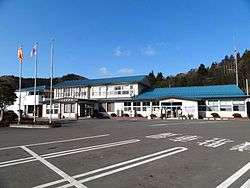 Hirata Village Hall | |||
| |||
|
Location of Hirata in Fukushima Prefecture | |||
 Hirata | |||
| Coordinates: 37°13′19.4″N 140°34′32.9″E / 37.222056°N 140.575806°ECoordinates: 37°13′19.4″N 140°34′32.9″E / 37.222056°N 140.575806°E | |||
| Country | Japan | ||
| Region | Tōhoku | ||
| Prefecture | Fukushima | ||
| District | Ishikawa | ||
| Area | |||
| • Total | 93.42 km2 (36.07 sq mi) | ||
| Population (March 31 2018) | |||
| • Total | 6,150 | ||
| • Density | 66/km2 (170/sq mi) | ||
| Time zone | UTC+9 (Japan Standard Time) | ||
| - Tree | Pinus densiflora | ||
| - Flower | Dandelion | ||
| - Bird | Oriental turtle dove | ||
| Phone number | 0247-55-3111 | ||
| Address | 34 Nagata Hiromachi, Hirata-mura, Ishikawa-gun, Fukushima-ken 963-8292 | ||
| Website | Official website | ||
Hirata (平田村 Hirata-mura) is a village located in Fukushima Prefecture, Japan. As of 21 March 2018, the village had an estimated population of 6,150 in 2012 households,[1] and a population density of 66 persons per km². The total area of the village was 93.42 square kilometres (36.1 sq mi).
Geography
Hirata is located in southeast Fukushima prefecture, approximately halfway between the cities of Iwaki and Kōriyama. The landscape consists of rolling hills with an altitude of between 500 and 700 meters. Hirata has a humid climate (Köppen climate classification Cfa). The average annual temperature in Hirata is 10.6 °C (51.1 °F). The average annual rainfall is 1,412 mm (55.6 in) with September as the wettest month. The temperatures are highest on average in August, at around 23.0 °C (73.4 °F), and lowest in January, at around −0.6 °C (30.9 °F).[2]
- Rivers: Abukuma River
Neighboring municipalities
Demographics
Per Japanese census data,[3] the population of Hirata has been gradually declining since 1970.
| Census year | Population |
|---|---|
| 1970 | 9,359 |
| 1980 | 8,804 |
| 1990 | 8,523 |
| 2000 | 7,910 |
| 2010 | 6,921 |
History
The area of present-day Hirata was part of ancient Mutsu Province. During the Edo period it was mostly the territory of Tsuchiura Domain. After the Meiji Restoration, it was organized as part of Ishikawa District within the Nakadōri region of Iwaki Province. The villages of Odaira and Yomogida were created on April 1, 1889 with the establishment of the modern municipalities system. The two villages merged on March 31, 1955 to form the village of Hirata.
Economy
The economy of Hirata is primarily based on agriculture.
Education
Hiram has two public elementary schools and one public junior high school operated by the village government, and one public high school operated by the Fukushima Prefectural Department of Education.
- Fukushima Prefectural Ono Higher Hirata High School
- Hirata Yomogida High School
- Hirata Odaira Middle School
- Hirata Yomogida School
- Hirata Odaira Elementary School
Transportation
Railway
- Hirata is not served by any passenger train stations.
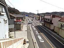
Highway
Local attractions
- Site of Yomogida Castle
- Shibazakura Matsuri
- Komagata Jangara Nembutsu Folk Dance
External links
![]()
- Official website (in Japanese)