Kitashiobara, Fukushima
| Kitashiobara 北塩原村 | |||
|---|---|---|---|
| Village | |||
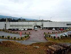 Kitashiobara Village Hall | |||
| |||
|
Location of Kitashiobara in Fukushima Prefecture | |||
 Kitashiobara | |||
| Coordinates: 37°39′21″N 139°56′16″E / 37.65583°N 139.93778°ECoordinates: 37°39′21″N 139°56′16″E / 37.65583°N 139.93778°E | |||
| Country | Japan | ||
| Region | Tōhoku | ||
| Prefecture | Fukushima Prefecture | ||
| District | Yama District | ||
| Area | |||
| • Total | 233.94 km2 (90.32 sq mi) | ||
| Population (September 2014) | |||
| • Total | 2,952 | ||
| • Density | 12.6/km2 (33/sq mi) | ||
| Time zone | UTC+9 (Japan Standard Time) | ||
| - Tree | Prunus sargentii | ||
| - Flower | Lysichiton camtschatcensis | ||
| - Bird | Japanese tit | ||
| Phone number | 0241-23-3111 | ||
| Address | 3151 Kitayama Kitashiobara-mura, Yama-gun, Fukushima-ken 966-0485 | ||
| Website | http://www.vill.kitashiobara.fukushima.jp/ | ||
Kitashiobara (北塩原村 Kitashiobara-mura) is a village located in Fukushima Prefecture, Japan. As of September 2014, the village had an estimated population of 2,952, and a population density of 12.6 persons per km². The total area is 233.94 km².
Geography
Kitashiobara is located at the far northern Aizu region of Fukushima Prefecture, bordered by Yamagata Prefecture to the north. Kitayama consists of three areas, named after the former the villages of Kitayama, Ōshio, and Hibara. The western portion, Hibara, has a higher elevation than the other two areas, most of it between 800 m and 1000 m. Also, Lake Hibara in Hibara is located in the Bandai-Asahi National Park. It was created in 1888 during the eruption of Mount Bandai. Oguni-numa, a swamp, is reserved by the Japanese government as a natural monument.[1] The climate is like many other parts of northern Japan, with cold winters and snowfall averaging 2 meters.
- Mountains : Mount Bandai
- Rivers : Nakutsu-gawa, Ono-gawa
- Lakes : Lake Hibara, Goshiki-numa, Lake Onogawa, Oguni-numa, Akimoto Lake
Neighboring municipalities
History
The area of present-day Kitashiobara was part of ancient Mutsu Province, and formed part of the holdings of Aizu Domain during the Edo period. After the Meiji Restoration, it was organized as part of Yama District.
Kitashiobara village was created on March 31, 1954 by the merger of the former villages of Kitayama, Ōshio (all from Yama District).
Transportation
Railway
- Kitashiobara is not served by any rail transport.
Highway
Local attractions
External links
![]()
- Official Website (in Japanese)