Illabo
| Illabo New South Wales | |
|---|---|
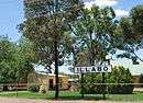
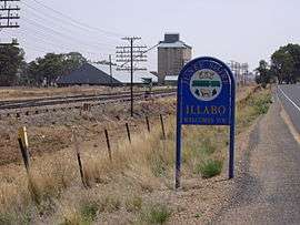 Entering Illabo | |
|
Illabo | |
| Coordinates | 34°49′0″S 147°45′0″E / 34.81667°S 147.75000°ECoordinates: 34°49′0″S 147°45′0″E / 34.81667°S 147.75000°E |
| Population | 190 (2006 census Census)[1] |
| Postcode(s) | 2590 |
| Elevation | 279 m (915 ft) |
| Location |
|
| LGA(s) | Junee Shire |
| County | Clarendon |
| State electorate(s) | Cootamundra |
| Federal Division(s) | Riverina |
Illabo is a locality in the South West Slopes part of the Riverina and situated about 13 kilometres (8 mi) southwest of Bethungra and 16 kilometres (10 mi) northeast of Junee. At the 2006 census, Illabo had a population of 190.[1][2]
Illabo Post Office opened on 1 July 1879.[3] A railway station on the Main South railway served the town between 1878 and the 1970s.[4] A grain silo remains in use. The town name is said to derive from an Aboriginal word meaning "where", but other sources derive it as a clipping of billabong.[5][2]
Notes and references
- 1 2 Australian Bureau of Statistics (25 October 2007). "Illabo (State Suburb)". 2006 Census QuickStats. Retrieved 8 October 2009.
- 1 2 "Illabo". Geographical Names Register (GNR) of NSW. Geographical Names Board of New South Wales. Retrieved 3 August 2013.
- ↑ Premier Postal History. "Post Office List". Archived from the original on 19 August 2008. Retrieved 11 June 2009.
- ↑ Illabo station Archived 1 August 2008 at the Wayback Machine.. NSWrail.net. Accessed 29 August 2009.
- ↑ "Archived copy" (PDF). Archived (PDF) from the original on 23 March 2016. Retrieved 25 April 2018.
External links
![]()
| Preceding station | NSW Main lines | Following station | ||
|---|---|---|---|---|
towards Albury | Main Southern Line | towards Sydney |
Illabo Railway Station sign
This article is issued from
Wikipedia.
The text is licensed under Creative Commons - Attribution - Sharealike.
Additional terms may apply for the media files.