Gobarralong
| Gobarralong New South Wales | |
|---|---|
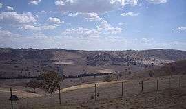 Gobarralong Valley | |
|
Gobarralong | |
| Coordinates | 35°2′8″S 148°19′28″E / 35.03556°S 148.32444°ECoordinates: 35°2′8″S 148°19′28″E / 35.03556°S 148.32444°E |
| Population | 52 (2016 census)[1] |
| Postcode(s) | 2727 |
| Elevation | 199 m (653 ft) |
| Location |
|
| LGA(s) | Cootamundra-Gundagai Regional Council |
| County | Buccleuch |
| State electorate(s) | Cootamundra |
| Federal Division(s) | Riverina |
Gobarralong is a rural community in the central east part of the Riverina. It is situated about 16 kilometres southeast from Coolac and 27 kilometres northwest from Adjungbilly. At the 2016 census, Gobarralong and the surrounding area had a population of 52 people.[1]
North Gobarralong Post Office opened on 1 November 1876, was renamed Gobarralong in 1909, and closed in 1967.[2]
Notes and references
- 1 2 Australian Bureau of Statistics (27 June 2017). "Gobarralong (State Suburb)". 2016 Census QuickStats. Retrieved 1 April 2018.

- ↑ Premier Postal History, Post Office List, retrieved 2009-06-11
| Wikimedia Commons has media related to Gobarralong. |
This article is issued from
Wikipedia.
The text is licensed under Creative Commons - Attribution - Sharealike.
Additional terms may apply for the media files.