Wymah, New South Wales
| Wymah New South Wales | |
|---|---|
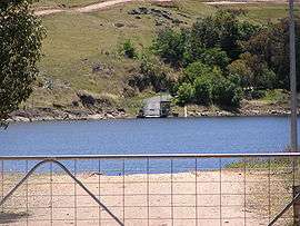 Wymah ferry December 2005 (when the Hume Dam was nearly full) | |
|
Wymah | |
| Coordinates | 35°59′42″S 147°16′12″E / 35.99500°S 147.27000°ECoordinates: 35°59′42″S 147°16′12″E / 35.99500°S 147.27000°E |
| Population | 37 (2016 census)[1] |
| Postcode(s) | 2640 |
| Location | |
| LGA(s) | Greater Hume Shire Council |
| County | Goulburn |
| State electorate(s) | Albury |
Wymah /ˈwaɪmə/ is a rural community in the south-east part of the Riverina very close to the border of Victoria, Australia. It is situated by road, about 11 kilometres (7 mi) south from Bowna and 23 kilometres (14 mi) west from Talmalmo. Wymah is situated on the Wymah River Road accessible from Bowna. At the 2016 census, Wymah had a population of 37.[1]
The place name is derived from the Aboriginal word meaning "White Cockatoo".[2] Wagra Post Office opened on 1 February 1879, was renamed Wymah in 1912 and closed in 1952.[3]
The Wymah Ferry crosses the Murray River when the Hume Dam is full; in low water conditions, the ferry cannot operate.
Notes and references
- 1 2 Australian Bureau of Statistics (27 June 2017). "Wymah (State Suburb)". 2016 Census QuickStats. Retrieved 3 April 2018.

- ↑ "Wymah". Geographical Names Register (GNR) of NSW. Geographical Names Board of New South Wales. Retrieved 11 August 2013.
- ↑ Premier Postal History, Post Office List, retrieved 2008-04-11
| Wikimedia Commons has media related to Wymah, New South Wales. |
This article is issued from
Wikipedia.
The text is licensed under Creative Commons - Attribution - Sharealike.
Additional terms may apply for the media files.