Dêqên County
| Dêqên County 德钦县 • བདེ་ཆེན་རྫོང་ | |
|---|---|
| County | |
 | |
.png) Location of Dêqên County (pink) within Diqing Prefecture (yellow) and Yunnan | |
 Dêqên Location in Yunnan | |
| Coordinates: 28°12′N 98°59′E / 28.200°N 98.983°E | |
| Country | People's Republic of China |
| Province | Yunnan |
| Prefecture | Diqing |
| Area | |
| • Total | 7,596 km2 (2,933 sq mi) |
| Elevation | 3,300 m (10,800 ft) |
| Population | |
| • Total | 62,400 |
| • Density | 8.2/km2 (21/sq mi) |
| Time zone | UTC+8 (China Standard) |
| Postal code | 674500 |
| Area code(s) | 0887 |
| Website |
www |
| Dêqên County | |||||||
| Chinese name | |||||||
|---|---|---|---|---|---|---|---|
| Simplified Chinese | 德钦县 | ||||||
| Traditional Chinese | 德欽縣 | ||||||
| |||||||
| Tibetan name | |||||||
| Tibetan | བདེ་ཆེན་རྫོང་ | ||||||
| |||||||
Dêqên County (Standard Tibetan: བདེ་ཆེན་རྫོང་), or Deqin County (Chinese: 德钦县), is under the administration of Diqing Tibetan Autonomous Prefecture, located in the northwest of Yunnan province, China.
Geography and climate
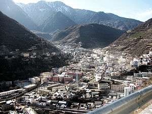
Dêqên occupies the northwest corner of Diqing Prefecture, and in latitude has a range of 27° 33'−29° 15' N and in longitude has a range of 98° 36'−99° 33' E, covering an area of 7,596 square kilometres (2,933 sq mi),[1] bordering the Tibet Autonomous Region to the northwest and Sichuan to the northeast. It is located in the central part of the Hengduan Mountains, and contains the valleys of the Salween, Mekong, and Jinsha Rivers.
Being located at an altitude of 3,300 metres (10,800 ft), Dêqên lies in the transition between a subtropical highland climate (Köppen Cwb) and humid continental climate (Köppen Dwb), which is remarkable for its latitude. Although mean maximum temperatures, as in Lhasa and Shigatse, stay above freezing year-round, minima are below freezing from November to March, and temperatures average −2.1 °C (28.2 °F) in January, 12.7 °C (54.9 °F) in July, while the annual mean is 5.65 °C (42.2 °F). The town is nonetheless a little warmer during the winter than Shangri-La County to the east despite being slightly higher in elevation, due to its more southerly aspect. Rainfall is concentrated between June and September, accounting for nearly 60% of the annual total of 622 mm (24.5 in); snowfall is rare but still causes major transport problems in the winter. With monthly percent possible sunshine ranging from 29% in July to 62% in December, the county seat receives 1,989 hours of bright sunshine annually, with autumn and winter sunnier than spring and summer.
| Climate data for Dêqên County (1971−2000) | |||||||||||||
|---|---|---|---|---|---|---|---|---|---|---|---|---|---|
| Month | Jan | Feb | Mar | Apr | May | Jun | Jul | Aug | Sep | Oct | Nov | Dec | Year |
| Record high °C (°F) | 13.9 (57) |
14.1 (57.4) |
17.2 (63) |
21.2 (70.2) |
22.9 (73.2) |
26.9 (80.4) |
23.9 (75) |
23.8 (74.8) |
23.8 (74.8) |
20.4 (68.7) |
15.8 (60.4) |
14.9 (58.8) |
26.9 (80.4) |
| Average high °C (°F) | 4.1 (39.4) |
4.5 (40.1) |
6.8 (44.2) |
10.1 (50.2) |
15.0 (59) |
17.9 (64.2) |
18.1 (64.6) |
17.7 (63.9) |
15.9 (60.6) |
12.8 (55) |
8.8 (47.8) |
5.6 (42.1) |
11.4 (52.6) |
| Daily mean °C (°F) | −2.1 (28.2) |
−1.2 (29.8) |
1.2 (34.2) |
4.3 (39.7) |
9.0 (48.2) |
12.4 (54.3) |
12.7 (54.9) |
12.4 (54.3) |
10.6 (51.1) |
6.9 (44.4) |
2.4 (36.3) |
−0.8 (30.6) |
5.7 (42.3) |
| Average low °C (°F) | −6.2 (20.8) |
−5 (23) |
−2.4 (27.7) |
0.6 (33.1) |
4.7 (40.5) |
8.6 (47.5) |
9.6 (49.3) |
9.4 (48.9) |
7.7 (45.9) |
3.3 (37.9) |
−1.6 (29.1) |
−5 (23) |
2.0 (35.6) |
| Record low °C (°F) | −13.3 (8.1) |
−11.5 (11.3) |
−8.4 (16.9) |
−4.7 (23.5) |
−1.6 (29.1) |
2.7 (36.9) |
3.6 (38.5) |
4.0 (39.2) |
−0.1 (31.8) |
−2.8 (27) |
−11.5 (11.3) |
−12 (10) |
−13.3 (8.1) |
| Average precipitation mm (inches) | 8.8 (0.346) |
19.0 (0.748) |
52.3 (2.059) |
56.8 (2.236) |
47.0 (1.85) |
60.8 (2.394) |
118.5 (4.665) |
112.2 (4.417) |
73.1 (2.878) |
46.9 (1.846) |
19.8 (0.78) |
6.9 (0.272) |
622.1 (24.491) |
| Average precipitation days (≥ 0.1 mm) | 6.5 | 10.2 | 14.4 | 13.4 | 12.4 | 15.5 | 21.6 | 20.7 | 15.9 | 9.1 | 5.3 | 3.6 | 148.6 |
| Average relative humidity (%) | 57 | 65 | 72 | 73 | 70 | 77 | 83 | 83 | 82 | 74 | 62 | 54 | 71.0 |
| Mean monthly sunshine hours | 191.1 | 159.6 | 168.2 | 161.0 | 190.9 | 157.9 | 125.1 | 133.5 | 133.4 | 179.1 | 191.2 | 198.3 | 1,989.3 |
| Percent possible sunshine | 59 | 51 | 45 | 42 | 46 | 38 | 29 | 33 | 36 | 50 | 60 | 62 | 45 |
| Source: China Meteorological Administration | |||||||||||||
Demographics
There are many Tibetans who live in Dêqên and they, compared to Tibetans in Tibet, have had longer-lasting trade relations with Han-Chinese and other ethnic minorities.[2]
Composition
Meilishi (梅里石) is in Foshan Township,[3] in the northernmost part of the county.[4]
Transportation
Deqin can be reached by many daily buses traveling North from Kunming - Dali - Lijiang - Zhongdian - Deqin.
The route is a very scenic and most of it is a newly built highway apart from the Zhongdian to Deqin section which is a winding mountain road through the scenic North Yunnan/Tibetan mountains.
See also
- Bamê, a village in Foshan, Dêqên County
- Meili Xue Shan (Chinese translation: "Mainri snowy range") or Mainri Snow Mountains (Tibetan: སྨན་རི། ).
References
- Galipeau, Brendan A. "Socio-Ecological Vulnerability in a Tibetan Village on the Lancang River, China" (Archive) (master's thesis). Oregon State University. July 6, 2012.
Reference notes
External links
| Wikimedia Commons has media related to Dêqên County. |

- Deqin County Official Website