North Whitehall Township, Lehigh County, Pennsylvania
| North Whitehall Township | |
|---|---|
| Township | |
 | |
.svg.png) Location of Pennsylvania in the United States | |
| Coordinates: 40°37′27″N 75°37′25″W / 40.62417°N 75.62361°WCoordinates: 40°37′27″N 75°37′25″W / 40.62417°N 75.62361°W | |
| Country | United States |
| State | Pennsylvania |
| County | Lehigh |
| Area[1] | |
| • Total | 28.55 sq mi (73.95 km2) |
| • Land | 28.07 sq mi (72.71 km2) |
| • Water | 0.48 sq mi (1.24 km2) |
| Elevation | 627 ft (191 m) |
| Population (2010) | |
| • Total | 15,703 |
| • Estimate (2016)[2] | 16,255 |
| • Density | 579.05/sq mi (223.57/km2) |
| Time zone | UTC-5 (EST) |
| • Summer (DST) | UTC-4 (EDT) |
| ZIP codes | 18037, 18059, 18065, 18069, 18078, 18104 |
| Area code(s) | 610 and 484 |
| FIPS code | 42-077-55576 |
| Website |
www |
North Whitehall Township is a township in Lehigh County, Pennsylvania, in the United States. It is a suburb of Allentown, Pennsylvania, in the Lehigh Valley region of the state.
The population of North Whitehall Township was 15,703 at the 2010 census.
Geography
According to the United States Census Bureau, the township has a total area of 28.9 square miles (74.8 km²), of which, 28.5 square miles (73.9 km²) of it is land and 0.3 square miles (0.9 km²) of it (1.21%) is water. It is drained by the Lehigh River, which separates it from Northampton County.
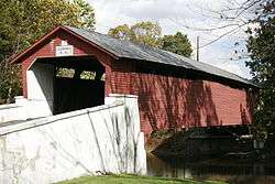
North Whitehall's villages include Ballietsville, Coffeetown, Ironton, Kernsville, Laurys Station, Mechanicsville (also in South Whitehall,) Meyersville (also in South Whitehall,) Neffs (also in Washington Township,) Orefield (also in South Whitehall,) Ormrod, Ruchsville, Scheidy, and Schnecksville.
Adjacent municipalities
- Whitehall Township (east)
- South Whitehall Township (south)
- Upper Macungie Township (tangent to the southwest)
- Lowhill Township (west)
- Heidelberg Township (west)
- Washington Township (northwest)
- Lehigh Township, Northampton County (north)
- Allen Township, Northampton County (northeast)
- Northampton, Northampton County (tangent to the east)
Demographics
| Historical population | |||
|---|---|---|---|
| Census | Pop. | %± | |
| 2000 | 14,731 | — | |
| 2010 | 15,703 | 6.6% | |
| Est. 2016 | 16,255 | [2] | 3.5% |
| U.S. Decennial Census[3] | |||
As of the census[4] of 2010, there were 15,703 people, 5,766 households, and 4,453 families residing in the township. The population density was 543.4 people per square mile (209.8/km²). There were 6,000 housing units at an average density of 207.6/sq mi (80.2/km²). The racial makeup of the township was 94.71% White, 1.53% African American, 0.12% Native American, 1.34% Asian, 0.01% Pacific Islander, 1.02% from other races, and 1.26% from two or more races. Hispanic or Latino of any race were 3.69% of the population.
There were 5,766 households, out of which 36.39% had children under the age of 18 living with them, 64.46% were married couples living together, 4.06% had a male household with no wife present, 8.71% had a female householder with no husband present, and 22.77% were non-families. 18.21% of all households were made up of individuals, and 7.25% had someone living alone who was 65 years of age or older. The average household size was 2.68 and the average family size was 3.05.
In the township the population was spread out, with 27.74% under the age of 20, 4.36% from 20 to 24, 20.99% from 25 to 44, 33.87% from 45 to 64, and 13.04% who were 65 years of age or older. The median age was 43.3 years. For every 100 females there were 98.72 males. For every 100 females age 18 and over, there were 94.94 males age 18 and over.
As of 2015, the median income for a household in the township was $75,714, and the median income for a family was $89,182. Males had a median income of $56,152 versus $43,855 for females. The per capita income for the township was $35,470. About 4.1% of families and 4.8% of the population were below the poverty line, including 5.0% of those under age 18 and 9.1% of those age 65 or over.
Politics and government
Legislators
- State Representative Gary Day, Republican, 187th district
- State Senator Pat Browne, Republican, 16th district
- US Representative Charlie Dent, Republican, 15th district
Board of Supervisors
- Ronald Heintzelman, Chairman
- Mark Hills, Vice Chairman
- Dennis Klucharitz
Jeff Bartlect, Township Manager
Education
The Township is served by the Parkland School District along with South Whitehall and Upper Macungie Townships. Ironton, Kernsville, and Schnecksville Elementary Schools are located in North Whitehall and its secondary students attend Orefield Middle School and Parkland High School.[5] It is also home to Lehigh Carbon Community College in Schnecksville.
Transportation
The township's numbered routes include Pennsylvania Route 309, Pennsylvania Route 873, Pennsylvania Route 329, and Pennsylvania Route 145. Another thoroughfare is Mauch Chunk Road, which runs from PA 329 in Ballietsville into Allentown. LANta serves the township with bus route 325 along the Route 309/873 corridor.
References
- ↑ "2016 U.S. Gazetteer Files". United States Census Bureau. Retrieved Aug 14, 2017.
- 1 2 "Population and Housing Unit Estimates". Retrieved June 9, 2017.
- ↑ "Census of Population and Housing". Census.gov. Retrieved June 4, 2016.
- ↑ "American FactFinder". United States Census Bureau. Retrieved 2010-05-30.
- ↑ http://www.parklandsd.org/about/district-map
External links
Municipalities and communities of Lehigh County, Pennsylvania, United States | ||
|---|---|---|
| Cities | 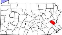 | |
| Boroughs | ||
| Townships | ||
| CDPs | ||
| Unincorporated communities |
| |
| Footnotes | ‡This populated place also has portions in an adjacent county or counties | |