Merom Golan
| Merom Golan מְרוֹם גּוֹלָן | |
|---|---|
 | |
 Merom Golan | |
| Coordinates: 33°08′00″N 35°46′33″E / 33.13333°N 35.77583°ECoordinates: 33°08′00″N 35°46′33″E / 33.13333°N 35.77583°E | |
| District | Northern |
| Council | Golan |
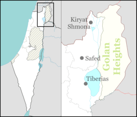
| Region | Golan Heights |
| Affiliation | Kibbutz Movement |
| Founded | 14 July 1967 |
| Population (2017)[1] | 701 |
| Website | merom-golan.org.il |
Merom Golan (Hebrew: מְרוֹם גּוֹלָן) is an Israeli settlement and kibbutz in the Western Golan Heights. The kibbutz was established as a settlement after Israel occupied the area in the Six Day War in 1967. The international community considers Israeli settlements in the Golan Heights illegal under international law, but the Israeli government disputes this.[2]
It is located at the bottom of the volcanic crater[3] of Mount Bental. The settlement falls under the jurisdiction of Golan Regional Council. In 2017, it had a population of 701.[1]
History
Kibbutz Golan (later Merom Golan) was established on 14 July 1967 with funds from the Upper Galilee Regional Council on the site of the abandoned military camp of Aleika.[4]
The kibbutz had the lowest temperature ever recorded by an Israeli weather station: -14.2° C. The previous record was -13.7C in the Beit Netofa Valley.[5]
Geography
Climate
| Climate data for Merom Golan (Temperature: 1995–2010, Precipitation: 1980-2010) | |||||||||||||
|---|---|---|---|---|---|---|---|---|---|---|---|---|---|
| Month | Jan | Feb | Mar | Apr | May | Jun | Jul | Aug | Sep | Oct | Nov | Dec | Year |
| Record high °C (°F) | 21.2 (70.2) |
22.0 (71.6) |
29.7 (85.5) |
33.3 (91.9) |
38.2 (100.8) |
38.0 (100.4) |
40.8 (105.4) |
41.4 (106.5) |
38.3 (100.9) |
35.1 (95.2) |
28.6 (83.5) |
24.2 (75.6) |
41.4 (106.5) |
| Average high °C (°F) | 9.9 (49.8) |
11.0 (51.8) |
14.5 (58.1) |
18.8 (65.8) |
24.5 (76.1) |
27.7 (81.9) |
29.2 (84.6) |
29.4 (84.9) |
27.7 (81.9) |
24.1 (75.4) |
17.5 (63.5) |
12.3 (54.1) |
20.6 (69) |
| Daily mean °C (°F) | 5.7 (42.3) |
6.5 (43.7) |
9.3 (48.7) |
12.8 (55) |
17.2 (63) |
20.7 (69.3) |
23.1 (73.6) |
23.1 (73.6) |
20.9 (69.6) |
17.5 (63.5) |
11.8 (53.2) |
7.9 (46.2) |
14.7 (58.5) |
| Average low °C (°F) | 1.5 (34.7) |
2.0 (35.6) |
4.1 (39.4) |
6.8 (44.2) |
10.0 (50) |
13.8 (56.8) |
17.0 (62.6) |
16.8 (62.2) |
14.1 (57.4) |
10.9 (51.6) |
6.1 (43) |
3.4 (38.1) |
8.9 (48) |
| Record low °C (°F) | −14.2 (6.4) |
−12.5 (9.5) |
−6.7 (19.9) |
−4.5 (23.9) |
−0.2 (31.6) |
4.0 (39.2) |
7.7 (45.9) |
6.7 (44.1) |
3.4 (38.1) |
−2.0 (28.4) |
−6.1 (21) |
−8.8 (16.2) |
−14.2 (6.4) |
| Average rainfall mm (inches) | 201 (7.91) |
196 (7.72) |
115 (4.53) |
40 (1.57) |
9.1 (0.358) |
0 (0) |
0 (0) |
0 (0) |
1.9 (0.075) |
22 (0.87) |
86 (3.39) |
159 (6.26) |
830 (32.683) |
| Average rainy days (≥ 0.1 mm) | 13 | 13 | 10 | 5 | 2.0 | 0.5 | 0.1 | 0 | 0.7 | 5 | 8 | 11 | 68.3 |
| Average relative humidity (%) | 80 | 79 | 73 | 64 | 57 | 57 | 60 | 67 | 65 | 62 | 69 | 78 | 68 |
| Source: Israel Meteorological Service[6][7] | |||||||||||||
See also
References
- 1 2 "List of localities, in Alphabetical order" (PDF). Israel Central Bureau of Statistics. Retrieved August 26, 2018.
- ↑ "The Geneva Convention". BBC. 10 December 2009.
- ↑ http://www.israel-tours-hotel.com/israel/details_site_tiyol.php?ts_id=25
- ↑ 1967 Israel, the War and the Year that Transformed the Middle east by Tom Segev p.574-575
- ↑ "Golan sees record low temperatures during storm". The Times of Israel. 12 January 2015.
Kibbutz Merom Golan on the Golan Heights experienced temperatures of -14.2° C [...] The previous low was reached in February 1950 in the Beit Netofa valley. [...] The Golan Heights were not a part of Israel at that time, and their higher altitude likely would have earned them the original record too.
- ↑ "Temperature average". Israel Meteorological Service. Archived from the original on 2013-06-18. Retrieved December 2011. Check date values in:
|accessdate=(help) (in Hebrew) - ↑ "Precipitation average". Archived from the original on 25 September 2011. Retrieved 12 July 2011. (in Hebrew)
External links
| Wikimedia Commons has media related to Merom Golan. |