Kfar Haruv
| Kfar Haruv כְּפַר חָרוּב | |
|---|---|
 Kfar Haruv | |
| Coordinates: 32°45′45″N 35°39′49″E / 32.76250°N 35.66361°ECoordinates: 32°45′45″N 35°39′49″E / 32.76250°N 35.66361°E | |
| District | Northern |
| Council | Golan Regional Council |
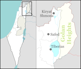
| Region | Golan Heights |
| Affiliation | Kibbutz Movement |
| Founded | 1974 |
| Founded by | Hashomer Hatzair members |
| Population (2017) | 400[1] |
Kfar Haruv (Hebrew: כְּפַר חָרוּב, lit. Carob Village) is an Israeli settlement organized as a kibbutz located in the southern Golan Heights. A member of the Kibbutz Movement, it falls under the jurisdiction of Golan Regional Council. The international community considers Israeli settlements in the Golan Heights illegal under international law, but the Israeli government disputes this.[2] In 2017 it had a population of 400.[1]
Geography
The kibbutz is located on the edge of the cliffs 315 meters (1,033 ft) above sea level (about 525 meters (1,722 ft) above the Sea of Galilee) and 2 kilometers (1.2 mi) east of the sea.
History
The Kfar Yahrib village name is mentioned in the 3rd century Mosaic of Rehob.[3] Later an Arab village with a similar name Kafr Harib existed in the area, until the Six Day War in 1967.
The Israeli settlement was founded in 1973, and took its name from an Arab village that had been located to the south of the kibbutz, Kafr Ḥarib, and which name, in turn, is a corruption of the old village name, Kefar Yaḥrīb, that existed there during the Talmudic era.[3] The new Israeli founders settled temporarily in Afik camp, and moved to the present-day location (the site of a Syrian army base that overlooks Ein Gev and HaOn) in 1974. The sixteenth Israeli settlement established in the Golan Heights, its members are native Israelis and immigrants from the United States. As of 2011 the population stood at 400 residents, of whom 90 live in the new neighborhood built in 2004.
Economy
The main employer of the settlement is the A.R.I. factory that it owns, which manufactures hydraulic equipment. The settlement continues to grow plants for agriculture, such as almonds, avocado, nectars, and peaches. It also has a cow stable for milk. There is also a laundromat and curtain-maker. The settlement is a partner in the tourist site Hamat Gader, and it operates Mitzpe LeShalom (Peace Vista), a place for recreation on the edge of the On Cliffs.
See also
References
- 1 2 "List of localities, in Alphabetical order" (PDF). Israel Central Bureau of Statistics. Retrieved August 26, 2018.
- ↑ "The Geneva Convention". BBC. 10 December 2009.
- 1 2 The Holy Land - from the Persian to the Arab Conquests (536 B.C. to A.D. 640) A Historical Geography , Michael Avi-Yonah, Grand Rapids, 1979, p. 170; ISBN 0-8010-0010-6
External links
- Kfar Haruv Golan Heights website (in Hebrew)