Gainza, Camarines Sur
| Gainza | ||
|---|---|---|
| Municipality | ||
| Municipality of Gainza | ||
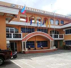 Municipal Hall | ||
| ||
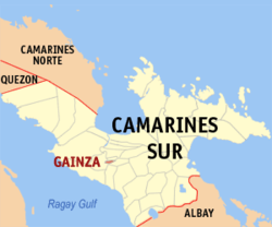 Map of Camarines Sur with Gainza highlighted | ||
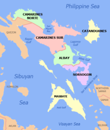
.svg.png) Gainza Location within the Philippines | ||
| Coordinates: 13°37′N 123°09′E / 13.62°N 123.15°ECoordinates: 13°37′N 123°09′E / 13.62°N 123.15°E | ||
| Country |
| |
| Region | Bicol Region (Region V) | |
| Province | Camarines Sur | |
| District | 2nd district | |
| Barangays | 8 (see Barangays) | |
| Government [1] | ||
| • Type | Sangguniang Bayan | |
| • Mayor | Leonardo Agor Sr. | |
| • Vice Mayor | Glenn Romeo Gontang | |
| • Electorate | 7,458 voters (2016) | |
| Area [2] | ||
| • Total | 14.75 km2 (5.70 sq mi) | |
| Population (2015 census)[3] | ||
| • Total | 11,262 | |
| • Density | 760/km2 (2,000/sq mi) | |
| Time zone | UTC+8 (PST) | |
| ZIP code | 4412 | |
| PSGC | 051713000 | |
| IDD : area code | +63 (0)54 | |
| Climate type | Tropical rainforest climate | |
| Income class | 5th municipal income class | |
| Revenue (₱) | 41,725,880.60 (2016) | |
| Poverty incidence | 33.81 (2012)[4] | |
| Native languages |
Central Bikol Tagalog | |

Gainza, officially the Municipality of Gainza, is a 5th class municipality in the province of Camarines Sur, Philippines. According to the 2015 census, it has a population of 11,262 people.[3]
Barangays
Gainza is politically subdivided into 8 barangays:
- Cagbunga
- Dahilig
- Loob
- Malbong
- Namuat
- Sampaloc
- District I (poblacion)
- District II (poblacion)
Demographics
| Population census of Gainza | ||
|---|---|---|
| Year | Pop. | ±% p.a. |
| 1903 | 2,149 | — |
| 1918 | 1,575 | −2.05% |
| 1939 | 2,461 | +2.15% |
| 1948 | 2,672 | +0.92% |
| 1960 | 5,068 | +5.48% |
| 1970 | 4,823 | −0.49% |
| 1975 | 5,931 | +4.23% |
| 1980 | 6,212 | +0.93% |
| 1990 | 7,095 | +1.34% |
| 1995 | 7,743 | +1.65% |
| 2000 | 8,412 | +1.79% |
| 2007 | 9,404 | +1.55% |
| 2010 | 10,345 | +3.53% |
| 2015 | 11,262 | +1.63% |
| Source: Philippine Statistics Authority[3] [5] [6] [7] | ||
In the 2015 census, the population of Gainza, Camarines Sur, was 11,262 people,[3] with a density of 760 inhabitants per square kilometre or 2,000 inhabitants per square mile.
Economy
Majority of the land is devoted to rice, vegetables and other root crops.
Climate
| Climate data for Gainza, Camarines Sur | |||||||||||||
|---|---|---|---|---|---|---|---|---|---|---|---|---|---|
| Month | Jan | Feb | Mar | Apr | May | Jun | Jul | Aug | Sep | Oct | Nov | Dec | Year |
| Average high °C (°F) | 33 (91) |
31 (88) |
35 (95) |
37 (99) |
38 (100) |
37 (99) |
36 (97) |
34 (93) |
35 (95) |
34 (93) |
33 (91) |
32 (90) |
35 (94) |
| Average low °C (°F) | 27 (81) |
27 (81) |
29 (84) |
31 (88) |
32 (90) |
32 (90) |
30 (86) |
29 (84) |
30 (86) |
29 (84) |
28 (82) |
28 (82) |
29 (85) |
| Average precipitation mm (inches) | 44.2 (1.74) |
52.17 (2.0539) |
45.43 (1.7886) |
54.15 (2.1319) |
92.29 (3.6335) |
182.23 (7.1744) |
289.11 (11.3823) |
260.60 (10.2598) |
180.07 (7.0894) |
340.22 (13.3945) |
98.7 (3.886) |
337.4 (13.283) |
1,976.57 (77.8173) |
| Average rainy days | 21 | 22 | 19 | 19 | 24 | 26 | 30 | 29 | 27 | 29 | 24 | 29 | 299 |
| Source: World Weather Online[8] | |||||||||||||
References
- ↑ "Municipality". Quezon City, Philippines: Department of the Interior and Local Government. Retrieved 31 May 2013.
- ↑ "Province: Camarines Sur". PSGC Interactive. Quezon City, Philippines: Philippine Statistics Authority. Retrieved 12 November 2016.
- 1 2 3 4 Census of Population (2015). "Region V (Bicol Region)". Total Population by Province, City, Municipality and Barangay. PSA. Retrieved 20 June 2016.
- ↑ "PSA Releases the 2012 Municipal and City Level Poverty Estimates". Quezon City, Philippines: Philippine Statistics Authority. Archived from the original on 28 January 2017. Retrieved 28 January 2017.
- ↑ Census of Population and Housing (2010). "Region V (Bicol Region)". Total Population by Province, City, Municipality and Barangay. NSO. Retrieved 29 June 2016.
- ↑ Censuses of Population (1903–2007). "Region V (Bicol Region)". Table 1. Population Enumerated in Various Censuses by Province/Highly Urbanized City: 1903 to 2007. NSO.
- ↑ "Province of Camarines Sur". Municipality Population Data. Local Water Utilities Administration Research Division. Retrieved 17 December 2016.
- ↑ "Gainza, Camarines Sur: Average Temperatures and Rainfall". World Weather Online. Retrieved 29 October 2017.
External links
| Wikimedia Commons has media related to Gainza, Camarines Sur. |
- Philippine Standard Geographic Code
- Philippine Census Information
- Official Site of the Province of Camarines Sur
Places adjacent to Gainza, Camarines Sur | ||||||||||
|---|---|---|---|---|---|---|---|---|---|---|
| ||||||||||
| Administrative divisions |
|  | ||||
|---|---|---|---|---|---|---|
| Geography | ||||||
| History | ||||||
| Religion | ||||||
| Public utilities and services |
| |||||
| Transportation | ||||||
| Education | ||||||
| Landmarks | ||||||
Pili (capital) | |
| Municipalities | |
| Component city | |
| Independent component city |
|
This article is issued from
Wikipedia.
The text is licensed under Creative Commons - Attribution - Sharealike.
Additional terms may apply for the media files.