List of Farm to Market Roads in Texas (1200–1299)
|
Texas Farm to Market Road and Ranch to Market Road markers | |
| Highway names | |
|---|---|
| Interstates | Interstate Highway X (IH-X, I-X) |
| US Highways | U.S. Highway X (US X) |
| State | State Highway X (SH X) |
| Loops: | Loop X |
| Spurs: | Spur X |
| Farm or Ranch to Market Roads: |
Farm to Market Road X (FM X) Ranch-to-Market Road X (RM X) |
| Park Roads: | Park Road X (PR X) |
| System links | |
Farm to Market Roads in Texas are owned and maintained by the Texas Department of Transportation (TxDOT).
FM 1200
| |
|---|---|
| Location | Cooke County |
| Length | 6.947 mi[1] (11.180 km) |
| Existed | July 14, 1949[1]–present |
Farm to Market Road 1200 (FM 1200) is located entirely in Cooke County.
FM 1200 begins at an intersection with FM 1201 in western Gainesville near Gainesville Municipal Airport. The highway travels northwest through rural farm areas with several playa lakes. State maintenance ends south of South Fish Creek with the road continuing as County Road 460 towards Marysville.
FM 1200 was designated on July 14, 1949, running from US 82 west of Gainesville northwestward at a distance of 5.0 miles (8.0 km). The section of highway between US 82 and FM 1201 was transferred to the latter highway on February 6, 1953. FM 1200 was extended 3.4 miles (5.5 km) northwestward on July 11, 1968.
- Junction list
The entire route is in Cooke County.
| Location | mi[1] | km | Destinations | Notes | |
|---|---|---|---|---|---|
| Gainesville | 0.000 | 0.000 | |||
| | 6.947 | 11.180 | County Road 460 – Marysville | ||
| 1.000 mi = 1.609 km; 1.000 km = 0.621 mi | |||||
FM 1201
| |
|---|---|
| Location | Cooke County |
| Length | 15.917 mi[2] (25.616 km) |
| Existed | 1949[2]–present |
Farm to Market Road 1201 (FM 1201) is located entirely in Cooke County.
FM 1201 begins at an intersection with US 82 in western Gainesville. The highway travels in a north-northwest direction near the eastern border of Gainesville Municipal Airport and intersects FM 1200 before leaving the city limits. After leaving Gainesville, FM 1201 travels through rural farm areas until reaching the Moss Lake area. In the Moss Lake area, the highway sees more development along its route and passes near a few rural subdivisions. After leaving the Moss Lake area, FM 1201 runs closely to the Red River and travels through Sivells Bend. The highway ends just north of Sivells Bend, with state maintenance ending south of County Road 406; the roadway continues north as County Road 403.
FM 1201 was designated on July 14, 1949, running from FM 1200 northward at a distance of 4 miles (6.4 km). On February 6, 1953, the highway was extended to US 82 (absorbing the southernmost 1.5 miles (2.4 km) of FM 1200) and was extended 6.7 miles (10.8 km) northwest; FM 1201 was extended to Sivells Bend later that year on October 28. A spur route was designated on March 2, 1967 along the highway's old location near Moss Lake.
- Junction list
The entire route is in Cooke County.
| Location | mi[3] | km | Destinations | Notes | |
|---|---|---|---|---|---|
| Gainesville | 0.0 | 0.0 | |||
| 1.2 | 1.9 | ||||
| | 3.6 | 5.8 | |||
| | 10.9 | 17.5 | |||
| | 15.9 | 25.6 | County Road 403 | ||
| 1.000 mi = 1.609 km; 1.000 km = 0.621 mi | |||||
FM 1202
| |
|---|---|
| Location | Cooke County |
| Length | 2.843 mi[4] (4.575 km) |
| Existed | 1949[4]–present |
Farm to Market Road 1202 (FM 1202) is located entirely in Cooke County.
FM 1202 begins at an intersection with FM 1201. The highway travels in a northeast direction then turns southeast at Lake Lane before turning east at County Road 444. FM 1202 enters Gainesville before ending at I-35 near an outlet center.
FM 1202 was designated on July 14, 1949 along the current route.
- Junction list
The entire route is in Cooke County.
| Location | mi[4] | km | Destinations | Notes | |
|---|---|---|---|---|---|
| | 0.000 | 0.000 | |||
| Gainesville | 2.843 | 4.575 | Interchange; I-35 exit 501 | ||
| 1.000 mi = 1.609 km; 1.000 km = 0.621 mi | |||||
FM 1203
| |
|---|---|
| Location | Live Oak County |
| Length | 5.676 mi[5] (9.135 km) |
| Existed | October 31, 1958[5]–present |
Farm to Market Road 1203 (FM 1203) is located entirely in Live Oak County.
FM 1203 begins at an intersection with the northbound frontage road of I-37 south of Oakville. The highway travels in a northeastern direction, turns east, then turns southeast near a county road. FM 1203 continues to run in a southeastern direction before ending at an intersection with FM 799.
The current FM 1203 was designated on October 31, 1958, running from SH 9 (now I-37) near Oakville, eastward and southeastward to FM 799.
- Junction list
The entire route is in Live Oak County.
| Location | mi[5] | km | Destinations | Notes | |
|---|---|---|---|---|---|
| | 0.000 | 0.000 | |||
| | 5.676 | 9.135 | |||
| 1.000 mi = 1.609 km; 1.000 km = 0.621 mi | |||||
FM 1203 (1949)
| |
|---|---|
| Location | Cooke County |
| Existed | July 14, 1949–October 18, 1954 |
FM 1203 was originally designated on July 14, 1949, running from US 82 east of Gainesville to Callisburg at a distance of 4.0 miles (6.4 km). The highway was extended to 1.0 mile (1.6 km) south of Sturgeon on February 6, 1953, absorbing FM 1629, while the old route became a spur of FM 1203.[6] FM 1203 was cancelled and combined with FM 678 on October 18, 1954.[7]
FM 1204
| |
|---|---|
| Location | Wise County |
| Length | 5.449 mi[8] (8.769 km) |
| Existed | June 25, 1952[8]–present |
Farm to Market Road 1204 (FM 1204) is located entirely in Wise County.
FM 1204 begins at the intersection of County Roads 2646 and 2745. The highway travels in a southeastern direction and turns to the southwest at Greenwood then turns back southeast at Greenwood Road. FM 1204 continues to run southeast before ending at an intersection with FM 51 northeast of Decatur.
The current FM 1204 was designated on June 25, 1952 along the current route. The highway follows a former routing of FM 455. A portion was FM 1657.[9]
- Junction list
The entire route is in Wise County.
| Location | mi[8] | km | Destinations | Notes | |
|---|---|---|---|---|---|
| | 0.000 | 0.000 | County Road 2646 / County Road 2745 | ||
| | 5.449 | 8.769 | |||
| 1.000 mi = 1.609 km; 1.000 km = 0.621 mi | |||||
FM 1204 (1949)
| |
|---|---|
| Location | Throckmorton County |
| Existed | July 14, 1949–January 3, 1952 |
The original FM 1204 was designated on July 14, 1949, running from SH 6 at Woodson eastward at a distance of 3.0 miles (4.8 km). The highway was cancelled on January 3, 1952, with the mileage being transferred to FM 209.[10]
FM 1205
| |
|---|---|
| Location | Borden and Howard counties |
| Length | 18.966 mi[11] (30.523 km) |
| Existed | July 28, 1953[11]–present |
FM 1205 (1949)
| |
|---|---|
| Location | Wichita County |
| Existed | July 14, 1949–February 6, 1953 |
FM 1206
| |
|---|---|
| Location | Wichita County |
| Length | 7.966 mi[12] (12.820 km) |
| Existed | 1949[12]–present |
FM 1207
| |
|---|---|
| Location | Wilbarger County |
| Length | 4.946 mi[13] (7.960 km) |
| Existed | 1949[13]–present |
FM 1208
| |
|---|---|
| Location | Midland County |
| Length | 5.051 mi[14] (8.129 km) |
| Existed | September 21, 1955[14]–present |
FM 1208 (1949)
| |
|---|---|
| Location | Wilbarger County |
| Existed | July 14, 1949–July 28, 1955 |
FM 1209
| |
|---|---|
| Location | Bastrop County |
| Length | 4.57 mi[15] (7.35 km) |
| Existed | March 26, 1958[15]–present |
FM 1209 (1949)
| |
|---|---|
| Location | Crane County |
| Existed | July 14, 1949–September 28, 1950 |
FM 1210
| |
|---|---|
| Location | Dawson and Borden counties |
| Length | 14.108 mi[16] (22.705 km) |
| Existed | July 25, 1951[16]–present |
FM 1210 (1949)
| |
|---|---|
| Location | Ector County |
| Existed | July 14, 1949–February 28, 1951 |
FM 1211
| |
|---|---|
| Location | Loving and Winkler counties |
| Existed | July 14, 1949–August 29, 1990[17] |
Farm to Market Road 1211 (FM 1211) is a former highway that was located in Loving and Winkler counties. No highway currently uses the FM 1211 designation.
FM 1211 was designated on July 14, 1949, running from SH 276 at Mentone northeastward at a distance of 2.0 miles (3.2 km). The highway was extended 28.8 miles (46.3 km) to the to SH 115 near Wink on December 17, 1952. On December 1, 1953, FM 1211 was signed (but not designated) as part of SH 302. The highway was cancelled on August 29, 1990, with the mileage officially transferred to SH 302.[18]
FM 1212
| |
|---|---|
| Location | Martin County |
| Length | 18.72 mi[19] (30.13 km) |
| Existed | 1949[19]–present |
FM 1213
| |
|---|---|
| Location | Midland County |
| Length | 7.964 mi[20] (12.817 km) |
| Existed | 1949[20]–present |
FM 1214
| |
|---|---|
| Location | Henderson County |
| Length | 1.192 mi[21] (1.918 km) |
| Existed | January 22, 1958[21]–present |
Farm to Market Road 1214 (FM 1214) is located entirely in Henderson County in Caney City.
FM 1214 begins at Barron Road north of Wingham Road. The highway travels in a predominately northern direction before turning east at Thomas Drive. FM 1214 travels near the shore of Cedar Creek Reservoir before ending at an intersection with SH 198.
The current FM 1214 was designated on January 26, 1958, running from FM 316 (now SH 198) to St. Paul's School.
- Junction list
The entire route is in Caney City, Henderson County.
| mi[21] | km | Destinations | Notes | ||
|---|---|---|---|---|---|
| 0.000 | 0.000 | Barron Road | |||
| 1.192 | 1.918 | ||||
| 1.000 mi = 1.609 km; 1.000 km = 0.621 mi | |||||
FM 1214 (1949)
| |
|---|---|
| Location | Pecos and Brewster counties |
| Existed | July 14, 1949–November 24, 1956 |
FM 1214 was originally designated on July 14, 1949, running from Spur 194 in Fort Stockton southward at a distance of 5.0 miles (8.0 km). The highway was extended 13.5 miles (21.7 km) southward on December 17, 1952. FM 1214 was extended to US 90 near Marathon on September 29, 1954. The highway was cancelled and re-designated as SH 51 on November 24, 1956 at TXDOT proposed a U.S. Highway on this corridor.[22]
FM 1215
| |
|---|---|
| Location | Reeves County |
| Length | 4.39 mi[23][nb 1] (7.07 km) |
| Existed | 1949[23]–present |
Farm to Market Road 1215 (FM 1215) is a Farm to Market Road in the U.S. state of Texas maintained by the Texas Department of Transportation (TxDOT). The 4.9-mile (7.9 km) road, located in southwestern Reeves County, begins along the north service road of Interstate 10 (I-10) east of Balmorhea, intersects State Highway 17 (SH 17) in Saragosa, and ends at a rural road junction.
FM 1215 begins along the north service road of I-10. The road does not have its own dedicated exit from I-10, but can be reached by eastbound traffic from exit 209 then following the SH 17 south underpass to the north service road while westbound traffic follows exit 212 for SH 17 north / FM 2448 to the north service road.[24][25]
From the I-10 service road, the two-lane road proceeds on a convoluted path first to the north, then makes turns to the east and north into Saragosa where the route is known as West Main Street and makes one more eastward turn to SH 17 all along following the local county road system's partial grid of section line roads. Except at I-10 and SH 17, the route uses curves to change direction avoiding right-angle turns. In Saragosa, the road turns south for one-half mile (0.8 km) along SH 17. At Reeves County Road 306 (CR 306), FM 1215 turns east along that route and follows it for one mile (1.6 km) before terminating at an intersection with CR 309. CR 306 continues an additional mile to FM 2448.[24][25]
FM 1215 was designated along its present route on July 14, 1949.[23]
- Junction list
The entire route is in Reeves County. [24]
| Location[24] | mi[25] | km | Destinations | Notes | |
|---|---|---|---|---|---|
| | 0 | 0.0 | Western terminus | ||
| Saragosa | 3.4 | 5.5 | Northern end of SH 17 overlap | ||
| | 3.9 | 6.3 | Southern end of SH 17 overlap | ||
| | 4.9 | 7.9 | Eastern terminus; roadway continues east as CR 306 one mile to FM 2448 | ||
1.000 mi = 1.609 km; 1.000 km = 0.621 mi
| |||||
FM 1216
| |
|---|---|
| Location | Reeves County |
| Length | 10.093 mi[26] (16.243 km) |
| Existed | 1949[26]–present |
Farm to Market Road 1216 (FM 1216) is a Farm to Market Road in the U.S. state of Texas maintained by the Texas Department of Transportation (TxDOT). The road, located in northeastern Reeves County, connects US 285 in Pecos northward to the location of a former school. The road has an intersection with FM 3398.
FM 1216 begins at US 285 on the northern edge of Pecos. The two-lane road proceeds to the north 3 miles (4.8 km) to FM 3398. The road continues an additional 7.1 miles (11.4 km) before state maintenance ends. The roadway continues to the northeast as Reeves County Road 425, which ends at SH 302. The path of FM 1216 is roughly parallel to the Pecos River to the east.[26][27][28][29]
FM 1216 was designated in on July 14, 1949 along approximately 6.0 miles (9.7 km) of its present route beginning at US 285. The route was extended along the remainder of its current length to the site of the former Patrole School on December 18, 1951.
- Junction list
The entire route is in Reeves County. [27][28]
| Location[27][28] | mi[29] | km | Destinations | Notes | |
|---|---|---|---|---|---|
| Pecos | 0 | 0.0 | Southern terminus | ||
| | 3.0 | 4.8 | |||
| | 10.1 | 16.3 | Northern terminus; roadway continues north as CR 425 to SH 302 | ||
| 1.000 mi = 1.609 km; 1.000 km = 0.621 mi | |||||
FM 1217
| |
|---|---|
| Location | Pecos and Terrell counties |
| Existed | July 14, 1949–August 29, 1990[30] |
Farm to Market Road 1217 (FM 1217) is a former highway that was located in Pecos and Terrell counties. No highway currently uses the FM 1217 designation.
FM 1217 was designated on July 14, 1949, running from US 90 in Dryden northward at a distance of 5.5 miles (8.9 km). The highway was extended 3.2 miles (5.1 km) northward on May 23, 1951 and was extended another 7.5 miles (12.1 km) on December 18. FM 1217 was extended 14.0 miles (22.5 km) northward on December 17, 1952. The highway was extended 2.3 miles (3.7 km) northward on April 24, 1954. FM 1217 was extended to US 290 at Sheffield on September 29, 1954, absorbing FM 1749 in the process.[31] On December 13, 1956, FM 1217 was signed (but not designated) as part of SH 349[32] The highway was cancelled on August 29, 1990, with the mileage officially transferred to SH 349.[33]
FM 1218
| |
|---|---|
| Location | Andrews and Winkler counties |
| Length | 13.171 mi[34] (21.197 km) |
| Existed | December 18, 1951[34]–present |
FM 1218 (1949)
| |
|---|---|
| Location | Upton County |
| Existed | July 14, 1949–December 18, 1951 |
FM 1219
| |
|---|---|
| Location | Ward County |
| Length | 22.566 mi[35] (36.316 km) |
| Existed | 1949[35]–present |
FM 1220
| |
|---|---|
| Location | Tarrant County |
| Length | 13.361 mi[36] (21.502 km) |
| Existed | 1953[36]–present |
Farm to Market Road 1220 (FM 1220) is located entirely in Tarrant County.
FM 1220 begins at an intersection with SH 183 in the Far Greater Northside area of Fort Worth. The highway travels in a northwestern direction along Azle Avenue through a residential area and runs along the northern edge of Sansom Park before entering Lake Worth. In Lake Worth, FM 1220 has a junction with I-820 and turns north onto Boat Club Road near Lake Worth High School. The highway travels in a northern direction near several subdivisions, running between Lake Worth and Marine Creek Reservoir, before re-entering Fort Worth near Saginaw. FM 1220 continues to run near several subdivisions in far northwest Fort Worth and turns west north of an intersection with Park Drive, then enters the town of Eagle Mountain. The highway runs through the town and runs close to Eagle Mountain Lake. West of Eagle Mountain, the Boat Club Road designation leaves the highway, with FM 1220's local designation becoming Morris Dido Newark Road. The highway runs in a northwestern direction near the eastern shore of Eagle Mountain Lake with state maintenance ending at Peden Road at the southern boundary of Pecan Acres; Morris Dido Newark Road continues past Peden Road for another 5.3 miles (8.5 km) to FM 718 near Newark.[37]
FM 1220 was designated on December 1, 1953, running from SH 183 in Fort Worth northwestward and northward to a road intersection at a distance of 6.8 miles (10.9 km). The highway was extended 4.0 miles (6.4 km) northwestward on October 13, 1954. FM 1220 was extended 2.4 miles (3.9 km) to its current northern terminus on September 27, 1960. The section of highway between SH 183 and I-820 was internally re-designated as Urban Road 1220 by TxDOT in 1995.[38]
- Junction list
The entire route is in Tarrant County.
| Location | mi[39] | km | Destinations | Notes | |
|---|---|---|---|---|---|
| Fort Worth | 0.0 | 0.0 | |||
| Lake Worth | 2.7 | 4.3 | I-820 exit 10A/10B | ||
| Pecan Acres | 13.3 | 21.4 | Peden Road | ||
| 1.000 mi = 1.609 km; 1.000 km = 0.621 mi | |||||
FM 1220 (1949)
| |
|---|---|
| Location | Winkler County |
| Existed | July 14, 1949–by 1953 |
FM 1220 was designated on July 14, 1949, from SH 115 at Wink southeast 7.8 miles to a road intersection. FM 1220 was cancelled by 1953 and removed from the state highway system.
FM 1221
| |
|---|---|
| Location | Kimble and Menard counties |
| Existed | July 14, 1949–November 13, 1959 |
Farm to Market Road 1221 (FM 1221) is a former highway that was located in Kimble and Menard counties.
FM 1221 was designated on July 14, 1949, running from SH 29 at Hext southward to US 183/US 283. The highway was cancelled and re-designated as RM 1221 in 1959.
RM 1221
| |
|---|---|
| Location | Kimble and Menard counties |
| Length | 13.198 mi[40] (21.240 km) |
| Existed | November 13, 1959[40]–present |
Ranch to Market Road 1221 (RM 1221) is a ranch to market road in eastern Kimble and Menard counties, Texas.
RM 1221 is approximately 13.5 miles (21.7 km) in length. Its southern terminus is at a junction with US 377 northeast of London.[41] The route travels due north to an intersection with RM 1773 before curving slightly to the northeast. It ends at a junction with SH 29 in Hext.[42] The roadway is two-lane and shoulderless for its entire length.
RM 1221 was designated in 1959 when FM 1221 was re-designated as a ranch-to-market road.
- Junction list
| County | Location | mi[43] | km | Destinations | Notes |
|---|---|---|---|---|---|
| Kimble | | 0.0 | 0.0 | Southern terminus | |
| Menard | | 4.3 | 6.9 | ||
| Hext | 13.2 | 21.2 | Northern terminus | ||
| 1.000 mi = 1.609 km; 1.000 km = 0.621 mi | |||||
FM 1222
| |
|---|---|
| Location | Mason County |
| Existed | July 14, 1949–October 1, 1956 |
RM 1222
| |
|---|---|
| Location | Mason County |
| Length | 21.581 mi[44] (34.731 km) |
| Existed | October 1, 1956[44]–present |
FM 1223
| |
|---|---|
| Location | Tom Green County |
| Length | 19.851 mi[45] (31.947 km) |
| Existed | 1949[45]–present |
Farm to Market Road 1223 (FM 1223) is located entirely in Tom Green County.
State maintenance for FM 1223 begins on Susan Peak Road south of the main entrance to Rocking Chair Ranch. The highway travels northwest through rural farm and ranch land and has a junction with US 87/Loop 306 west of Wall. After the junction with US 87/Loop 306, FM 1223 continues to run in a northwest direction and enters San Angelo near an intersection with FM 765. The highway turns west at Old Eola Road near Goodfellow Air Force Base, turns northwest at Loop 378, then turns north near the South Concho River. After crossing the river, FM 1233 travels in a northern direction and closely parallels the river before ending at an intersection with FM 388. The section of highway within San Angelo is known locally as Chadbourne Street.
FM 1223 was designated on July 14, 1949, running from US 87 (now Cottonseed Road) 3.5 miles (5.6 km) west of Wall, southeastward at a distance of 7.3 miles (11.7 km). The highway was extended 0.8 miles (1.3 km) over the old location of US 87 to the current location of US 87 at Loop 306 on November 1, 1962. The highway was extended 5.0 miles (8.0 km) southeastward on July 11, 1968. FM 1223 was extended over the old location of US 87 between Loop 306 and Loop 378 on February 10, 1972. On November 3, 1972, the highway was extended 23.1 miles (37.2 km) southeastward to US 83 near Menard, absorbing FM 3142.[46] The section of FM 1223 in Menard County was cancelled on January 9, 1984, with part of the old highway being re-designated as FM 3463.[47] The highway was extended 1.7 miles (2.7 km) northwestward from Loop 378 to FM 388 on March 29, 1988, absorbing the northern part of Loop 378.[48] The section of FM 1223 between US 87 and FM 388 was internally re-designated as Urban Road 1223 by TxDOT on June 27, 1995.[49]
- Junction list
The entire route is in Tom Green County.
| Location | mi[50] | km | Destinations | Notes | |
|---|---|---|---|---|---|
| | 0.0 | 0.0 | Susan Peak Road | ||
| | 13.8 | 22.2 | Interchange | ||
| San Angelo | 16.5 | 26.6 | |||
| 18.0 | 29.0 | ||||
| 19.8 | 31.9 | ||||
| 1.000 mi = 1.609 km; 1.000 km = 0.621 mi | |||||
FM 1224
| |
|---|---|
| Location | Fisher County |
| Length | 11.482 mi[51] (18.478 km) |
| Existed | 1949[51]–present |
FM 1225
| |
|---|---|
| Location | Haskell County |
| Length | 8.728 mi[52] (14.046 km) |
| Existed | 1949[52]–present |
FM 1226
| |
|---|---|
| Location | Jones County |
| Length | 25.699 mi[53] (41.359 km) |
| Existed | 1949[53]–present |
FM 1227
| |
|---|---|
| Location | Grimes County |
| Length | 7.381 mi[54] (11.879 km) |
| Existed | 1952[54]–present |
FM 1227 (1949)
| |
|---|---|
| Location | Jones County |
| Existed | 1949[54]–1952 |
FM 1228
| |
|---|---|
| Location | Kent County |
| Length | 13.456 mi[55] (21.655 km) |
| Existed | 1949[55]–present |
FM 1229
| |
|---|---|
| Location | Mitchell County |
| Length | 19.445 mi[56] (31.294 km) |
| Existed | 1949[56]–present |
FM 1230
| |
|---|---|
| Location | Nolan County |
| Length | 8.076 mi[57] (12.997 km) |
| Existed | 1949[57]–present |
FM 1231
| |
|---|---|
| Location | Kent and Scurry counties |
| Existed | July 14, 1949–August 29, 1990[58] |
Farm to Market Road 1231 (FM 1231) is a former highway that was located in Kent and Scurry counties. No highway currently uses the FM 1231 designation.
FM 1231 was designated on July 14, 1949, running from US 84 at Snyder northward to a road intersection at a distance of 8.8 miles (14.2 km). The highway was extended 7.6 miles (12.2 km) northward to the Kent county line on June 21, 1951. FM 1231 was extended 3.0 miles (4.8 km) north of the Scurry-Kent county line later that year on November 20. The highway was extended to US 380 near Clairemont on April 29, 1952, replacing FM 1741.[59] On February 23, 1956, FM 1231 was signed, but not designated, as SH 208.[60] FM 1231 was cancelled in 1990 as the extension of the SH 208 designation became official.[61]
FM 1232
| |
|---|---|
| Location | Winkler County |
| Length | 11.768 mi[62] (18.939 km) |
| Existed | February 18, 1952[62]–present |
FM 1232 (1949)
| |
|---|---|
| Location | Shackelford County |
| Existed | July 14, 1949–January 14, 1952 |
FM 1233
| |
|---|---|
| Location | Crane and Ward counties |
| Length | 34.179 mi[63] (55.006 km) |
| Existed | December 18, 1951[63]–present |
FM 1233 (1949)
| |
|---|---|
| Location | Taylor and Jones counties |
| Existed | July 14, 1949–December 10, 1951 |
FM 1234
| |
|---|---|
| Location | Panola County |
| Length | 0.863 mi[64] (1.389 km) |
| Existed | June 28, 1963[64]–present |
FM 1234 (1949)
| |
|---|---|
| Location | Taylor County |
| Existed | July 14, 1949–July 31, 1962 |
FM 1235
| |
|---|---|
| Location | Jones and Taylor counties |
| Length | 28.87 mi[65] (46.46 km) |
| Existed | 1949[65]–present |
FM 1236
| |
|---|---|
| Location | Fort Bend County |
| Length | 5.73 mi[66] (9.22 km) |
| Existed | October 31, 1958[66]–present |
Farm to Market Road 1236 (FM 1236) is a state highway in the U.S. state of Texas that remains within Fort Bend County. The two-lane highway begins at FM 442 south of Needville and goes northwest and then northeast before ending at State Highway 36 (SH 36) in Needville.
A two-lane highway for its entire length, FM 1236 begins at a stop sign on FM 442 south of Needville. This location is 3.1 miles (5.0 km) northwest of the San Bernard River bridge on FM 442. From its starting point, the highway heads 2.0 miles (3.2 km) northwest to Needville Four Corners Road. This section of FM 1236, which is also named Bushnell Road, crosses Buffalo Creek. At Needville Four Corners Road, FM 1236 curves to the northeast and goes 2.4 miles (3.9 km) to Altimore Road on the edge of Needville. The highway continues in the same direction through Needville for 1.0 mile (1.6 km) before coming to a traffic signal at FM 360. The portion of FM 1236 within Needville is also called School Street. The section from FM 360 to the end of the highway at the SH 36 traffic light is an additional 0.3 miles (0.5 km). On the other side of SH 36, School Street continues to the northeast and becomes Old Needville Fairchild Road, but is not part of the state highway system.[67]
FM 1236 was redesignated on October 31, 1958 to begin at FM 442 and head northwest then northeast to end at SH 36 in Needville. The 0.3 miles (0.5 km) long former spur connection to SH 36 was transferred to FM 1236 from FM 360.
- Junction list
The entire highway is in Fort Bend County.
| Location | mi | km | Destinations | Notes | |
|---|---|---|---|---|---|
| | 0.0 | 0.0 | Southern terminus of FM 1236 | ||
| Needville | 5.4 | 8.7 | Main Street | ||
| 5.7 | 9.2 | Northern terminus of FM 1236 | |||
| 1.000 mi = 1.609 km; 1.000 km = 0.621 mi | |||||
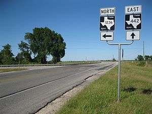 Start of FM 1236 on FM 442 south of Needville
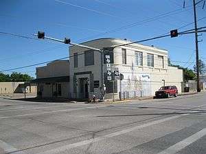 Kanak Law Building at FM 360 and FM 1236 in Needville
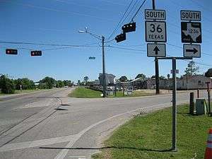 End of FM 1236 at Highway 36 in Needville
FM 1236 (1949)
| |
|---|---|
| Location | Bell and Williamson counties |
| Existed | July 14, 1949–January 7, 1955 |
FM 1236 was originally designated on July 14, 1949, to start at State Highway 95 (SH 95) in Bartlett, Texas and run about 6.6 miles (10.6 km) to the east. The highway was entirely within Bell County. On December 17, 1952, FM 1236 was extended to the Milam County line, making a total distance of about 9.4 miles (15.1 km). On July 10, 1953, the former right-of-way of FM 1329 was canceled and combined with FM 1236, making a total distance of 36.6 miles (58.9 km).[68] In effect this extended FM 1236 27.2 miles (43.8 km) to the west from Bartlett through Jarrell to State Highway 195 at Florence in Williamson County. On January 7, 1955, FM 1236 was canceled and its right-of-way was transferred to FM 487.[69]
FM 1237
| |
|---|---|
| Location | Bell County |
| Length | 6.195 mi[70] (9.970 km) |
| Existed | 1949[70]–present |
FM 1238
| |
|---|---|
| Location | Bosque and Hamilton counties |
| Length | 13.966 mi[71] (22.476 km) |
| Existed | 1949[71]–present |
FM 1239
| |
|---|---|
| Location | McLennan and Falls counties |
| Length | 7.449 mi[72] (11.988 km) |
| Existed | 1949[72]–present |
FM 1240
| |
|---|---|
| Location | Falls County |
| Length | 12.852 mi[73] (20.683 km) |
| Existed | 1949[73]–present |
FM 1241
| |
|---|---|
| Location | Hamilton and Coryell counties |
| Length | 19.946 mi[74] (32.100 km) |
| Existed | 1949[74]–present |
FM 1242
| |
|---|---|
| Location | Hill County |
| Length | 9.471 mi[75] (15.242 km) |
| Existed | 1949[75]–present |
FM 1243
| |
|---|---|
| Location | Hill County |
| Length | 10.632 mi[76] (17.111 km) |
| Existed | 1949[76]–present |
FM 1244
| |
|---|---|
| Location | Hill County |
| Length | 3.654 mi[77] (5.881 km) |
| Existed | 1949[77]–present |
FM 1245
| |
|---|---|
| Location | Limestone County |
| Length | 20.184 mi[78] (32.483 km) |
| Existed | 1949[78]–present |
FM 1246
| |
|---|---|
| Location | Limestone County |
| Length | 14.488 mi[79] (23.316 km) |
| Existed | 1949[79]–present |
FM 1247
| |
|---|---|
| Location | Cherokee County |
| Length | 9.569 mi[80] (15.400 km) |
| Existed | 1949[80]–present |
FM 1248
| |
|---|---|
| Location | Cherokee County |
| Length | 6.57 mi[81] (10.57 km) |
| Existed | 1949[81]–present |
FM 1249
| |
|---|---|
| Location | Gregg and Rusk counties |
| Length | 10.036 mi[82] (16.151 km) |
| Existed | 1949[82]–present |
Farm to Market Road 1249 or FM 1249 is a Farm to Market Road in Texas, running from US 259 Bus. in Kilgore east to SH 322 near Lakeport.
FM 1249 was designated from US 259 (now Business US 259) to SH 322 on July 14, 1949. On January 26, 1965, FM 1249 was extended over the old location of SH 322, completing its current route.
- Junction list
| County | Location | mi[83] | km | Destinations | Notes |
|---|---|---|---|---|---|
| Gregg | Kilgore | 0.0 | 0.0 | ||
| Rusk | 2.2 | 3.5 | Interchange | ||
| | 4.9 | 7.9 | |||
| | 10.0 | 16.1 | |||
| 1.000 mi = 1.609 km; 1.000 km = 0.621 mi | |||||
FM 1250
| |
|---|---|
| Location | Medina County |
| Length | 2.314 mi[84] (3.724 km) |
| Existed | May 5, 1966[84]–present |
Farm to Market Road 1250 (FM 1250) is located entirely in Medina County in the town of Hondo and is known locally as 30th Street.
FM 1250 begins at an intersection with US 90 in the western part of the town. The highway travels in an eastern direction through rural parts of the town until an intersection with Avenue U. East of Avenue U, FM 1250 travels through a residential area before ending at an intersection with FM 462 near Medina Community Hospital.
The current FM 1250 was designated on May 5, 1966 along the current route.
- Junction list
The entire route is in Hondo, Medina County.
| mi[84] | km | Destinations | Notes | ||
|---|---|---|---|---|---|
| 0.000 | 0.000 | ||||
| 2.314 | 3.724 | ||||
| 1.000 mi = 1.609 km; 1.000 km = 0.621 mi | |||||
FM 1250 (1949)
| |
|---|---|
| Location | Henderson County |
| Existed | July 14, 1949–October 30, 1966 |
FM 1250 was first designated on July 14, 1949, traveling from FM 85 near Mabank, eastward to US 175 at a distance of 5.6 miles (9.0 km). The highway was cancelled on October 30, 1961 when FM 85 was rerouted over it.[85]
FM 1251
| |
|---|---|
| Location | Rusk and Panoloa counties |
| Length | 14.113 mi[86] (22.713 km) |
| Existed | 1949[86]–present |
FM 1252
| |
|---|---|
| Location | Smith and Gregg counties |
| Length | 17.873 mi[87] (28.764 km) |
| Existed | 1949[87]–present |
Farm to Market Road 1252 or FM 1252 is a Farm to Market Road in Texas, running from FM 757 near its intersection with I-20 east to SH 31 near Kilgore. The highway runs parallel to I-20 for its entire length.
FM 1252 was designated on July 14. 1949 from FM 757 to the Gregg County Line. On May 23, 1951, FM 1252 was extended east to SH 31.
- Junction list
| County | Location | mi[88] | km | Destinations | Notes |
|---|---|---|---|---|---|
| Smith | | 0.0 | 0.0 | ||
| Gregg | Liberty City | 11.7 | 18.8 | ||
| | 12.3 | 19.8 | |||
| | 15.7 | 25.3 | |||
| | 17.9 | 28.8 | |||
| 1.000 mi = 1.609 km; 1.000 km = 0.621 mi | |||||
FM 1253
| |
|---|---|
| Location | Smith County |
| Length | 11.787 mi[89] (18.969 km) |
| Existed | 1949[89]–present |
FM 1254
| |
|---|---|
| Location | Wood County |
| Length | 8.252 mi[90] (13.280 km) |
| Existed | 1949[90]–present |
FM 1255
| |
|---|---|
| Location | Van Zandt County |
| Length | 18.715 mi[91] (30.119 km) |
| Existed | 1949[91]–present |
FM 1256
| |
|---|---|
| Location | Van Zandt County |
| Length | 7.954 mi[92] (12.801 km) |
| Existed | 1949[92]–present |
FM 1257
| |
|---|---|
| Location | Refugio County |
| Length | 1.429 mi[93] (2.300 km) |
| Existed | September 26, 1979[93]–present |
FM 1257 (1949)
| |
|---|---|
| Location | Van Zandt County |
| Existed | July 14, 1949–September 29, 1949 |
FM 1257 (1951)
| |
|---|---|
| Location | Pecos County |
| Existed | May 23, 1951–June 30, 1977 |
FM 1258
| |
|---|---|
| Location | Armstrong, Randall and Potter counties |
| Length | 32.667 mi[94] (52.572 km) |
| Existed | 1949[94]–present |
FM 1259
| |
|---|---|
| Location | Deaf Smith County |
| Length | 12.981 mi[95] (20.891 km) |
| Existed | 1949[95]–present |
FM 1260
| |
|---|---|
| Location | Donley County |
| Length | 18.602 mi[96] (29.937 km) |
| Existed | 1949[96]–present |
FM 1261
| |
|---|---|
| Location | Hansford County |
| Length | 22.57 mi[97] (36.32 km) |
| Existed | 1949[97]–present |
FM 1262
| |
|---|---|
| Location | Hansford County |
| Length | 15.961 mi[98] (25.687 km) |
| Existed | 1949[98]–present |
FM 1263
| |
|---|---|
| Location | Stonewall County |
| Length | 16.478 mi[99] (26.519 km) |
| Existed | August 26, 1953[99]–present |
FM 1263 (1949)
| |
|---|---|
| Location | Hemphill County |
| Existed | July 14, 1949–January 27, 1953 |
FM 1263 (1952)
| |
|---|---|
| Location | Washington County |
| Existed | December 17, 1952–May 1953 |
FM 1264
| |
|---|---|
| Location | Lubbock County |
| Length | 15.135 mi[100][nb 2] (24.357 km) |
| Existed | December 17, 1952[100]–present |
Farm to Market Road 1264 (FM 1264) is a farm-to-market road located in Lubbock County, Texas, and maintained by the Texas Department of Transportation (TxDOT). The section of highway within the city limits of Lubbock is known locally as North University Avenue.
FM 1264 begins at an intersection with U.S. Highway 84 (US 84, Clovis Road) in northwest Lubbock; the road continues past here as University Avenue. The highway travels between the Conquistador and Llano Estacado Lakes and runs near the Lubbock County Juvenile Justice Center before meeting Loop 289. Just north of Loop 289, FM 1264 runs past the Lubbock State School and a subdivision before leaving the city limits of Lubbock. Just north of the Lubbock city limits, the highway has an intersection with FM 2641. The rest of FM 1264's route is generally rural before reaching its northern terminus at FM 597 west of Abernathy.
The current FM 1264 was designated on December 17, 1952, running from US 84 north to FM 1294. On June 2, 1967, the highway was extended farther north to FM 597. On June 27, 1995, the section of FM 1264 between US 84 and FM 2641 was designated as Urban Road 1264 by TxDOT.[101] Like other urban roads, the highway still retains its FM signage.
- Junction list
The entire route is in Lubbock County.
| Location | mi[102] | km | Destinations | Notes | |
|---|---|---|---|---|---|
| Lubbock | 0.0 | 0.0 | North University Avenue – Texas Tech University | Continuation | |
| 1.1 | 1.8 | ||||
| | 3.1 | 5.0 | |||
| | 6.1 | 9.8 | |||
| | 9.1 | 14.6 | Southern end of FM 1729 overlap | ||
| | 10.1 | 16.3 | Northern end of FM 1729 overlap | ||
| | 16.2 | 26.1 | |||
1.000 mi = 1.609 km; 1.000 km = 0.621 mi
| |||||
FM 1264 (1949)
| |
|---|---|
| Location | Hutchinson County |
| Existed | July 14, 1949–1952 |
An earlier FM 1264 was designated on July 14, 1949 from FM 279 (now FM 281) 9 miles east of SH 117 (now SH 207), southeast to the Roberts County Line.[103] This was combined with FM 279, while the old route of FM 279 was renumbered FM 760.
FM 1265
| |
|---|---|
| Location | Lipscomb County |
| Existed | July 14, 1949–August 29, 1990[104] |
Farm to Market Road 1265 (FM 1265) is a former highway that was located entirely in Lipscomb County. No highway currently uses the FM 1265 designation.
FM 1265 was designated on July 14, 1949 from the Texas/Oklahoma state line north of Booker to a road intersection south of Booker at a total distance of 5.7 miles (9.2 km). The highway was extended 12.0 miles (19.3 km) southward to a road intersection on October 26, 1954. FM 1265 was extended 11.4 miles (18.3 km) southward to US 83 on January 21, 1956. On January 27, 1959, FM 1265 was signed (but not designated) as SH 23. The highway was cancelled and officially re-designated as SH 23 on August 29, 1990.[105]
FM 1266
| |
|---|---|
| Location | Galveston County |
| Length | 2.011 mi[106] (3.236 km) |
| Existed | February 21, 1952[106]–present |
FM 1266 (1949)
| |
|---|---|
| Location | Moore County |
| Existed | July 14, 1949–December 7, 1953 |
FM 1267
| |
|---|---|
| Location | Ochiltree County |
| Length | 20.143 mi[107] (32.417 km) |
| Existed | 1949[107]–present |
FM 1268
| |
|---|---|
| Location | Roberts and Hemphill counties |
| Length | 16.986 mi[108] (27.336 km) |
| Existed | 1949[108]–present |
FM 1269
| |
|---|---|
| Location | Scurry and Garza counties |
| Length | 19.1 mi[109] (30.7 km) |
| Existed | December 17, 1952[109]–present |
FM 1269 (1949)
| |
|---|---|
| Location | Sherman County |
| Existed | July 14, 1949–September 17, 1952 |
FM 1270
| |
|---|---|
| Location | Angelina County |
| Length | 6.038 mi[110] (9.717 km) |
| Existed | 1949[110]–present |
FM 1271
| |
|---|---|
| Location | Angelina County |
| Length | 3.256 mi[111] (5.240 km) |
| Existed | 1949[111]–present |
FM 1272
| |
|---|---|
| Location | Houston County |
| Length | 7.597 mi[112] (12.226 km) |
| Existed | 1949[112]–present |
FM 1273
| |
|---|---|
| Location | Kerr County |
| Length | 2.479 mi[113] (3.990 km) |
| Existed | December 18, 1951[113]–present |
Farm to Market Road 1273 (FM 1273) is located entirely in Kerr County in the Hill Country area. The highway is known locally as Upper Turtle Creek Road.
State maintenance for FM 1273 begins near the intersection of Upper Turtle Creek Road and Pikes Peak Road. The highway snakes its way through hilly terrain and runs parallel to Turtle Creek in an area with several lodges and camps. FM 1273 ends at an intersection with SH 16 southwest of Kerrville.
The current FM 1273 was designated on December 18, 1951, traveling from SH 16 westward to Camp Maddox at a distance of 4.6 miles (7.4 km). The westernmost 2.1 miles (3.4 km) of the highway was turned over to Kerr County for maintenance on June 24, 1953.
- Junction list
The entire route is in Kerr County.
| Location | mi[113] | km | Destinations | Notes | |
|---|---|---|---|---|---|
| | 0.000 | 0.000 | Upper Turtle Creek Road | ||
| | 2.479 | 3.990 | |||
| 1.000 mi = 1.609 km; 1.000 km = 0.621 mi | |||||
FM 1273 (1949)
| |
|---|---|
| Location | Houston County |
| Existed | July 14, 1949–December 18, 1951 |
The first FM 1273 was designated on July 14, 1949, running from SH 45 (now SH 19) at Lovelady to a road intersection at a distance of 3.5 miles (5.6 km). The highway was cancelled and combined with FM 1280 in 1952.
FM 1274
| |
|---|---|
| Location | Coleman County |
| Length | 2.488 mi[114] (4.004 km) |
| Existed | March 2, 1967[114]–present |
FM 1274 (1949)
| |
|---|---|
| Location | Nacogdoches County |
| Existed | July 14, 1949–March 18, 1964 |
FM 1275
| |
|---|---|
| Location | Nacogdoches County |
| Length | 12.814 mi[115] (20.622 km) |
| Existed | 1949[115]–present |
FM 1276
| |
|---|---|
| Location | Polk County |
| Length | 13.522 mi[116] (21.762 km) |
| Existed | 1949[116]–present |
FM 1277
| |
|---|---|
| Location | San Augustine County |
| Length | 21.329 mi[117] (34.326 km) |
| Existed | 1949[117]–present |
FM 1278
| |
|---|---|
| Location | Cottle County |
| Length | 7.408 mi[118] (11.922 km) |
| Existed | October 28, 1953[118]–present |
FM 1278 (1949)
| |
|---|---|
| Location | Shelby County |
| Existed | July 14, 1949–November 13, 1953 |
FM 1279
| |
|---|---|
| Location | San Augustine and Shelby counties |
| Length | 10.707 mi[119] (17.231 km) |
| Existed | 1949[119]–present |
FM 1280
| |
|---|---|
| Location | Houston and Trinity counties |
| Length | 34.005 mi[120] (54.726 km) |
| Existed | 1949[120]–present |
Farm to Market Road 1280 (FM 1280) is farm to market road in Houston and Trinity Counties in Texas.
FM 1280 begins in the unincorporated community of Ash in Houston County, at the intersection of County Roads 3190 and 3220.[121] The route proceeds to the east, curving to the southeast to intersect SH 21 in Austonio.[122] It curves back toward the east, passing through the former town of Pearson Chapel, where it intersects FM 3151, before meeting FM 230 and SH 19 in Lovelady. FM 1280 passes Holly before dipping into Trinity County, where it provides access to the communities of Zion Hill and Friday. The route reaches its eastern terminus at a junction with US 287 within the boundaries of the Davy Crockett National Forest shortly thereafter.[122]
FM 1280 was designated on July 14, 1949; the original route was from its eastern terminus near Groveton westward approximately 7.8 miles (12.6 km). It was extended further west Lovelady on November 20, 1951, replacing FM 1273, which went from SH 45 (now SH 19) east 3.5 miles.[113] On October 13, 1954, FM 1280 extended 6.3 miles to Pearsons Chapel. On November 21, 1956, FM 1280 extended west to Ash, replacing FM 1732 which started at SH 21.[123]
- Junction list
| County | Location | mi[124] | km | Destinations | Notes |
|---|---|---|---|---|---|
| Houston | Ash | 0.0 | 0.0 | CR 3190/CR 3220 | Western terminus |
| Austonio | 3.9 | 6.3 | |||
| Pearson Chapel | 10.4 | 16.7 | |||
| Lovelady | 16.8 | 27.0 | |||
| 16.9 | 27.2 | ||||
| Smith Grove | 20.6 | 33.2 | |||
| | 23.6 | 38.0 | |||
| Trinity | Groveton | 34.0 | 54.7 | Eastern terminus | |
| 1.000 mi = 1.609 km; 1.000 km = 0.621 mi | |||||
FM 1281
| |
|---|---|
| Location | El Paso County |
| Length | 8.179 mi[125] (13.163 km) |
| Existed | November 25, 1975[125]–present |
FM 1281 (1949)
| |
|---|---|
| Location | Grayson County |
| Existed | July 14, 1949–December 17, 1970 |
RM 1281
| |
|---|---|
| Location | El Paso County |
| Existed | November 3, 1972–November 25, 1975 |
FM 1282
| |
|---|---|
| Location | Childress and Hall counties[126] |
| Length | 2.107 mi[127] (3.391 km) |
| Existed | May 6, 1964[127]–present |
FM 1282 (1949)
| |
|---|---|
| Location | Grayson County |
| Existed | July 14, 1949–January 17, 1958 |
RM 1282
| |
|---|---|
| Location | Mason County |
| Existed | October 31, 1958–May 24, 1962 |
FM 1283
| |
|---|---|
| Location | Bandera and Medina counties |
| Length | 20.871 mi[128] (33.589 km) |
| Existed | August 22, 1951[128]–present |
Farm to Market Road 1283 (FM 1283) is a FM highway that is located in the Hill Country area of South Texas and runs near the eastern shore of Medina Lake.
Farm to Market Road 1283 begins at an intersection with Farm to Market Road 471 just southeast of Lakehills. The highway runs in a near east–west direction, turning northeast near Red Wing Road, then turns back to a near east–west direction at Medina County Road 2801 E. FM 1283 turns north again at County Road 271, with the latter running towards Mico. The highway begins to run near the eastern shore of Medina Lake and begins to twist and turn to follow to the shore of the lake. FM 1283 enters the town of Lakehills, intersecting with Park Road 37. After leaving the town, the highway enters the community of Bandera Falls before taking a more rural route. FM 1283 ends at an intersection with State Highway 16 in Pipe Creek.
The current designation of FM 1283 was first signed on August 22, 1951, running from State Highway 16 at Pipe Creek south for 3 miles to a county road. The highway was further extended south to Park Road 37 on October 31, 1957, being extended again on May 2, 1962 to the Bandera–Medina county line. FM 1283 was extended again on May 7, 1970 to FM 471, replacing RM 1608 and reaching its current length.[129]
- Junction list
| County | Location | mi[130] | km | Destinations | Notes |
|---|---|---|---|---|---|
| Medina | | 0.0 | 0.0 | ||
| | 6.5 | 10.5 | CR 271 (Medina Dam Road) – Mico | ||
| Bandera | Lakehills | 11.6 | 18.7 | ||
| Pipe Creek | 20.9 | 33.6 | |||
| 1.000 mi = 1.609 km; 1.000 km = 0.621 mi | |||||
FM 1283 (1949)
| |
|---|---|
| Location | Grayson County |
| Existed | July 14, 1949–August 22, 1951 |
FM 1283 was originally designated as a highway in Grayson County from US 69 east to the Fannin County line on July 14, 1949, before being combined with FM 898 on August 22, 1951.[131]
FM 1284
| |
|---|---|
| Location | Moore County |
| Length | 5.178 mi[132] (8.333 km) |
| Existed | December 17, 1952[132]–present |
FM 1284 (1949)
| |
|---|---|
| Location | Grayson County |
| Existed | July 14, 1949–January 16, 1953 |
FM 1285
| |
|---|---|
| Location | Baylor and Archer counties |
| Length | 12.292 mi[133] (19.782 km) |
| Existed | 1949[133]–present |
FM 1286
| |
|---|---|
| Location | Baylor County |
| Length | 4.525 mi[134] (7.282 km) |
| Existed | 1949[134]–present |
FM 1287
| |
|---|---|
| Location | Stephens and Young counties |
| Length | 12.756 mi[135] (20.529 km) |
| Existed | 1949[135]–present |
FM 1288
| |
|---|---|
| Location | Clay County |
| Length | 18.055 mi[136][nb 3] (29.057 km) |
| Existed | 1949[136]–present |
Farm to Market Road 1288 (FM 1288) is a farm to market road in Clay County, Texas.
FM 1288 begins north of Newport, at an intersection with SH 59.[137] It travels to the north through the farming areas of southeastern Clay County, through the community of Vashti, to Bellevue and US 287, the main thoroughfare in the region. After a brief concurrency with US 287, the route continues north about 4.5 mi (7.2 km) before state maintenance ends. The roadway continues as Worsham Road under county jurisdiction before it eventually becomes FM 1134.[137]
FM 1288 is a two-lane route for its entire length, except for the section that is concurrent with US 287 in Bellevue.
FM 1288 was first designated in neighboring Montague County on July 14, 1949; the route traveled westward from US 287 near Bowie to the Clay County line. The section from Bellevue to Vashti was originally designated FM 176 until FM 176 was replaced by an extension of FM 174; after the designation of FM 1288 was extended on December 17, 1952 to Vashti and then southward to SH 59, the state effectively swapped the designations of the two segments, eliminating the 90-degree bend in FM 174 and removing FM 1288 from Montague County.[138] On October 31, 1958, FM 1288 extended north 3 miles. On November 24, 1959, FM 1288 extended north 2.2 miles to its current terminus.
- Junction list
The entire route is in Clay County.
| Location | mi[139] | km | Destinations | Notes | |
|---|---|---|---|---|---|
| | 0.0 | 0.0 | Southern terminus | ||
| Vashti | 7.0 | 11.3 | South end of FM 174 concurrency | ||
| | 7.6 | 12.2 | North end of FM 174 concurrency | ||
| | 11.2 | 18.0 | |||
| Bellevue | 13.8 | 22.2 | South end of US 287 concurrency | ||
| 14.2 | 22.9 | North end of US 287 concurrency | |||
| | 19.0 | 30.6 | Worsham Road | Northern terminus; state maintenance ends | |
| 1.000 mi = 1.609 km; 1.000 km = 0.621 mi | |||||
FM 1289
| |
|---|---|
| Location | Calhoun County |
| Length | 11.213 mi[140] (18.046 km) |
| Existed | 1949[140]–present |
FM 1290
| |
|---|---|
| Location | Sherman County |
| Length | 11.868 mi[141] (19.100 km) |
| Existed | June 9, 1964[141]–present |
FM 1290 (1949)
| |
|---|---|
| Location | Colorado County |
| Existed | July 14, 1949–July 29, 1963 |
FM 1291
| |
|---|---|
| Location | Colorado and Fayette counties |
| Length | 30.396 mi[142] (48.918 km) |
| Existed | 1949[142]–present |
FM 1292
| |
|---|---|
| Location | Knox County |
| Length | 4.673 mi[143] (7.520 km) |
| Existed | May 6, 1964[143]–present |
FM 1292 (1949)
| |
|---|---|
| Location | Fayette County |
| Existed | July 14, 1949–November 25, 1958 |
FM 1293
| |
|---|---|
| Location | Hardin County |
| Length | 20.433 mi[144] (32.884 km) |
| Existed | February 17, 1952[144]–present |
FM 1293 (1949)
| |
|---|---|
| Location | Fayette County |
| Existed | July 14, 1949–January 16, 1953 |
FM 1294
| |
|---|---|
| Location | Hockley and Lubbock counties |
| Length | 37.22 mi[145][nb 4] (59.90 km) |
| Existed | December 17, 1952[145]–present |
Farm to Market Road 1294 (FM 1294) is located in Hockley and Lubbock counties.
FM 1294 begins at an intersection with US 385 between Whitharral and Levelland. The highway travels through rural areas of northern Hockley County, intersecting FM 2646 and FM 168 and has an overlap with FM 2130 before entering Lubbock County near FM 2378. FM 1294 intersects US 84 and Loop 388 near Shallowater. The highway runs near the northern boundary of Shallowater along 12th Street and exits the town near Avenue Q and resumes its rural route. FM 1294 intersects FM 2528 and FM 1264 north of Lubbock and has a junction with I-27/US 87 near Lubbock Preston Smith International Airport and briefly travels through northern Lubbock east of I-27/US 87. After leaving Lubbock, the highway travels in an eastern direction before ending at an intersection with FM 1729.
The current FM 1294 was designated on December 17, 1952, running from US 84 (now Loop 388) at Shallowater eastward to US 87 (now signed with I-27) south of Monroe at a distance of 8.8 miles (14.2 km). The highway was extended 20.1 miles (32.3 km) westward to US 385 on October 31, 1958, with 9.0 miles (14.5 km) of this extension coming from FM 2395.[146] The remainder of FM 2395 became part of FM 168 on November 24, 1959. FM 1294 was extended 1.0 mile (1.6 km) east of US 87 on June 28, 1963. FM 1294 was extended to its current eastern terminus at FM 1729 on November 5, 1971.
- Junction list
| County | Location | mi[147] | km | Destinations | Notes |
|---|---|---|---|---|---|
| Hockley | | 0.0 | 0.0 | ||
| | 5.3 | 8.5 | |||
| | 10.5 | 16.9 | |||
| | 14.5 | 23.3 | West end of FM 2130 overlap | ||
| | 15.5 | 24.9 | East end of FM 2130 overlap | ||
| Lubbock | | 17.0 | 27.4 | ||
| | 21.1 | 34.0 | |||
| Shallowater | 21.4 | 34.4 | |||
| | 25.1 | 40.4 | |||
| | 29.0 | 46.7 | |||
| Lubbock | 31.0 | 49.9 | I-27 exit 11 | ||
| | 38.0 | 61.2 | |||
1.000 mi = 1.609 km; 1.000 km = 0.621 mi
| |||||
FM 1294 (1949)
| |
|---|---|
| Location | Fayette County |
| Existed | July 14, 1949–December 17, 1952 |
FM 1294 was originally designated on July 14, 1949, running from SH 71 west of La Grange to a road intersection at a distance of 2.8 miles (4.5 km). The highway was extended 1.4 miles (2.3 km) to another road intersection on May 23, 1951. FM 1294 was cancelled on December 17, 1952, with the mileage being transferred to FM 609.[148]
FM 1295
| |
|---|---|
| Location | Fayette and Lavaca counties |
| Length | 12.909 mi[149] (20.775 km) |
| Existed | 1949[149]–present |
FM 1296
| |
|---|---|
| Location | Gonzales, Caldwell and Bastrop counties |
| Length | 8.714 mi[150] (14.024 km) |
| Existed | 1949[150]–present |
FM 1297
| |
|---|---|
| Location | Bowie County |
| Length | 1.227 mi[151] (1.975 km) |
| Existed | June 28, 1963[151]–present |
Farm to Market Road 1297 (FM 1297) is located entirely in Bowie County in Texarkana. The highway is known locally as McKnight Road.
FM 1297 begins at an intersection with FM 2878 in the Pleasant Grove area of the city. The highway travels in an eastern direction and passes Pleasant Grove High School before ending at an intersection with FM 559.
The current FM 1297 was designated on June 28, 1963, running from FM 2878 to FM 559. The entire highway was internally re-designated as Urban Road 1297 by TxDOT on June 27, 1995.[152]
- Junction list
The entire route is in Texarkana, Bowie County.
| mi[151] | km | Destinations | Notes | ||
|---|---|---|---|---|---|
| 0.000 | 0.000 | ||||
| 1.227 | 1.975 | ||||
| 1.000 mi = 1.609 km; 1.000 km = 0.621 mi | |||||
FM 1297 (1949)
| |
|---|---|
| Location | Gonzales County |
| Existed | July 14, 1949–May 24, 1962 |
The original FM 1297 was designated on July 14, 1949, running from SH 200 (now SH 97) at Cost westward to a road intersection at a distance of 4.1 miles (6.6 km). The highway was extended 1.6 miles (2.6 km) northwestward to Monthalia on May 23, 1951. FM 1297 was extended 3.9 miles (6.3 km) northwestward of Monthalia to a road intersection on November 21, 1956. The highway was extended to SH 80 near Belmont on September 27, 1960. FM 1297 was extended to the Guadalupe County line on September 20, 1961. The highway was cancelled on May 24, 1962, with the mileage being transferred to FM 466.[153]
FM 1298
| |
|---|---|
| Location | Scurry and Mitchell counties |
| Length | 9.144 mi[154] (14.716 km) |
| Existed | October 9, 1953[154]–present |
FM 1298 (1949)
| |
|---|---|
| Location | Lavaca County |
| Existed | July 14, 1949–November 13, 1953 |
FM 1299
| |
|---|---|
| Location | Wharton County |
| Length | 6.65 mi[155] (10.70 km) |
| Existed | 1949[155]–present |
Notes
- ↑ The certified length given is shorter than the actual mileage, as the Texas Department of Transportation description of FM 1215 considers it to be discontinuous at rather than concurrent with SH 17.
- ↑ The certified length given is shorter than the actual mileage, as the Texas Department of Transportation description of FM 1264 considers it to be discontinuous at rather than concurrent with FM 1729.
- ↑ The certified length given is shorter than the actual mileage, as the Texas Department of Transportation description of FM 1288 considers it to be discontinuous at FM 174 and US 287.
- ↑ The certified length given is shorter than the actual mileage, as the Texas Department of Transportation description of FM 1294 considers it to be discontinuous at rather than concurrent with FM 2130.
References
- 1 2 3 Transportation Planning and Programming Division (n.d.). "Farm to Market Road No. 1200". Highway Designation Files. Texas Department of Transportation. Retrieved May 16, 2018.
- 1 2 Transportation Planning and Programming Division (n.d.). "Farm to Market Road No. 1201". Highway Designation Files. Texas Department of Transportation. Retrieved May 16, 2018.
- ↑ Google (May 18, 2018). "Route of FM 1201" (Map). Google Maps. Google. Retrieved May 18, 2018.
- 1 2 3 Transportation Planning and Programming Division (n.d.). "Farm to Market Road No. 1202". Highway Designation Files. Texas Department of Transportation. Retrieved May 16, 2018.
- 1 2 3 Transportation Planning and Programming Division (n.d.). "Farm to Market Road No. 1203". Highway Designation Files. Texas Department of Transportation. Retrieved May 16, 2018.
- ↑ Transportation Planning and Programming Division (n.d.). "Farm to Market Road No. 1629". Highway Designation Files. Texas Department of Transportation. Retrieved May 18, 2018.
- ↑ Transportation Planning and Programming Division (n.d.). "Farm to Market Road No. 678". Highway Designation Files. Texas Department of Transportation. Retrieved May 18, 2018.
- 1 2 3 Transportation Planning and Programming Division (n.d.). "Farm to Market Road No. 1204". Highway Designation Files. Texas Department of Transportation. Retrieved May 16, 2018.
- ↑ Transportation Planning and Programming Division (n.d.). "Farm to Market Road No. 455". Highway Designation Files. Texas Department of Transportation. Retrieved May 21, 2018.
- ↑ Transportation Planning and Programming Division (n.d.). "Farm to Market Road No. 209". Highway Designation Files. Texas Department of Transportation. Retrieved May 21, 2018.
- 1 2 Transportation Planning and Programming Division (n.d.). "Farm to Market Road No. 1205". Highway Designation Files. Texas Department of Transportation. Retrieved May 16, 2018.
- 1 2 Transportation Planning and Programming Division (n.d.). "Farm to Market Road No. 1206". Highway Designation Files. Texas Department of Transportation. Retrieved May 16, 2018.
- 1 2 Transportation Planning and Programming Division (n.d.). "Farm to Market Road No. 1207". Highway Designation Files. Texas Department of Transportation. Retrieved May 16, 2018.
- 1 2 Transportation Planning and Programming Division (n.d.). "Farm to Market Road No. 1208". Highway Designation Files. Texas Department of Transportation. Retrieved May 16, 2018.
- 1 2 Transportation Planning and Programming Division (n.d.). "Farm to Market Road No. 1209". Highway Designation Files. Texas Department of Transportation. Retrieved May 16, 2018.
- 1 2 Transportation Planning and Programming Division (n.d.). "Farm to Market Road No. 1210". Highway Designation Files. Texas Department of Transportation. Retrieved May 16, 2018.
- ↑ Transportation Planning and Programming Division (n.d.). "Farm to Market Road No. 1211". Highway Designation Files. Texas Department of Transportation. Retrieved May 16, 2018.
- ↑ Transportation Planning and Programming Division (n.d.). "State Highway No. 302". Highway Designation Files. Texas Department of Transportation. Retrieved May 16, 2018.
- 1 2 Transportation Planning and Programming Division (n.d.). "Farm to Market Road No. 1212". Highway Designation Files. Texas Department of Transportation. Retrieved May 16, 2018.
- 1 2 Transportation Planning and Programming Division (n.d.). "Farm to Market Road No. 1213". Highway Designation Files. Texas Department of Transportation. Retrieved May 16, 2018.
- 1 2 3 Transportation Planning and Programming Division (n.d.). "Farm to Market Road No. 1214". Highway Designation Files. Texas Department of Transportation. Retrieved May 16, 2018.
- ↑ Transportation Planning and Programming Division (n.d.). "State Highway No. 51". Highway Designation Files. Texas Department of Transportation. Retrieved May 17, 2018.
- 1 2 3 Transportation Planning and Programming Division (n.d.). "Farm to Market Road No. 1215". Highway Designation Files. Texas Department of Transportation. Retrieved May 16, 2018.
- 1 2 3 4 Transportation Planning and Programming Division (2012). Texas County Mapbook (Map) (2012 ed.). 1:120,000. Texas Department of Transportation. OCLC 867856197. Retrieved April 20, 2012.
- 1 2 3 Google (April 20, 2012). "Route of FM 1215" (Map). Google Maps. Google. Retrieved April 20, 2012.
- 1 2 3 Transportation Planning and Programming Division (n.d.). "Farm to Market Road No. 1216". Highway Designation Files. Texas Department of Transportation. Retrieved May 16, 2018.
- 1 2 3 Transportation Planning and Programming Division (2014). Texas County Mapbook (PDF) (Map) (2014 ed.). 1:120,000. Texas Department of Transportation. p. 50. Retrieved December 6, 2014.
- 1 2 3 Transportation Planning and Programming Division (2014). Texas County Mapbook (PDF) (Map) (2014 ed.). 1:120,000. Texas Department of Transportation. p. 49. Retrieved December 6, 2014.
- 1 2 Google (April 27, 2012). "Route of FM 1216" (Map). Google Maps. Google. Retrieved April 27, 2012.
- ↑ Transportation Planning and Programming Division (n.d.). "Farm to Market Road No. 1217". Highway Designation Files. Texas Department of Transportation. Retrieved May 16, 2018.
- ↑ Transportation Planning and Programming Division (n.d.). "Farm to Market Road No. 1749". Highway Designation Files. Texas Department of Transportation. Retrieved May 17, 2018.
- ↑ (PDF) https://publicdocs.txdot.gov/minord/MinuteOrderDocLib/003676492.pdf. Missing or empty
|title=(help) - ↑ Transportation Planning and Programming Division (n.d.). "State Highway No. 349". Highway Designation Files. Texas Department of Transportation. Retrieved May 17, 2018.
- 1 2 Transportation Planning and Programming Division (n.d.). "Farm to Market Road No. 1218". Highway Designation Files. Texas Department of Transportation. Retrieved May 16, 2018.
- 1 2 Transportation Planning and Programming Division (n.d.). "Farm to Market Road No. 1219". Highway Designation Files. Texas Department of Transportation. Retrieved May 16, 2018.
- 1 2 Transportation Planning and Programming Division (n.d.). "Farm to Market Road No. 1220". Highway Designation Files. Texas Department of Transportation. Retrieved May 18, 2018.
- ↑ Google (May 18, 2018). "Morris Dido Newark Road from Peden Road to FM 718" (Map). Google Maps. Google. Retrieved May 18, 2018.
- ↑ Transportation Planning and Programming Division (n.d.). "Urban Road No. 1220". Highway Designation Files. Texas Department of Transportation. Retrieved May 18, 2018.
- ↑ Google (May 18, 2018). "Route of FM 1220" (Map). Google Maps. Google. Retrieved May 18, 2018.
- 1 2 Transportation Planning and Programming Division (n.d.). "Ranch to Market Road No. 1221". Highway Designation Files. Texas Department of Transportation. Retrieved May 18, 2018.
- ↑ Transportation Planning and Programming Division (2012). Texas County Mapbook (PDF) (Map) (2012 ed.). 1:120,000. Texas Department of Transportation. p. 341. OCLC 867856197.
- ↑ Transportation Planning and Programming Division (2012). Texas County Mapbook (PDF) (Map) (2012 ed.). 1:120,000. Texas Department of Transportation. p. 340. OCLC 867856197.
- ↑ Google (2011-04-05). "Overview map of Ranch to Market Road 1221 Distances Between Interchanges" (Map). Google Maps. Google. Retrieved 2011-04-05.
- 1 2 Transportation Planning and Programming Division (n.d.). "Ranch to Market Road No. 1222". Highway Designation Files. Texas Department of Transportation. Retrieved May 18, 2018.
- 1 2 Transportation Planning and Programming Division (n.d.). "Farm to Market Road No. 1223". Highway Designation Files. Texas Department of Transportation. Retrieved May 18, 2018.
- ↑ Transportation Planning and Programming Division (n.d.). "Farm to Market Road No. 3142". Highway Designation Files. Texas Department of Transportation. Retrieved May 19, 2018.
- ↑ Transportation Planning and Programming Division (n.d.). "Farm to Market Road No. 3463". Highway Designation Files. Texas Department of Transportation. Retrieved May 19, 2018.
- ↑ Transportation Planning and Programming Division (n.d.). "State Highway Loop No. 378". Highway Designation Files. Texas Department of Transportation. Retrieved May 19, 2018.
- ↑ Transportation Planning and Programming Division (n.d.). "Urban Road No. 1223". Highway Designation Files. Texas Department of Transportation. Retrieved May 18, 2018.
- ↑ Google (May 19, 2018). "Route of FM 1223" (Map). Google Maps. Google. Retrieved May 19, 2018.
- 1 2 Transportation Planning and Programming Division (n.d.). "Farm to Market Road No. 1224". Highway Designation Files. Texas Department of Transportation. Retrieved May 18, 2018.
- 1 2 Transportation Planning and Programming Division (n.d.). "Farm to Market Road No. 1225". Highway Designation Files. Texas Department of Transportation. Retrieved May 18, 2018.
- 1 2 Transportation Planning and Programming Division (n.d.). "Farm to Market Road No. 1226". Highway Designation Files. Texas Department of Transportation. Retrieved May 18, 2018.
- 1 2 3 Transportation Planning and Programming Division (n.d.). "Farm to Market Road No. 1227". Highway Designation Files. Texas Department of Transportation. Retrieved May 18, 2018.
- 1 2 Transportation Planning and Programming Division (n.d.). "Farm to Market Road No. 1228". Highway Designation Files. Texas Department of Transportation. Retrieved May 18, 2018.
- 1 2 Transportation Planning and Programming Division (n.d.). "Farm to Market Road No. 1229". Highway Designation Files. Texas Department of Transportation. Retrieved May 18, 2018.
- 1 2 Transportation Planning and Programming Division (n.d.). "Farm to Market Road No. 1230". Highway Designation Files. Texas Department of Transportation. Retrieved May 18, 2018.
- ↑ Transportation Planning and Programming Division (n.d.). "Farm to Market Road No. 1231". Highway Designation Files. Texas Department of Transportation. Retrieved May 17, 2018.
- ↑ Transportation Planning and Programming Division (n.d.). "Farm to Market Road No. 1741". Highway Designation Files. Texas Department of Transportation. Retrieved May 17, 2018.
- ↑ (PDF) https://publicdocs.txdot.gov/minord/MinuteOrderDocLib/003676479.pdf. Missing or empty
|title=(help) - ↑ Transportation Planning and Programming Division (n.d.). "State Highway No. 208". Highway Designation Files. Texas Department of Transportation. Retrieved May 17, 2018.
- 1 2 Transportation Planning and Programming Division (n.d.). "Farm to Market Road No. 1232". Highway Designation Files. Texas Department of Transportation. Retrieved May 18, 2018.
- 1 2 Transportation Planning and Programming Division (n.d.). "Farm to Market Road No. 1233". Highway Designation Files. Texas Department of Transportation. Retrieved May 19, 2018.
- 1 2 Transportation Planning and Programming Division (n.d.). "Farm to Market Road No. 1234". Highway Designation Files. Texas Department of Transportation. Retrieved May 19, 2018.
- 1 2 Transportation Planning and Programming Division (n.d.). "Farm to Market Road No. 1235". Highway Designation Files. Texas Department of Transportation. Retrieved May 19, 2018.
- 1 2 Transportation Planning and Programming Division (n.d.). "Farm to Market Road No. 1236". Highway Designation Files. Texas Department of Transportation. Retrieved May 18, 2018.
- ↑ Google (April 24, 2013). "List of Farm to Market Roads in Texas (1200–1299)" (Map). Google Maps. Google. Retrieved April 24, 2013.
- ↑ Transportation Planning and Programming Division (n.d.). "Farm to Market Road No. 1329". Highway Designation Files. Texas Department of Transportation. Retrieved May 18, 2018.
- ↑ Transportation Planning and Programming Division (n.d.). "Farm to Market Road No. 487". Highway Designation Files. Texas Department of Transportation. Retrieved May 18, 2018.
- 1 2 Transportation Planning and Programming Division (n.d.). "Farm to Market Road No. 1237". Highway Designation Files. Texas Department of Transportation. Retrieved May 19, 2018.
- 1 2 Transportation Planning and Programming Division (n.d.). "Farm to Market Road No. 1238". Highway Designation Files. Texas Department of Transportation. Retrieved May 19, 2018.
- 1 2 Transportation Planning and Programming Division (n.d.). "Farm to Market Road No. 1239". Highway Designation Files. Texas Department of Transportation. Retrieved May 19, 2018.
- 1 2 Transportation Planning and Programming Division (n.d.). "Farm to Market Road No. 1240". Highway Designation Files. Texas Department of Transportation. Retrieved May 19, 2018.
- 1 2 Transportation Planning and Programming Division (n.d.). "Farm to Market Road No. 1241". Highway Designation Files. Texas Department of Transportation. Retrieved May 19, 2018.
- 1 2 Transportation Planning and Programming Division (n.d.). "Farm to Market Road No. 1242". Highway Designation Files. Texas Department of Transportation. Retrieved May 19, 2018.
- 1 2 Transportation Planning and Programming Division (n.d.). "Farm to Market Road No. 1243". Highway Designation Files. Texas Department of Transportation. Retrieved May 19, 2018.
- 1 2 Transportation Planning and Programming Division (n.d.). "Farm to Market Road No. 1244". Highway Designation Files. Texas Department of Transportation. Retrieved May 19, 2018.
- 1 2 Transportation Planning and Programming Division (n.d.). "Farm to Market Road No. 1245". Highway Designation Files. Texas Department of Transportation. Retrieved May 19, 2018.
- 1 2 Transportation Planning and Programming Division (n.d.). "Farm to Market Road No. 1246". Highway Designation Files. Texas Department of Transportation. Retrieved May 19, 2018.
- 1 2 Transportation Planning and Programming Division (n.d.). "Farm to Market Road No. 1247". Highway Designation Files. Texas Department of Transportation. Retrieved May 19, 2018.
- 1 2 Transportation Planning and Programming Division (n.d.). "Farm to Market Road No. 1248". Highway Designation Files. Texas Department of Transportation. Retrieved May 19, 2018.
- 1 2 Transportation Planning and Programming Division (n.d.). "Farm to Market Road No. 1249". Highway Designation Files. Texas Department of Transportation. Retrieved May 18, 2018.
- ↑ Google (May 18, 2018). "Route of FM 1249" (Map). Google Maps. Google. Retrieved May 18, 2018.
- 1 2 3 Transportation Planning and Programming Division (n.d.). "Farm to Market Road No. 1250". Highway Designation Files. Texas Department of Transportation. Retrieved May 20, 2018.
- ↑ Transportation Planning and Programming Division (n.d.). "Farm to Market Road No. 85". Highway Designation Files. Texas Department of Transportation. Retrieved May 21, 2018.
- 1 2 Transportation Planning and Programming Division (n.d.). "Farm to Market Road No. 1251". Highway Designation Files. Texas Department of Transportation. Retrieved May 20, 2018.
- 1 2 Transportation Planning and Programming Division (n.d.). "Farm to Market Road No. 1252". Highway Designation Files. Texas Department of Transportation. Retrieved May 18, 2018.
- ↑ Google (May 21, 2018). "Route of FM 1252" (Map). Google Maps. Google. Retrieved May 21, 2018.
- 1 2 Transportation Planning and Programming Division (n.d.). "Farm to Market Road No. 1253". Highway Designation Files. Texas Department of Transportation. Retrieved May 20, 2018.
- 1 2 Transportation Planning and Programming Division (n.d.). "Farm to Market Road No. 1254". Highway Designation Files. Texas Department of Transportation. Retrieved May 20, 2018.
- 1 2 Transportation Planning and Programming Division (n.d.). "Farm to Market Road No. 1255". Highway Designation Files. Texas Department of Transportation. Retrieved May 20, 2018.
- 1 2 Transportation Planning and Programming Division (n.d.). "Farm to Market Road No. 1256". Highway Designation Files. Texas Department of Transportation. Retrieved May 20, 2018.
- 1 2 Transportation Planning and Programming Division (n.d.). "Farm to Market Road No. 1257". Highway Designation Files. Texas Department of Transportation. Retrieved May 20, 2018.
- 1 2 Transportation Planning and Programming Division (n.d.). "Farm to Market Road No. 1258". Highway Designation Files. Texas Department of Transportation. Retrieved May 20, 2018.
- 1 2 Transportation Planning and Programming Division (n.d.). "Farm to Market Road No. 1259". Highway Designation Files. Texas Department of Transportation. Retrieved May 20, 2018.
- 1 2 Transportation Planning and Programming Division (n.d.). "Farm to Market Road No. 1260". Highway Designation Files. Texas Department of Transportation. Retrieved May 20, 2018.
- 1 2 Transportation Planning and Programming Division (n.d.). "Farm to Market Road No. 1261". Highway Designation Files. Texas Department of Transportation. Retrieved May 20, 2018.
- 1 2 Transportation Planning and Programming Division (n.d.). "Farm to Market Road No. 1262". Highway Designation Files. Texas Department of Transportation. Retrieved May 20, 2018.
- 1 2 Transportation Planning and Programming Division (n.d.). "Farm to Market Road No. 1263". Highway Designation Files. Texas Department of Transportation. Retrieved May 20, 2018.
- 1 2 Transportation Planning and Programming Division (n.d.). "Farm to Market Road No. 1264". Highway Designation Files. Texas Department of Transportation. Retrieved May 18, 2018.
- ↑ Transportation Planning and Programming Division (n.d.). "Urban Road No. 1264". Highway Designation Files. Texas Department of Transportation. Retrieved June 21, 2017.
- ↑ Google (June 21, 2017). "Overview Map of FM 1264" (Map). Google Maps. Google. Retrieved June 21, 2017.
- ↑ "Minute Order 003676397" (PDF). July 14, 1949. p. 22. Retrieved May 18, 2018.
- ↑ Transportation Planning and Programming Division (n.d.). "Farm to Market Road No. 1265". Highway Designation Files. Texas Department of Transportation. Retrieved May 18, 2018.
- ↑ Transportation Planning and Programming Division (n.d.). "State Highway No. 23". Highway Designation Files. Texas Department of Transportation. Retrieved May 18, 2018.
- 1 2 Transportation Planning and Programming Division (n.d.). "Farm to Market Road No. 1266". Highway Designation Files. Texas Department of Transportation. Retrieved May 21, 2018.
- 1 2 Transportation Planning and Programming Division (n.d.). "Farm to Market Road No. 1267". Highway Designation Files. Texas Department of Transportation. Retrieved May 21, 2018.
- 1 2 Transportation Planning and Programming Division (n.d.). "Farm to Market Road No. 1268". Highway Designation Files. Texas Department of Transportation. Retrieved May 21, 2018.
- 1 2 Transportation Planning and Programming Division (n.d.). "Farm to Market Road No. 1269". Highway Designation Files. Texas Department of Transportation. Retrieved May 21, 2018.
- 1 2 Transportation Planning and Programming Division (n.d.). "Farm to Market Road No. 1270". Highway Designation Files. Texas Department of Transportation. Retrieved May 21, 2018.
- 1 2 Transportation Planning and Programming Division (n.d.). "Farm to Market Road No. 1271". Highway Designation Files. Texas Department of Transportation. Retrieved May 21, 2018.
- 1 2 Transportation Planning and Programming Division (n.d.). "Farm to Market Road No. 1272". Highway Designation Files. Texas Department of Transportation. Retrieved May 21, 2018.
- 1 2 3 4 Transportation Planning and Programming Division (n.d.). "Farm to Market Road No. 1273". Highway Designation Files. Texas Department of Transportation. Retrieved May 21, 2018.
- 1 2 Transportation Planning and Programming Division (n.d.). "Farm to Market Road No. 1274". Highway Designation Files. Texas Department of Transportation. Retrieved May 21, 2018.
- 1 2 Transportation Planning and Programming Division (n.d.). "Farm to Market Road No. 1275". Highway Designation Files. Texas Department of Transportation. Retrieved May 21, 2018.
- 1 2 Transportation Planning and Programming Division (n.d.). "Farm to Market Road No. 1276". Highway Designation Files. Texas Department of Transportation. Retrieved May 21, 2018.
- 1 2 Transportation Planning and Programming Division (n.d.). "Farm to Market Road No. 1277". Highway Designation Files. Texas Department of Transportation. Retrieved May 21, 2018.
- 1 2 Transportation Planning and Programming Division (n.d.). "Farm to Market Road No. 1278". Highway Designation Files. Texas Department of Transportation. Retrieved May 21, 2018.
- 1 2 Transportation Planning and Programming Division (n.d.). "Farm to Market Road No. 1279". Highway Designation Files. Texas Department of Transportation. Retrieved May 21, 2018.
- 1 2 Transportation Planning and Programming Division (n.d.). "Farm to Market Road No. 1280". Highway Designation Files. Texas Department of Transportation. Retrieved May 18, 2018.
- ↑ Transportation Planning and Programming Division (2012). Texas County Mapbook (PDF) (Map) (2012 ed.). 1:120,000. Texas Department of Transportation. p. 536. OCLC 867856197. Retrieved October 28, 2012.
- 1 2 Transportation Planning and Programming Division (2012). Texas County Mapbook (PDF) (Map) (2012 ed.). 1:120,000. Texas Department of Transportation. p. 557. OCLC 867856197. Retrieved October 28, 2012.
- ↑ Transportation Planning and Programming Division (n.d.). "Farm to Market Road No. 1732". Highway Designation Files. Texas Department of Transportation. Retrieved May 18, 2018.
- ↑ Google (October 28, 2012). "FM 1280 Overview Map with Major Intersections" (Map). Google Maps. Google. Retrieved October 28, 2012.
- 1 2 Transportation Planning and Programming Division (n.d.). "Farm to Market Road No. 1281". Highway Designation Files. Texas Department of Transportation. Retrieved May 18, 2018.
- ↑ https://www.google.com/maps/@34.4070438,-100.4295998,3a,20.5y,47.14h,83.64t/data=!3m6!1e1!3m4!1sBaILgdkoqk2No5g29Xn8zQ!2e0!7i13312!8i6656. Missing or empty
|title=(help) - 1 2 Transportation Planning and Programming Division (n.d.). "Ranch to Market Road No. 1282". Highway Designation Files. Texas Department of Transportation. Retrieved May 18, 2018.
- 1 2 Transportation Planning and Programming Division (n.d.). "Farm to Market Road No. 1283". Highway Designation Files. Texas Department of Transportation. Retrieved May 16, 2018.
- ↑ Transportation Planning and Programming Division (n.d.). "Farm to Market Road No. 1608". Highway Designation Files. Texas Department of Transportation. Retrieved May 16, 2018.
- ↑ Google (February 23, 2016). "Highway Overview Map of FM 1283" (Map). Google Maps. Google. Retrieved February 23, 2016.
- ↑ Transportation Planning and Programming Division (n.d.). "Farm to Market Road No. 898". Highway Designation Files. Texas Department of Transportation. Retrieved February 23, 2016.
- 1 2 Transportation Planning and Programming Division (n.d.). "Farm to Market Road No. 1284". Highway Designation Files. Texas Department of Transportation. Retrieved May 18, 2018.
- 1 2 Transportation Planning and Programming Division (n.d.). "Farm to Market Road No. 1285". Highway Designation Files. Texas Department of Transportation. Retrieved May 18, 2018.
- 1 2 Transportation Planning and Programming Division (n.d.). "Farm to Market Road No. 1286". Highway Designation Files. Texas Department of Transportation. Retrieved May 18, 2018.
- 1 2 Transportation Planning and Programming Division (n.d.). "Farm to Market Road No. 1287". Highway Designation Files. Texas Department of Transportation. Retrieved May 18, 2018.
- 1 2 Transportation Planning and Programming Division (n.d.). "Farm to Market Road No. 1288". Highway Designation Files. Texas Department of Transportation. Retrieved May 18, 2018.
- 1 2 Transportation Planning and Programming Division (2012). Texas County Mapbook (PDF) (Map) (2012 ed.). 1:120,000. Texas Department of Transportation. p. 419. OCLC 867856197. Retrieved 2011-01-13.
- ↑ Transportation Planning and Programming Division (n.d.). "Farm to Market Road No. 174". Highway Designation Files. Texas Department of Transportation. Retrieved 2011-01-13.
- ↑ Google (2011-01-13). "Overview map of Farm to Market Road 1288 Distances Between Interchanges" (Map). Google Maps. Google. Retrieved 2011-01-13.
- 1 2 Transportation Planning and Programming Division (n.d.). "Farm to Market Road No. 1289". Highway Designation Files. Texas Department of Transportation. Retrieved May 18, 2018.
- 1 2 Transportation Planning and Programming Division (n.d.). "Farm to Market Road No. 1290". Highway Designation Files. Texas Department of Transportation. Retrieved May 18, 2018.
- 1 2 Transportation Planning and Programming Division (n.d.). "Farm to Market Road No. 1291". Highway Designation Files. Texas Department of Transportation. Retrieved May 18, 2018.
- 1 2 Transportation Planning and Programming Division (n.d.). "Farm to Market Road No. 1292". Highway Designation Files. Texas Department of Transportation. Retrieved May 18, 2018.
- 1 2 Transportation Planning and Programming Division (n.d.). "Farm to Market Road No. 1293". Highway Designation Files. Texas Department of Transportation. Retrieved May 18, 2018.
- 1 2 Transportation Planning and Programming Division (n.d.). "Farm to Market Road No. 1294". Highway Designation Files. Texas Department of Transportation. Retrieved May 17, 2018.
- ↑ Transportation Planning and Programming Division (n.d.). "Farm to Market Road No. 2395". Highway Designation Files. Texas Department of Transportation. Retrieved May 17, 2018.
- ↑ Google (May 17, 2018). "Route of FM 1294" (Map). Google Maps. Google. Retrieved May 17, 2018.
- ↑ Transportation Planning and Programming Division (n.d.). "Farm to Market Road No. 609". Highway Designation Files. Texas Department of Transportation. Retrieved May 17, 2018.
- 1 2 Transportation Planning and Programming Division (n.d.). "Farm to Market Road No. 1295". Highway Designation Files. Texas Department of Transportation. Retrieved May 17, 2018.
- 1 2 Transportation Planning and Programming Division (n.d.). "Farm to Market Road No. 1296". Highway Designation Files. Texas Department of Transportation. Retrieved May 17, 2018.
- 1 2 3 Transportation Planning and Programming Division (n.d.). "Farm to Market Road No. 1297". Highway Designation Files. Texas Department of Transportation. Retrieved May 17, 2018.
- ↑ Transportation Planning and Programming Division (n.d.). "Urban Road No. 1297". Highway Designation Files. Texas Department of Transportation. Retrieved May 17, 2018.
- ↑ Transportation Planning and Programming Division (n.d.). "Farm to Market Road No. 466". Highway Designation Files. Texas Department of Transportation. Retrieved May 17, 2018.
- 1 2 Transportation Planning and Programming Division (n.d.). "Farm to Market Road No. 1298". Highway Designation Files. Texas Department of Transportation. Retrieved May 17, 2018.
- 1 2 Transportation Planning and Programming Division (n.d.). "Farm to Market Road No. 1299". Highway Designation Files. Texas Department of Transportation. Retrieved May 17, 2018.