Cheviot, Ohio
| Cheviot, Ohio | ||
|---|---|---|
| City | ||
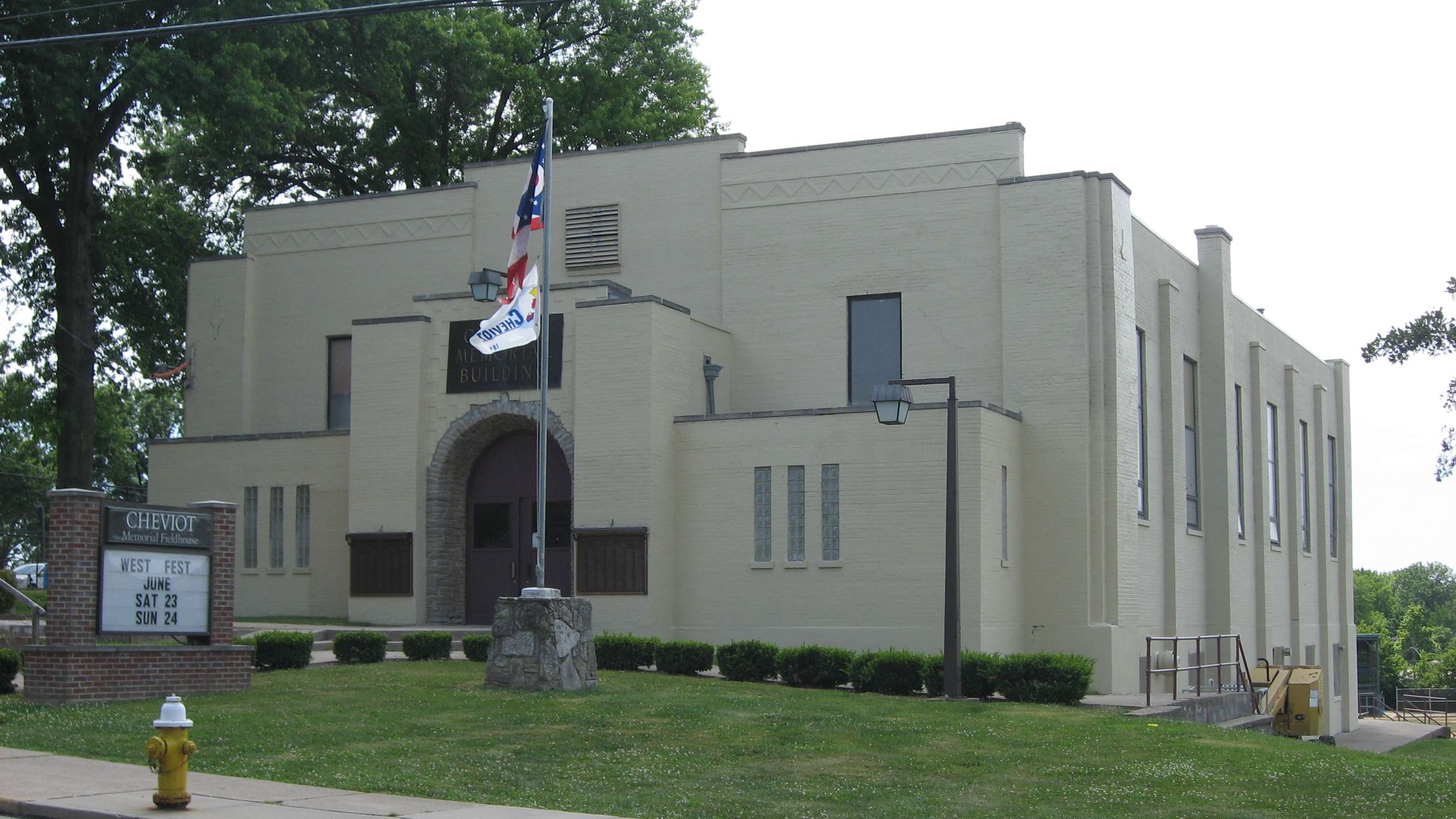 Cheviot's 1930s fieldhouse and community center | ||
| ||
| Motto(s): "Big City Spirit - Small Town Charm" | ||
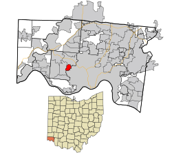 Location in Hamilton County and the state of Ohio. | ||
| Coordinates: 39°9′28″N 84°36′45″W / 39.15778°N 84.61250°WCoordinates: 39°9′28″N 84°36′45″W / 39.15778°N 84.61250°W | ||
| Country | United States | |
| State | Ohio | |
| County | Hamilton | |
| Government | ||
| • Mayor | Samuel D. Keller (D) | |
| Area[1] | ||
| • Total | 1.17 sq mi (3.03 km2) | |
| • Land | 1.17 sq mi (3.03 km2) | |
| • Water | 0 sq mi (0 km2) | |
| Elevation[2] | 909 ft (277 m) | |
| Population (2010)[3] | ||
| • Total | 8,375 | |
| • Estimate (2012[4]) | 8,327 | |
| • Density | 7,158.1/sq mi (2,763.8/km2) | |
| Time zone | UTC-5 (Eastern (EST)) | |
| • Summer (DST) | UTC-4 (EDT) | |
| ZIP code | 45211 | |
| Area code(s) | 513 | |
| FIPS code | 39-14128[5] | |
| GNIS feature ID | 1056799[2] | |
| Website |
www | |
Cheviot /ˈʃɛviət/[6] is a city in west-central Hamilton County, Ohio, United States. It is a suburb of Cincinnati. The population was 8,375 at the 2010 census.[7]
History
In 1818 a Scottish immigrant named John Craig purchased a half section of 320 acres (1.3 km2) of Green Township from Elias Boudinot. He built an inn and tavern on the Harrison Pike. On March 21, 1818 Craig laid out a town which he named after the Cheviot Hills in southern Scotland. He sold lots and growth began.
The town was incorporated as a Village in 1901 and a city in 1931 Originally a farming community, today Cheviot is a residential suburb of Cincinnati.
January 6, 2018 Fireworks at the Cheviot Memorial Building Fieldhouse kicked off the city's bicentennial. Events planned throughout 2018 include a new water splash park at Harvest Home Park, A historical marker at Harvest Home and personal bricks located next to the cannon at the Memorial Building on Robb avenue. March of 2018 members of the Cheviot Bicentennial Committee decided to restart the Cheviot Historical Society together with Cheviot History they plan to preserve the history of Cheviot.
Culture
The city of Cheviot is home to much of the same German-American and other ethnic cultures that inhabit the surrounding Cincinnati area.[8] The city is known locally (and regionally) for its annual Harvest Home Fair. Since about 1855, the fair has been held each year on the weekend after Labor Day. The city incorporated the West Fest Street Festival in 2002, which has steadily grown in popularity. The annual event features local food, various booths/activities, children's rides, and live music. Cheviot is often recognized by locals as "The Heart of The West Side" (of Cincinnati) because of its urban yet small-town, friendly culture. The city features a concentrated variety of small businesses and pubs along its main thoroughfares. 2016 was the last year of this festival due to dying popularity over the recent years. The city is part of the Cincinnati Public School district.
Government
| Legislation | |
|---|---|
| President of Council | Mark Waters |
| Clerk of Council | Jenny Eilermann |
| Councilman Ward 1 | David Voss |
| Councilman Ward 2 | Dennis Dinkelacker |
| Councilman Ward 3 | James Sunderhaus |
| Councilman Ward 4 | Alana Tucker |
| Councilwoman At-Large | Kitty Zech |
| Councilwoman At-Large | Amy Richter |
| Councilwoman At-Large | Gail Griffin |
| Administration | |
|---|---|
| Mayor | Sam Keller |
| Law Director | Kimberlee Erdman - Rohn |
| Safety Service Director | Tom Braun |
| Fire Chief | Robert Klein |
| Police Chief | Emmett Stone |
| Mayor's AA | Theresa Lehn |
Geography
Cheviot is located about 7 miles (11 km) northwest of downtown Cincinnati, at 39°9′28″N 84°36′45″W / 39.15778°N 84.61250°W (39.157659, -84.612594).[9] According to the United States Census Bureau, the city has a total area of 1.17 square miles (3.03 km2), all land.[1]
Demographics
| Historical population | |||
|---|---|---|---|
| Census | Pop. | %± | |
| 1880 | 325 | — | |
| 1910 | 1,930 | — | |
| 1920 | 4,108 | 112.8% | |
| 1930 | 8,046 | 95.9% | |
| 1940 | 9,043 | 12.4% | |
| 1950 | 9,944 | 10.0% | |
| 1960 | 10,701 | 7.6% | |
| 1970 | 11,135 | 4.1% | |
| 1980 | 9,888 | −11.2% | |
| 1990 | 9,616 | −2.8% | |
| 2000 | 9,015 | −6.2% | |
| 2010 | 8,375 | −7.1% | |
| Est. 2017 | 8,292 | [10] | −1.0% |
| Sources:[5][11][12][13][14][15] | |||
2010 census
As of the census[3] of 2010, there were 8,375 people, 3,779 households, and 1,931 families residing in the city. The population density was 7,158.1 inhabitants per square mile (2,763.8/km2). There were 4,303 housing units at an average density of 3,677.8 per square mile (1,420.0/km2). The racial makeup of the city was 89.0% White, 7.3% African American, 0.2% Native American, 0.5% Asian, 0.9% from other races, and 2.1% from two or more races. Hispanic or Latino of any race were 2.0% of the population.
There were 3,779 households of which 27.0% had children under the age of 18 living with them, 31.1% were married couples living together, 14.8% had a female householder with no husband present, 5.2% had a male householder with no wife present, and 48.9% were non-families. 39.6% of all households were made up of individuals and 11.3% had someone living alone who was 65 years of age or older. The average household size was 2.18 and the average family size was 2.96.
The median age in the city was 34.6 years. 21.8% of residents were under the age of 18; 9.4% were between the ages of 18 and 24; 31.3% were from 25 to 44; 24.1% were from 45 to 64; and 13.3% were 65 years of age or older. The gender makeup of the city was 48.2% male and 51.8% female.
2000 census
As of the census[5] of 2000, there were 9,015 people, 4,064 households, and 2,202 families residing in the city. The population density was 7,753.5 people per square mile (3,000.6/km²). There were 4,338 housing units at an average density of 3,731.0 per square mile (1,443.9/km²). The racial makeup of the city was 96.93% White, 0.79% African American, 0.18% Native American, 0.62% Asian, 0.01% Pacific Islander, 0.49% from other races, and 0.99% from two or more races. Hispanic or Latino of any race were 1.11% of the population.
There were 4,064 households out of which 26.9% had children under the age of 18 living with them, 39.1% were married couples living together, 10.9% had a female householder with no husband present, and 45.8% were non-families. 40.0% of all households were made up of individuals and 15.6% had someone living alone who was 65 years of age or older. The average household size was 2.17 and the average family size was 2.97.
In the city the population was spread out with 22.4% under the age of 18, 8.5% from 18 to 24, 33.7% from 25 to 44, 17.7% from 45 to 64, and 17.8% who were 65 years of age or older. The median age was 36 years. For every 100 females, there were 88.9 males. For every 100 females age 18 and over, there were 84.7 males.
The median income for a household in the city was $35,150, and the median income for a family was $48,947. Males had a median income of $36,886 versus $28,202 for females. The per capita income for the city was $19,686. About 5.2% of families and 7.6% of the population were below the poverty line, including 11.4% of those under age 18 and 5.8% of those age 65 or over.
Mayors
- Henry Fischer (R) 1901
- Fred Edward Wesselman (R) 1902-1905
- Ferd C. Baechle (R) 1905-1911
- Fred Henry Altemeier (R) 1912-1917
- Clifford Harry Hay (R) 1918-1941
- Edward Christian Gingerich (D) 1942-1967
- Albert William Schottelkotte (D) 1967
- Donald Paul Bennett (R) 1968-1971
- Louis Edgar Von Holle (D) 1972-1983
- John Michael (Mike) Laumann (D) 1983-2003
- Samuel D. Keller (D) 2004-
Notable people
- Andy Williams - singer and television personality
- Dorothy Mueller - baseball player
- Glenn Ryle - WKRC-TV personality; host of "Skipper Ryle" and later Bowling For Dollars
- Al Schottelkotte - WCPO TV news anchor (1959-1994)
Religious Organizations/Churches
- Cheviot United Methodist Church (UMC)
- One Accord Christian Church (Non-Denominational)
- St. Martin of Tours (RCC)
- Vineyard Westside (Vineyard USA)
- Cheviot for Jesus (interdenominational)
- Cheviot Christian Communion
- Cincinnati Word of Faith Church
References
- 1 2 "US Gazetteer files 2010". United States Census Bureau. Archived from the original on 2012-01-24. Retrieved 2013-01-06.
- 1 2 "US Board on Geographic Names". United States Geological Survey. 2007-10-25. Retrieved 2008-01-31.
- 1 2 "American FactFinder". United States Census Bureau. Retrieved 2013-01-06.
- ↑ "Population Estimates". United States Census Bureau. Archived from the original on 2013-06-17. Retrieved 2013-06-17.
- 1 2 3 "American FactFinder". United States Census Bureau. Archived from the original on 2013-09-11. Retrieved 2008-01-31.
- ↑ "A Pronunciation Guide to Places in Ohio". E.W.Scripps School of Journalism. Retrieved 2008-12-19.
- ↑ "Profile of General Population and Housing Characteristics: 2010 Demographic Profile Data (DP-1): Cheviot city, Ohio". U.S. Census Bureau, American Factfinder. Archived from the original on September 11, 2013. Retrieved October 30, 2012.
- ↑ Felix Winternitz & Sacha DeVroomen Bellman (2007). Insiders' Guide to Cincinnati. Globe Pequot. p. 304. Retrieved 2013-05-08.
- ↑ "US Gazetteer files: 2010, 2000, and 1990". United States Census Bureau. 2011-02-12. Retrieved 2011-04-23.
- ↑ "Population and Housing Unit Estimates". Retrieved June 9, 2017.
- ↑ "Population: Ohio" (PDF). 1910 U.S. Census. U.S. Census Bureau. Retrieved 28 November 2013.
- ↑ "Population: Ohio" (PDF). 1930 US Census. U.S. Census Bureau. Retrieved 28 November 2013.
- ↑ "Number of Inhabitants: Ohio" (PDF). 18th Census of the United States. U.S. Census Bureau. Retrieved 22 November 2013.
- ↑ "Ohio: Population and Housing Unit Counts" (PDF). U.S. Census Bureau. Retrieved 22 November 2013.
- ↑ "Incorporated Places and Minor Civil Divisions Datasets: Subcounty Population Estimates: April 1, 2010 to July 1, 2012". U.S. Census Bureau. Archived from the original on 17 June 2013. Retrieved 25 November 2013.
External links
Municipalities and communities of Hamilton County, Ohio, United States | ||
|---|---|---|
| Cities | 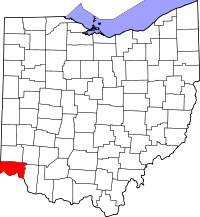 | |
| Villages | ||
| Townships | ||
| CDPs |
| |
| Other unincorporated communities | ||
| Footnotes | ‡This populated place also has portions in an adjacent county or counties | |