Delshire, Ohio
| Delshire, Ohio | |
|---|---|
| Census-designated place | |
 Location in Hamilton County and the state of Ohio. | |
| Coordinates: 39°5′20″N 84°35′47″W / 39.08889°N 84.59639°WCoordinates: 39°5′20″N 84°35′47″W / 39.08889°N 84.59639°W | |
| Country | United States |
| State | Ohio |
| County | Hamilton |
| Area | |
| • Total | 0.7 sq mi (1.8 km2) |
| • Land | 0.7 sq mi (1.8 km2) |
| • Water | 0.0 sq mi (0.0 km2) |
| Elevation[1] | 870 ft (270 m) |
| Population (2010) | |
| • Total | 3,180 |
| • Density | 4,600/sq mi (1,800/km2) |
| Time zone | UTC-5 (Eastern (EST)) |
| • Summer (DST) | UTC-4 (EDT) |
| Area code(s) | 513 |
| FIPS code | 39-21610[2] |
Delshire is a census-designated place (CDP) in Delhi Township, Hamilton County, Ohio, United States. The population was 3,180 at the 2010 census.[3]
Geography
Delshire is located at 39°5′20″N 84°35′47″W / 39.08889°N 84.59639°W,[4] on a bluff north of the Ohio River. It lies 6 miles (10 km) west of downtown Cincinnati and just east of the community of Delhi Hills.
According to the United States Census Bureau, the CDP has a total area of 0.69 square miles (1.8 km2), all land.
Education
Delshire is home to Delshire Elementary School which is a part of the Oak Hills Local School District. Delshire is also the home to St. Dominic Catholic School.
References
- ↑ "US Board on Geographic Names". United States Geological Survey. 2007-10-25. Retrieved 2008-01-31.
- ↑ "American FactFinder". United States Census Bureau. Archived from the original on 2013-09-11. Retrieved 2008-01-31.
- ↑ "Geographic Identifiers: 2010 Demographic Profile Data (G001): Delshire CDP, Ohio". U.S. Census Bureau, American Factfinder. Retrieved November 13, 2012.
- ↑ "US Gazetteer files: 2010, 2000, and 1990". United States Census Bureau. 2011-02-12. Retrieved 2011-04-23.
Municipalities and communities of Hamilton County, Ohio, United States | ||
|---|---|---|
| Cities | 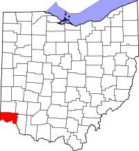 | |
| Villages | ||
| Townships | ||
| CDPs |
| |
| Other unincorporated communities | ||
| Footnotes | ‡This populated place also has portions in an adjacent county or counties | |
This article is issued from
Wikipedia.
The text is licensed under Creative Commons - Attribution - Sharealike.
Additional terms may apply for the media files.