Fairfax, Ohio
| Fairfax, Ohio | |
|---|---|
| Village | |
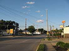
 Fairfax municipal building | |
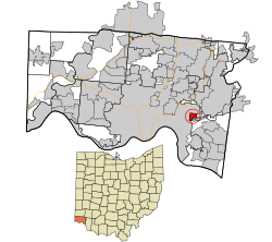 Location in Hamilton County and the state of Ohio. | |
| Coordinates: 39°8′34″N 84°23′46″W / 39.14278°N 84.39611°WCoordinates: 39°8′34″N 84°23′46″W / 39.14278°N 84.39611°W | |
| Country | United States |
| State | Ohio |
| County | Hamilton |
| Government | |
| • Mayor | Carson Shelton (R)[1] |
| Area[2] | |
| • Total | 0.76 sq mi (1.97 km2) |
| • Land | 0.76 sq mi (1.97 km2) |
| • Water | 0 sq mi (0 km2) |
| Elevation[3] | 564 ft (172 m) |
| Population (2010)[4] | |
| • Total | 1,699 |
| • Estimate (2012[5]) | 1,693 |
| • Density | 2,235.5/sq mi (863.1/km2) |
| Time zone | UTC-5 (Eastern (EST)) |
| • Summer (DST) | UTC-4 (EDT) |
| ZIP code | 45227 |
| Area code(s) | 513 |
| FIPS code | 39-25942[6] |
| GNIS feature ID | 1048718[3] |
| Website |
www |
Fairfax is a village in Hamilton County, Ohio, United States. The population was 1,699 at the 2010 census.[7]
Geography
Fairfax is located at 39°8′34″N 84°23′46″W / 39.14278°N 84.39611°W (39.142760, -84.396188).[8]
According to the United States Census Bureau, the village has a total area of 0.76 square miles (1.97 km2), all land.[2]
Demographics
| Historical population | |||
|---|---|---|---|
| Census | Pop. | %± | |
| 1960 | 2,430 | — | |
| 1970 | 2,705 | 11.3% | |
| 1980 | 2,222 | −17.9% | |
| 1990 | 2,029 | −8.7% | |
| 2000 | 1,938 | −4.5% | |
| 2010 | 1,699 | −12.3% | |
| Est. 2017 | 1,707 | [9] | 0.5% |
| U.S. Decennial Census[10] | |||
2010 census
As of the census[4] of 2010, there were 1,699 people, 709 households, and 455 families residing in the village. The population density was 2,235.5 inhabitants per square mile (863.1/km2). There were 778 housing units at an average density of 1,023.7 per square mile (395.3/km2). The racial makeup of the village was 94.8% White, 2.4% African American, 0.3% Native American, 0.8% Asian, 0.1% from other races, and 1.6% from two or more races. Hispanic or Latino of any race were 1.3% of the population.
There were 709 households of which 34.4% had children under the age of 18 living with them, 41.9% were married couples living together, 16.8% had a female householder with no husband present, 5.5% had a male householder with no wife present, and 35.8% were non-families. 29.5% of all households were made up of individuals and 9.8% had someone living alone who was 65 years of age or older. The average household size was 2.40 and the average family size was 2.97.
The median age in the village was 37.7 years. 24.4% of residents were under the age of 18; 6.9% were between the ages of 18 and 24; 29.6% were from 25 to 44; 27.8% were from 45 to 64; and 11.4% were 65 years of age or older. The gender makeup of the village was 46.5% male and 53.5% female.
2000 census
As of the census[6] of 2000, there were 1,938 people, 771 households, and 531 families residing in the village. The population density was 2,563.9 people per square mile (984.6/km²). There were 795 housing units at an average density of 1,051.8 per square mile (403.9/km²). The racial makeup of the village was 96.54% White, 1.08% African American, 0.15% Native American, 1.08% Asian, 0.05% from other races, and 1.08% from two or more races. Hispanic or Latino of any race were 0.21% of the population.
There were 771 households out of which 32.3% had children under the age of 18 living with them, 49.2% were married couples living together, 14.7% had a female householder with no husband present, and 31.0% were non-families. 26.3% of all households were made up of individuals and 11.3% had someone living alone who was 65 years of age or older. The average household size was 2.51 and the average family size was 3.06.
In the village, the population was spread out with 26.7% under the age of 18, 7.7% from 18 to 24, 29.8% from 25 to 44, 21.1% from 45 to 64, and 14.7% who were 65 years of age or older. The median age was 36 years. For every 100 females there were 88.9 males. For every 100 females age 18 and over, there were 86.5 males.
The median income for a household in the village was $41,418, and the median income for a family was $47,778. Males had a median income of $37,250 versus $26,960 for females. The per capita income for the village was $19,699. About 2.6% of families and 5.1% of the population were below the poverty line, including 7.2% of those under age 18 and 5.3% of those age 65 or over.
Education
Fairfax feeds into the Mariemont City School District, which includes Mariemont High School.
References
- ↑ "Hamilton County Officials 2016" (PDF). Hamilton County Board of Elections. 27 January 2016. p. 31. Retrieved 1 February 2016.
- 1 2 "US Gazetteer files 2010". United States Census Bureau. Archived from the original on 2012-01-24. Retrieved 2013-01-06.
- 1 2 "US Board on Geographic Names". United States Geological Survey. 2007-10-25. Retrieved 2008-01-31.
- 1 2 "American FactFinder". United States Census Bureau. Retrieved 2013-01-06.
- ↑ "Population Estimates". United States Census Bureau. Archived from the original on 2013-06-17. Retrieved 2013-06-17.
- 1 2 "American FactFinder". United States Census Bureau. Archived from the original on 2013-09-11. Retrieved 2008-01-31.
- ↑ "Profile of General Population and Housing Characteristics: 2010 Demographic Profile Data (DP-1): Fairfax village, Ohio". U.S. Census Bureau, American Factfinder. Archived from the original on September 11, 2013. Retrieved November 1, 2012.
- ↑ "US Gazetteer files: 2010, 2000, and 1990". United States Census Bureau. 2011-02-12. Retrieved 2011-04-23.
- ↑ "Population and Housing Unit Estimates". Retrieved May 26, 2018.
- ↑ "Census of Population and Housing". Census.gov. Archived from the original on May 12, 2015. Retrieved June 4, 2015.
External links
Municipalities and communities of Hamilton County, Ohio, United States | ||
|---|---|---|
| Cities | 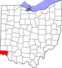 | |
| Villages | ||
| Townships | ||
| CDPs |
| |
| Other unincorporated communities | ||
| Footnotes | ‡This populated place also has portions in an adjacent county or counties | |