Faches-Thumesnil
| Faches-Thumesnil | ||
|---|---|---|
| Commune | ||
 | ||
| ||
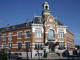
 Faches-Thumesnil Location within Hauts-de-France region  Faches-Thumesnil | ||
| Coordinates: 50°35′58″N 3°04′28″E / 50.5994°N 3.0744°ECoordinates: 50°35′58″N 3°04′28″E / 50.5994°N 3.0744°E | ||
| Country | France | |
| Region | Hauts-de-France | |
| Department | Nord | |
| Arrondissement | Lille | |
| Canton | Faches-Thumesnil | |
| Intercommunality | Métropole Européenne de Lille | |
| Government | ||
| • Mayor (2008–2014) | Nicolas Lebas | |
| Area1 | 4.62 km2 (1.78 sq mi) | |
| Population (1999)2 | 15,902 | |
| • Density | 3,400/km2 (8,900/sq mi) | |
| Time zone | UTC+1 (CET) | |
| • Summer (DST) | UTC+2 (CEST) | |
| INSEE/Postal code | 59220 /59155 | |
| Elevation |
30–58 m (98–190 ft) (avg. 43 m or 141 ft) | |
|
1 French Land Register data, which excludes lakes, ponds, glaciers > 1 km2 (0.386 sq mi or 247 acres) and river estuaries. 2 Population without double counting: residents of multiple communes (e.g., students and military personnel) only counted once. | ||
Faches-Thumesnil is a commune in the Nord department in northern France.
It is a suburb south of Lille and forms part of the Urban Community of Lille Métropole.
Heraldry
.svg.png) |
The arms of Faches-Thumesnil are blazoned : Quarterly 1&4: Sable, 6 bezants, overall a lion Or, armed and langued gules (derived from Faches); 2&3 Azure, an inescutcheon argent and in chief 3 mullets of 5 Or(Thumesnil). (Faches' original arms were bezanty, not 6 bezants. # reduced in the quartering.) |
Faches Thumesnil is twinned with the market town of St.Neots in Cambridgeshire, England, and with the town of Naousa, Greece.
See also
References
| Wikimedia Commons has media related to Faches-Thumesnil. |
.svg.png)
This article is issued from
Wikipedia.
The text is licensed under Creative Commons - Attribution - Sharealike.
Additional terms may apply for the media files.